Extract: what it takes to ship in government
Programme Manager
Product Manager
17 June 2026



Extract is now available to every local planning authority in England. That is the commitment the Prime Minister made at London Tech Week last year, and it is now delivered. And just over one week in, Extract had already processed over 1000 documents - that’s hundreds of hours saved for planning officers. In this post, we want to share the technical story behind Extract: what we built at various stages and how we iterated, what our evaluation found, and our lessons learned.
The Problem Extract Solves
England's planning system runs on data that is largely locked in paper. Local authorities hold hundreds of thousands of Conservation Area appraisals, Article 4 Directions and Tree Preservation Orders - many handwritten, scanned, or stored in ageing systems. Manually digitising a single document takes up to two hours. With an estimated 190,000–240,000 planning documents across England and only 20–25% currently published on MHCLG's Planning Data Platform, the backlog is substantial.
Extract is a multi-stage AI pipeline that converts scanned planning documents into structured geospatial data. It combines vision language models, image segmentation using Meta's Segment Anything Model (SAM), and automated geo-referencing using MatchAnything to detect Ground Control Points.
On average it takes Extract two minutes to produce a draft digital record, freeing up officers to focus on higher value tasks.

The Extract Journey
In Spring 2025, the team proved something big - AI could take a PDF, combine the unstructured contextual data, and produce geospatial output. From there, we needed to turn that proof of concept into something that planning officers would actually trust and use.
Building a multidisciplinary team
To get Extract from prototype to fully scaled product required a genuinely multidisciplinary team that spanned i.AI and the Digital Planning team within the Ministry for Housing, Communities and Local Government (MHCLG). We needed: applied AI engineers, product and delivery managers, policy specialists, front and back-end engineers, designers, evaluators, and strategists.
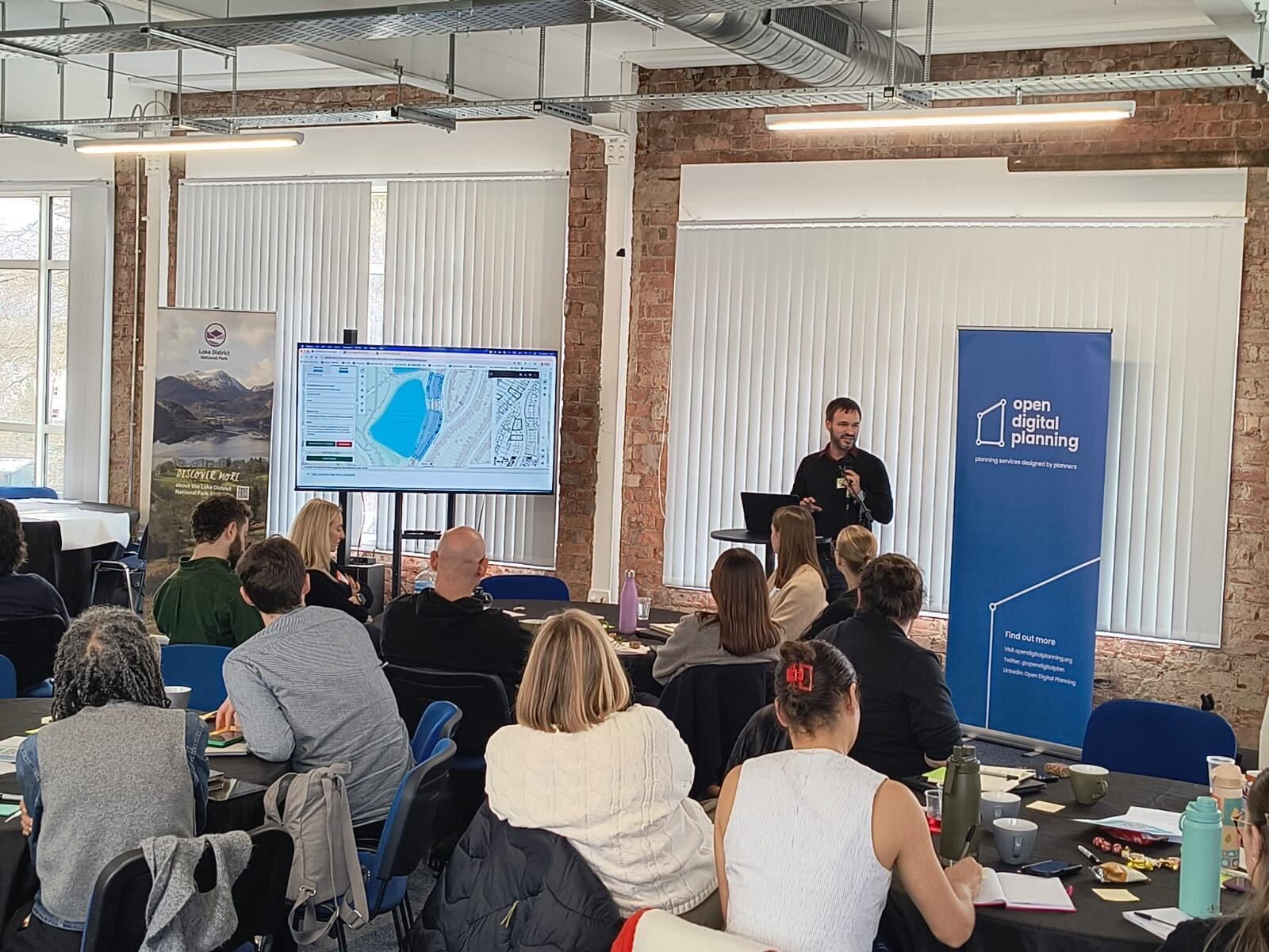
We worked increasingly closely with our MHCLG counterparts and attended Open Digital Planning events to explain Extract directly to planning officers - building the working relationships and sector buy-in that a tool like this depends on.
Building alongside real users
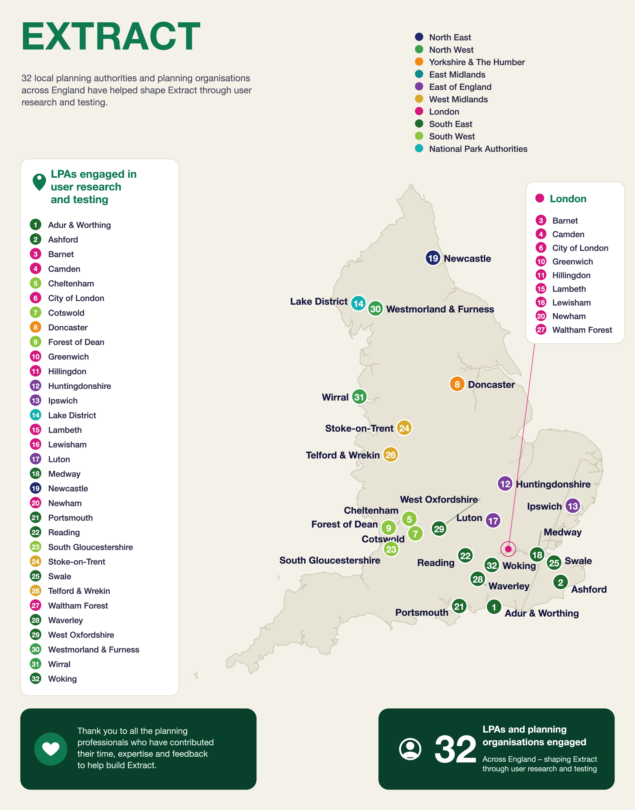
We kicked off Extract by getting the tool in front of the people who would use it. Over six months, we conducted user research with more than 30 local planning authorities, working alongside planning and GIS officers.
What we found was surprising - the variation in document style and quality was much wider than we had anticipated - from crisp modern PDFs to faded photocopies of hand-drawn originals from the 1970s. GIS officers in particular brought a level of domain expertise about what 'good enough' looked like and how they would not sign off on outputs they couldn't see and check for themselves.
This stage shaped a crucial design decision - to give users the ability to review and edit each step of the AI process in turn. This means that users have maximum transparency and control, and outputs that are close but not perfect are quick to correct. The toolset Extract offers to planners includes advanced GIS editing tools, satellite view and map overlays to support verification; and CSV bulk download for publishing to the Planning Data Platform.
Building the service
Getting a prototype working on a handful of documents is one thing. Running a service used by every local planning authority in England is another. We did substantial work on reliability and throughput, improving how Extract handles larger document volumes and more complex maps. alongside the accessibility, security and privacy requirements that come with any public sector tool.
Our user researchers and interaction designers brought the interface in line with GOV.UK standards, and we built out an onboarding guide and a step-by-step interactive tour that walks users through each output element.
Ensuring Extract Delivers Value
We tested Extract against a representative set of over 400 existing digital planning records across the three document types (Tree Preservation Orders, Article 4 Directions and Conservation Areas). For each, we compared Extract's outputs to the manually-produced originals.
The full evaluation report is published alongside this post. Here’s what we found:
Accuracy
Extract produces good-quality geospatial outputs requiring only minor edits in around two-thirds of cases (58–71%). The main factors that influence Extract’s performance are:
- document age – since an area may have changed significantly over time, making it hard to match to modern maps,
- whether the area is rural or urban – since there are more landmarks in urban areas, which help Extract to identify the correct location,
- style and scan quality - since there are no identifiable landmarks on maps that are very faded or blurred, or styled without road or building names.
Non-determinism
Because AI is non-deterministic, the same document can produce different outputs on different runs. When we ran Extract over our test set three times, Extract produced at least one good-quality output for three-quarters of documents. For around one in five documents, quality varied across runs, which means a retry is often worth attempting. The interface makes this easy. We treated non-determinism as a constraint to design around rather than a limitation to bury.
Text extraction
Extract transcribes text and dates very well, including from typewritten and handwritten originals, but can only do so if information is available in the source documents it is given. We find that, where the source document allows, Extract completes free text and date fields more often, more consistently and more accurately than manual data entry. Across the entire test set, we observed no hallucinations.
Time savings
When Extract’s geospatial outputs are accurate, it reduces the time taken to produce a digital record by 60 – 80%. Where Extract is less accurate, we expect that using its editing tools will still be faster than starting from scratch.
On average, Extract processes a document in under two minutes, and documents can be uploaded in bulk and run overnight. With the essential human review steps included, the overall time saving across all documents is around 50% compared to manual methods. We expect that to improve as we continue to develop the tool.
Reflections From Building Extract
Evaluation-driven development
Before we started testing at scale, we defined clear, measurable accuracy thresholds, for example, requiring at least 80% intersection over union for geospatial areas to count as a 'good quality' output. Having that threshold meant the team always knew whether we were making progress. It also made the evaluation credible: the criteria were set independently of the results.
Human-in-the-loop as a trust mechanism, not a fallback
We went into alpha with a human-in-the-loop design at the core. The user research showed us how essential this was, not only for double-checking accuracy but for planning officers' willingness to engage with the tool. Trust came from being able to see every output, check it against the original, and correct it. Tools that try to bypass this tend to struggle with adoption in high-stakes environments.
AI only a small part, delivery challenge is much bigger
Building the capability and making sure Extract was technologically feasible was only one part of the puzzle. Getting the right people around the table to ensure that we could deliver - across multiple stakeholders including planning officers, MHCLG, No.10. Over the course of the year, and through our testing, we were able to build strong working relationships with the partnering councils. We attended multiple Open Digital Planning events to explain Extract directly to planning officers to earn trust and buy-in.
Build for the models that don’t exist yet
We designed Extract so that the underlying AI models can be swapped out as better ones become available. The pipeline is modular: vision models, segmentation and geo-referencing are separate components. That means as frontier models improve (and they are improving fast) we can sub in more performant versions without rebuilding from scratch. With model improvements we hope to see even higher accuracy ratings in future iterations of Extract.
The full potential of Extract is still to come
Launching to all councils is a significant milestone but it’s not the end of Extract’s story. Throughout our research and testing with local planning authorities we’ve heard about the wide range of document types that they want Extract to digitise, from allotment sites and cemeteries to historical planning applications. We are committed to continuing to work with councils to unlock even more value and create the foundations of a modern planning system.

What's next
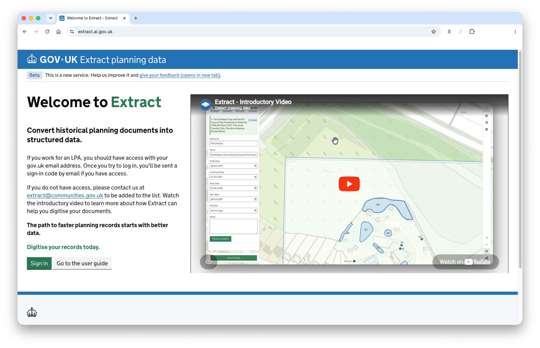
Extract is now available to all local planning authorities in England at extract.ai.gov.uk. The evaluation report is published on the i.AI website.
We'll be open-sourcing the Extract codebase before the end of 2026.
This work was done alongside MHCLG's Digital Planning programme, and Extract builds the data foundation for the next generation of planning tools - including a new prototype being built in collaboration with Google DeepMind and Faculty and trialled with Barnet, Camden and Dorset councils. This new tool aims to halve the time it takes to process householder planning applications. You can read more about that on the i.AI planning page.