No.77 The London wreck today

2015: Telling the story of the London today

A CGI reconstruction of the wreck of a wooden vessel lying on her side with holes blown in her structure.
A CGI reconstruction of the London wreck on the seabed. © Touch Productions

The ordnance, so crucial to the story of the lost London, as described in the previous post, and the salvage of the vessel in the aftermath, is also the theme of her more recent story. A gun was found on the site in 1962, and further investigation of the site in 1985 concluded that its iron content was too great to indicate a 17th century vessel (because the ordnance aboard the London was believed to be predominantly brass). Archaeological investigation in 2006, before dredging for the London Gateway project began, identified two discrete sites close to one another. In 2007 two bronze cannon said to be from the site were reported to the Receiver of Wreck, suggesting a threat sufficient to trigger an assessment of the site’s national importance as a candidate for designation under the Protection of Wrecks Act, which was achieved in 2008.

Local volunteers, under the site Licensee Steve Ellis, began monitoring the site in 2010. The Thames Estuary is a challenging environment for divers and for the wreck itself, which is also under threat from natural forces: the sediment mobility in the area and the effects of climate change, in which warm-water organisms have migrated northward with the potential to impact on wooden wrecks such as the London, leading to a noticeable loss of artefacts from the site.

Steve illustrates another major challenge facing archaeologists on the site, at the edge of a busy shipping channel:

A huge container ship dwarfs the dive vessel as it passes close by.
A large container ship passes close to the dive vessel near the London site. © Steve Ellis

These environmental threats in turn triggered a programme of finds recovery, with a very successful season in 2014 involving a collaboration between English Heritage, Cotswold Archaeology, Licensee divers, Southend Museums, and local volunteers, who sorted the recovered finds. Over 70 items were recovered, 41 by Cotswold Archaeology and 35 by the Licensees, a time capsule of life aboard a 17th century vessel, including bottles and personal items such as clay pipes and shoes.

A largely intact black leather latchet shoe viewed from above, next to an i
A well-preserved latchet shoe recovered from the wreck of the London. © Steve Ellis

Dan Pascoe, one of the site archaeologists, resumes the story with an account of recent archaeological activity concentrating on the guns:

‘The excavation thus far has revealed tantalizing clues towards determining which part of the ship survives on the seabed at site 2. The discovery of an intact gun carriage with the trucks situated against the remains of a deck, suggest the survival of parts of the gundeck. Directly either side of the carriage cheeks were the associated gun tackle, furniture and even gunner’s implements. The deck and carriage are situated on the vertical rather than horizontal, identifying that the remains of this part of the ship are on its side. Full excavation and recovery of the carriage this season will hopefully reveal the side of the hull and gun port.

South of the deck line, which would be below the gundeck, the excavation has uncovered  numerous cut logs of fired wood, galley tiles and bricks. In large ships, like the London, built prior to the mid-1660s, the cook room was found on a partial deck or platform within the forward part of the hold. Also found have been sections of partition planking, probably related to the internal structures of the ship, such has cabins and storerooms. The litter of hundreds of musket and pistol shot points to a possible location near the gunner’s storeroom. The present thinking is that site 2 is part of the bow from at least the gundeck down to hold, which includes the remains of a partial deck or platform. The excavation continues this spring and will hopefully be able to confirm the team’s initial thoughts and theories.’
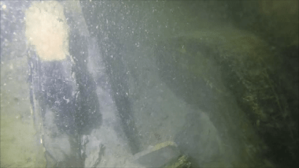
The remains of a wooden gun carriage truck in poor visibility in the Thames
Gun carriage truck in situ in the Thames, which also illustrates the challenges of working in limited visibility. © Steve Ellis

Steve Ellis, the site’s Licensee, says:

‘It has been a fantastic experience working on such a fascinating wreck site, especially the discoveries we have come across to help us all understand more about life aboard a 17th century British naval ship. This would not have been possible if it wasn’t for the full support that we had from English Heritage, seeing that we are only amateur archaeologists.’

A photographic exhibition documenting the finds opens later this month at the Beecroft Art Gallery, Southend-on-Sea, Essex; underwater investigations are due to resume in summer 2015 and can be followed via the Twitter hashtag #LondonWreck1665.

With many thanks to Dan and Steve, who have contributed so much to this post.
No. 76: The London Blows Up, 7 March 1665

To commemorate the 350th anniversary of the loss of the warship London in the Thames Estuary on 7 March 1665, I would like to take a look at the London in 1665 and in 2015, in a two-part blog. In this first part we look at the story of the wreck event in the words of those who were there at the time, and in the next part on Monday we will hear from those working on the London today.

1665

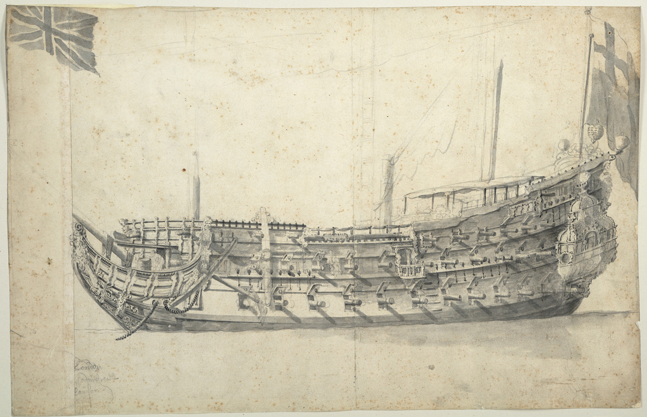
Pen and ink ship portrait of the hull of the London in broadside view, with flag at her stern.
The London, circa 1660, Willem van de Velde, © National Maritime Museum, Greenwich, London. Van de Velde was a Dutch marine artist and specialist in ship portraits, and played a role in documenting the battles of the Anglo-Dutch wars.

The London was a stalwart of the Commonwealth Navy, built in 1656 under Cromwell, but had also been part of the fleet accompanying Charles II on his return from exile in the Netherlands in 1660. On 7th March 1665, the London was bound from Chatham Dockyard to the Hope Reach in the Thames, a key location at a tense time, since war had just been declared between Charles II’s England and the United Provinces of the Netherlands on the 4th. The national mood was sombre, and it was also a cold day: thirty miles north, Ralph Josselin, vicar of Earls Colne in Essex, noted that his water pump had frozen that day. (1) Undoubtedly what happened next would have made headlines had there been such a thing as newspapers in England, but the first edition of the London Gazette would not come out until 7th November 1665. However, as Josselin’s journal shows, this was a time of assiduous diary-writing and administrative record-keeping, which allows us a window into the past.

Between Chatham and the Hope Reach lies the Nore: as so often, a safe deep-water anchorage, which was, and remained, a traditional assembly point for battle fleets and convoys up to and including the Second World War, lay next to a hazard, the notorious Nore sandbank. Yet it was not the Nore that was to claim the London.

A letter written on the 8th to Sir Joseph Williamson reported: ‘The brave ship London has blown up near the Hope’, leaving behind only her hull and stern. (2) On the same day Samuel Pepys, in his capacity as Clerk of the Acts to the Navy Board, provides us with more detail on the ‘sad newes of the London‘ in his personal diary: ‘a little a’this side the buoy of the Nower [that is, on the London side of the buoy, not the seaward side], she suddenly blew up.’ He tells us that only 24 persons were saved out of a complement of over 300, ‘the ship breaking all in pieces, with 80 pieces of brass ordinance.’ (3)

Portrait of Samuel Pepys in old age, wearing a wig and facing right against a dark background, in a gold frame.
Samuel Pepys, 1689, by Godfrey Kneller. © National Maritime Museum, Greenwich, London. Pepys was one of the key figures of the 17th century Navy and a very capable administrator. He had been asked to distribute the Articles of War to the fleet in the Hope just a few days previously.

Another letter, this time to Henry Bennet, 1st Earl of Arlington, passes on coffee-house gossip, blaming the easy availability of gunpowder ’20s a barrel cheaper than in London’ and therefore by implication suspect in provenance and quality. (4) On the 9th, John Evelyn, the other famous diarist of the period, ‘went to receive the poor creatures that were saved out of the London frigate, blown up by accident, with above 200 men,’ for he had been appointed one of the Commissioners for sick and wounded seamen by Charles II. (5) The Dutch ambassador, Michiel van Gogh, had more specific intelligence on numbers than Pepys, or perhaps more details were known by the time of his letter on 10th March: ‘The London, prepared for Vice-Admiral Lawson, was blown up while sailing up the river, and only 19 out of the crew of 351 saved.’ (6)

On the 11th Pepys recorded the results of an inspection of the wreck by Sir William Batten and Sir John Mennes: ‘out of which they say, the guns may be got, but the hull of her will be wholly lost’. (7) Those guns continued to be the focus of administrative attention for a good 30 years afterwards: recoveries made in 1679 caused some wrangling that surfaced in 1694-5, as the salvor attempted to leverage payment of a debt. (8)

What happened next? Part 2 on Monday will bring the story of the London up to date.

CGI reconstruction of the London, showing her gun decks and masts
CGI reconstruction of the London © Touch Productions

(1) Diary of Ralph Josselin, 7 March 1665

(2) Calendar of State Papers Domestic, Charles II, 1664-5, Vol.114, No.84

(3) Diary of Samuel Pepys, 8 March 1665

(4) Calendar of State Papers Domestic, Charles II, 1664-5, Vol.114, No.90

(5) Diary of John Evelyn, 9 March 1665

(6) Copy, Holland Correspondence, March 10, 1665, in Calendar of State Papers, Domestic, Charles II, 1664-5, Vol.114

(7) Diary of Samuel Pepys, 11 March 1665

(8) Calendar of Treasury Papers, Vol. 1, 1556-1696, May 17, 1694, and November 26, 1695

No.75 Andromeda (Diary of the War No.7)

One hundred years ago, on 13 February 1915, the English steel barque Andromeda struck the rocks while inbound for Falmouth, en route to London, with 3,000 tons of grain from Oregon.

Her inclusion in the War Diary for this month illustrates the fact that while ships faced new threats from enemy action in time of war, they continued to be just as vulnerable as ever to environmental hazards. It could be said that wartime voyages were doubly hazardous. For the year 1915 there were some 59 recorded strandings on beaches, sandbanks, and rocks, or approximately one eighth of all wrecks recorded for that year. (1)

The Andromeda is a snapshot in time: in the early 20th century the barque became a specialist carrier of grain cargoes, and her manner of loss was linked to another aspect of seafaring heritage: for she was inbound to Falmouth ‘for orders’. In effect, when a vessel was loaded at her departure port, her master and crew did not necessarily where the final leg of the voyage would take them. It would only be in making landfall in England at Falmouth, with its noted anchorage, that crews would receive their ‘orders’ for their final destination.

When the Andromeda ‘spoke with’ an armed patrol vessel off the Isles of Scilly on 12 February messages were exchanged: the patrol vessel warned of U-boat activity in the Channel, while the Andromeda requested a message be sent to Falmouth requesting a pilot to take her in there.

The vessel got into difficulties off Falmouth as squally, stormy weather ensued and the master continued to wait, with reduced sail, for a pilot who failed to materialise. As so often, the loss of the Andromeda was the result of a chain of circumstances. To quote the Board of Trade Inquiry report into the loss:

‘his implicit reliance on the wireless message of the patrol officer, the warning as to submarines, his knowledge that pilotage was compulsory at Falmouth, his anticipation that the harbour was mined’ kept him waiting off Falmouth, exposing his vessel to difficulties on a lee shore onto which she could not but be driven ashore. (2)

Thus it was that while not a war loss, the Andromeda was wrecked through environmental hazards – the weather driving her onto local rocks – in circumstances shaped by the heightened fear of wartime conditions.

With many thanks to Mark Milburn, who has located the bow of the Andromeda off Killigerran Head, east of Falmouth, and researched her history, enabling us to update our records.

(1) Source: National Record of the Historic Environment (NRHE) database

(2) Board of Trade Wreck Report for Andromeda

No. 74 The Bramble Bank

Hoegh Osaka aground on the Bramble Bank: Maritime and Coastguard Agency

Inspired by the vicissitudes of the car carrier Hoegh Osaka on the Bramble Bank since January 3, and her safe arrival last night (January 22) in Southampton, I thought I’d take a look this week at wrecks on the Bramble Bank.

Our earliest recorded shipwreck in the locality is an anonymous brig which was reported in Lloyd’s List as going ‘on the Brambles’, and ‘since bulged’, that is, bilged, or ending up with a hole in the bottom of her hull, after a ‘hard gale at NW’ on 18 December 1790. (1)

It can sometimes be very difficult to know the date of the earliest shipwreck on a particular feature: quite apart from the issues of the selective survival of documentary evidence, there is also the vagueness of contemporary reports, characteristic of the 18th century and earlier. It is likewise quite possible that contemporary or earlier wrecks or grounding incidents (in which the ship was, like the Hoegh Osaka, refloated) are masked by the brevity of such reports: a place of loss might simply be specified as ‘near Southampton’, ‘near Portsmouth’, and so on.

From the 19th and 20th centuries, however, a handful of wreck incidents involving the Bramble Bank are recorded, illustrating more regular and accurate reporting, rather than the bank becoming an increasing hazard to maritime traffic.

The most recent wreck to leave archaeological remains was Bridge No.4, formerly a chain ferry across the River Medina on the Isle of Wight, in 1976. Replaced by Bridge No.5 in 1975, she was decommissioned and foundered off the Bramble Bank en route to the breakers at Southampton in early 1976. This wreck demonstrates the diversity of 20th century wreck archaeology and is in good company with the remains of the King Harry Ferry, similarly lost off St. Agnes’ Head, Cornwall, en route to the Clyde in 1936. Chain ferries still remain in operation at Cowes and Falmouth.

The Bramble Bank also has another unusual heritage: an annual cricket match on the bank at low tide, probably inspired by similar matches on the Goodwin Sands, which we will revisit next week with a follow-up to the Turner post.

(1) Lloyd’s List, 21 December 1790, No.2,257

No.73 HMS Formidable (Diary of the War No.6)

Lifebelt from HMS Formidable washed up on the Dutch coast during the First World War, presented to the Imperial War Museum in 1920. © IWM (MAR 66)
Lifebelt from HMS Formidable washed up on the Dutch coast during the First World War, hundreds of miles from the site of the sinking in mid-Channel off the Bill of Portland. Presented to the Imperial War Museum in 1920. © IWM (MAR 66) http://www.iwm.org.uk/collections/item/object/30004000

As the year turned to 1915, the 5th Battle Squadron were deployed in the English Channel some 25 miles off the Bill of Portland on exercises, among them HMS Formidable, a pre-dreadnought battleship of 1898. Two hours and twenty minutes into the New Year, as the fleet crossed the path of some fishing vessels, and the weather began to worsen, a torpedo launched from U-24 roared out of the dark and into the Formidable. She began to list to starboard, compounding the difficulties of getting out the boats at night and in rough weather.

Twenty minutes later another torpedo struck the Formidable, causing her to capsize and sink completely at about 4.45am. One survivor told the Daily Telegraph of his ordeal bobbing about in the water as he watched the ship before she finally went under: “It was one of the saddest sights I have ever seen in my life . . . All this time a very loud hissing noise was coming from the sinking warship.” To him the water temperature seemed warmer than standing in his pyjamas for “over two hours in the terribly cold wind on the deck”. (Daily Telegraph, 4 January 1915, No.18,636, p9). Out of a complement of 780, only 199 men were saved.

It was a fishing vessel, the Provident or Providence, a Brixham smack out at sea off Berry Head, Devon, which picked up a significant number of the survivors. One of the Formidable‘s boats was spotted under the lee of the smack and after several perilous manoeuvres in waves 30 feet high, all 71 men were successfully transferred from their open boat to the smack in half an hour – just in time, for she had “a hole under her hull. This had been stuffed with a pair of pants, of which one of the seamen had divested himself for the purpose”. Another survivor downplayed the situation they were in: “undress uniform: swimming costume!” (Daily Telegraph, 2 January 1915, No.18,634, p9).

Captain Pillar and his crew aboard the Provident received numerous awards for the rescue, including a Gold Medal from the Shipwrecked Mariners’ Society, ‘only given in exceptional cases of bravery’. There is a memorial to those who lost their lives at Lyme Regis: the site of the wreck itself is a Controlled Site under the Protection of Military Remains Act.

It would not be the last time that wartime naval exercises in mid-Channel off Lyme Bay were interrupted by enemy action. During the Second World War, as Exercise Tiger was taking place in April 1944, German E-boats torpedoed two of the American landing craft which were taking part, Landing Ship Tanks LST 507 and LST 531.


No.72: The Acorn

To end the year, today’s post showcases several of the main themes of 2014 in maritime archaeology: first, early 2014 was exceptionally stormy, with numerous reports of wrecks having been exposed in different locations around the UK as storms scoured sand off beaches. Many members of the public gave English Heritage fantastic reports of shipwreck material they had seen.

One such report was from Sutton-on-Sea, Lincolnshire. It gives me great pleasure today to introduce as my guest blogger this week Jordan Havell, who is 13. After seeing some timbers on the shore this year, he has been researching the story behind one of the wrecks in his local area, the Acorn, which was a barque laden with ice when she struck in Lynn Roads in 1898.

Jordan tells the story of her origins: 

I got very interested in this shipwreck, amongst others, while doing a local history project. I am 13 years old and home educated.

The Acorn was built in 1855 in Dundee, County of Forfar, Scotland. The register date is recorded as 05/03/1855, with the master’s name shown as Peter Anderson, in the hands of Andrew Low for the Tay Ship Building Company, dated 28/02/1855. The employment of the Surveying Officer, Joseph Northmore, is recorded as a tide surveyor. These details come from the Dundee Archives, for whose help I was very grateful.

The ship had one and a half poop decks, 3 masts and her length is recorded as 119 feet. She was a barque which had one gallery and a full female figurehead. The framework and planking were made of wood.

The subscribing owners were named as Peter Anderson – Master Mariner – 16 shares. The manufacturers are recorded as Matthew Low and John Morrison, both having 12 shares. It is noted there were 2 other owners.

Image courtesy of Dundee City Archives.
Original register entry for the Acorn, 1855. Image courtesy of Dundee City Archives.

The Acorn appears in various articles in Dundee newspapers from 1856 to 1873. By 1871 her master is listed as George Wilson. On the records from this time there are numerous notes, including a query shown in 1873 regarding conversions to cubic metres weight. In 1873 the ship is registered under the port of Grimsby. The Acorn was believed to have been carrying ice between Norway and Grimsby for use by the Grimsby Ice Company in the fishing industry.

It appears she ended her days on the beach at Sutton-on-Sea in 1901 and is recorded under the English Heritage wreck report 928347 and account of wreck site 1484623. I am very grateful to Serena Cant and her colleagues who gave me help with this project.

I am hoping to find out about more shipwrecks along this coast over time.

**********************************************************

Many thanks to Jordan for his essay, which I am delighted to include today. I think an ice barque is an appropriate seasonal theme on which to end the year! For more on Norwegian ice barques, have a look at a past entry here.

The sharp-eyed among you, like Jordan, will have spotted that she struck a sandbank in the Wash in 1898, but ended up further north on the Lincolnshire coast in 1901. I did some research myself and found that the vessel was recovered in 1898, when she was sold for £105. (1) This was very typical. For the Acorn‘s owners, in far-away Sandefjord, it would have been much more economical to cut their losses by selling the vessel, rather than try to get her repaired at their own cost.

This, I suspect, is how she eventually ended up at Sutton-on-Sea in what has proven to be a ship graveyard, another theme which has emerged strongly in maritime archaeology over the last few years. These tend to be groups of vessels beyond economical repair, drawn up for breaking and then perhaps abandoned. The Acorn was one of six vessels which were recorded by partial excavation along this stretch of beach in 1997. (2)

I think there is plenty more for us to find out – what happened to the Acorn between 1898 and 1901, and what is the story of the other ships which may still remain under the sand at Sutton-on-Sea and elsewhere in the locality? Over to you, Jordan! I hope you will continue to be as fascinated by shipwreck archaeology as we are.

Wreck of post-medieval or early modern fishing vessel, Mablethorpe, 2007, first recorded 1997. Image courtesy of John Buglass.
Wreck of unidentified post-medieval or early modern fishing vessel, Mablethorpe, 2007, first recorded 1997. Image courtesy of John Buglass.

(1) Hull Daily Mail, 13 April 1898, No.3,902, p4

(2) Buglass, J 1997: The remains of six sailing ships and other archaeological features in the inter-tidal zone between Sutton-on-Sea and Mablethorpe, Lincolnshire; Buglass, J and Brigham, T 2008: Rapid Coastal Zone Assessment, Yorkshire and Lincolnshire: Donna Nook to Gibraltar Point, Humber Archaeology Report No.236

No.71: Remember Scarborough!

Diary of the War No.5

Scarborough Castle from the air
Scarborough Castle from the air:  N061078, © English Heritage Picture Library

One hundred years ago this week three German warships loomed out of the North Sea in the early morning of 16 December 1914, and commenced shelling Scarborough, Whitby, and Hartlepool. Whitby Abbey was struck by the light cruiser Kolberg, causing considerable damage, and Scarborough Castle by the battle cruisers Derfflinger and Von der Tann. Civilians going about their ordinary morning business were also killed in this, the first attack on English soil of the First World War.

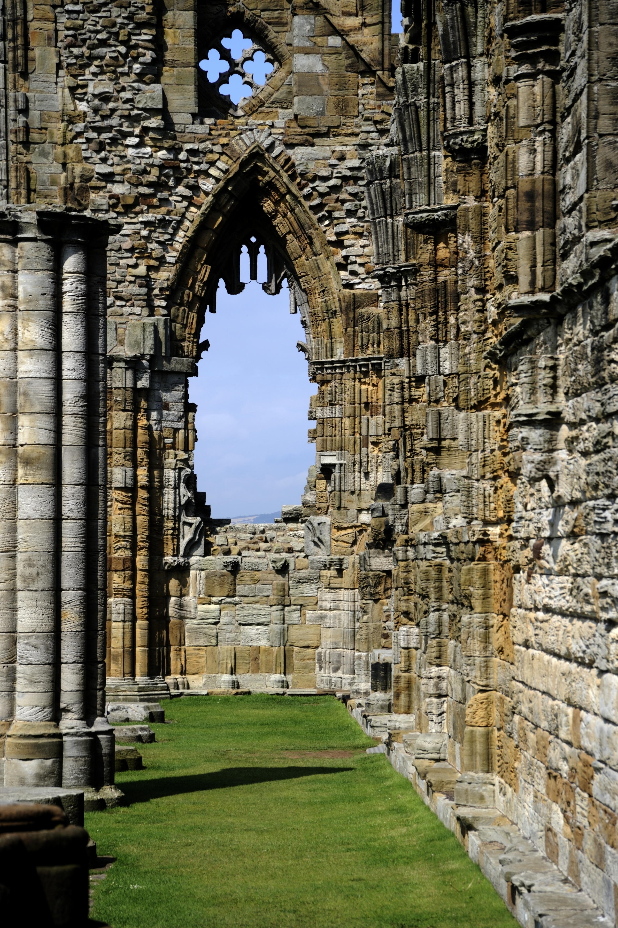
Whitby Abbey, West Front as seen from the east. This window was badly damaged in the shelling of 1914.  N080802 © English Heritage Photo Library
Whitby Abbey, West Front as seen from the east. This window was badly damaged in the shelling of 1914. N080802 © English Heritage Photo Library

Local residents and heritage sites were not the only victims of the raid, which screened the Kolberg‘s true objective of laying a minefield. That minefield claimed three victims the same day: the British collier Elterwater, bound from the Tyne for London, which sank in three minutes, three miles east of Scarborough itself; the Norwegian collier Vaaren, bound with Tyne coal for Palermo; and the British cargo vessel Princess Olga, laden with a general cargo, from Liverpool for Aberdeen. As the days and weeks went by, Kolberg‘s mines claimed further victims.

The mines off the Yorkshire coast were continually replenished during the war, designed to catch victims such as the Elterwater and Vaaren, and to strike at the coal trade on which Britain depended so heavily for heating, lighting, and export. The North Sea off the Yorkshire coast became a field of death and destruction, with the fishermen of Grimsby and Hull in the front line, manning the requisitioned trawlers turned minesweepers: as fast as they swept, more mines were laid, and as fast as they were laid, they were swept again.

Remember Scarborough! became the slogan of a recruitment poster. One hundred years on, we remember not only Scarborough, Whitby and Hartlepool, but also the deadly Scarborough minefield.

This is the first of a Christmas double bill: there will be another Wreck of the Week on Monday.

No.70 Wreck on the Goodwin Sands

The Morgan Library & Museum, New York. Bequest of Miss Alice Tully, 1996.67. Photography by Steven A. Crossot, 2014.
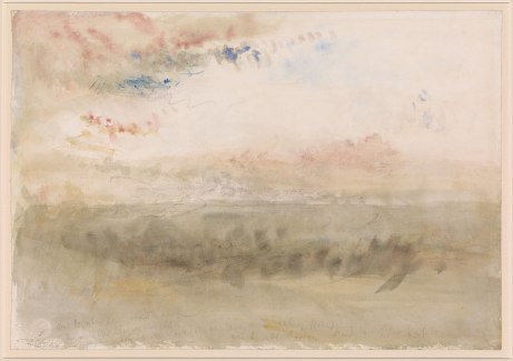
Wreck on the Goodwin Sands, J M W Turner. The Morgan Library & Museum, New York. Bequest of Miss Alice Tully, 1996.67. Photography by Steven A. Crossot, 2014.

This week’s wreck is a work of art and today I’d like to invite ‘audience participation’ focusing on wreck processes.

Wreck on the Goodwin Sands is currently on view at Tate Britain’s Late Turner exhibition as an excellent example of Turner’s late style, loose and impressionistic, yet amazingly precise in every detail. We see the skeleton of a wreck sitting upon the sands at low tide, with part of the sands exposed in streaks of yellow. Economical brushstrokes suggest the ribs of a vessel bowing out towards port and starboard, substantially more intact on both sides towards the middle and left of the painting, less so on the right, where one side is missing. A long downward stroke suggests a partially detached stem-post, with the ribs behind somewhat embedded in the exposed sand. Turner has pencilled some of his bleak poetry in lines only partially legible on the fallacy of hope, clearly identifying the wreck as one on the Goodwins. The view is from seaward of the Sands looking towards the white streak representing the famous cliffs of the Dover area.

My question this week is – what do you think happened to the ship Turner has shown here? Is it potential evidence for a wreck event?

Here are some potential clues: 

The Goodwin Sands were named as the ‘Great Ship Swallower’ as early as the 16th century, which has historically been characteristic of many of our designated wrecks in the vicinity, the Stirling Castle perhaps being the most dramatic of all, being found in a remarkably intact state, despite striking the sands in the ‘Great Storm’ of 1703.

There are other recorded wrecks, such as the Ogle Castle, an East Indiaman lost in 1825, where the ship disintegrated so comprehensively that much of her cargo was picked up in succeeding days as far afield as the Netherlands and Belgium.

Even those ships which floated off were often so badly damaged that they sank in deep water nearby, as happened with the Shepherdess in 1844.

Turner obsessively sketched what he saw and reused many sketches as details in paintings several years or decades later.

We have 24 wrecks recorded on the Goodwin Sands for the period 1840-1849, none for 1845 – the paper being characteristic of Turner’s sketchbooks for 1845. There is the possibility of some under-reporting, of course. Could it represent a wreck event we have not yet recorded?

Note the vertical brushstrokes suggesting ribs, but little in the way of horizontal brushstrokes to suggest the sides of the ship.

Responses will be collated and examined in a post in the New Year.

No.69 Diary of the War No.4

HMS Hood

The loss of HMS Hood, built 1916, and sunk in 1941, by shells from the Bismarck and Prinz Eugen in one of the Royal Navy’s worst disasters of the Second World War, is well-known. Less well-known is her predecessor of the same name, built in 1891 and disposed of on 4 November 1914.

Aerial view of Portland Harbour from the south-west. © English Heritage, reference 24688_028
Aerial view of Portland Harbour from the south-west, showing the gap between the breakwaters nearest the viewer: last resting place of HMS Hood. © English Heritage, 24688_028

Disposed? Surely a country at war needed all the warships it could get? The answer lies in her history and in the exigencies of war. Hood was the least functional of the Royal Sovereign-class warships, built in 1891. She was let down by her low freeboard (the side of the ship between the waterline and deck) which left her ill-equipped for rough British weather in rough British waters and serving principally in the Mediterranean or in static roles in home ports.

After three months of war the full scale of the threat at sea was not yet apparent. Most of the war losses in English waters between the declaration of war to 4 November 1914 were 27 ships sunk by mines, but the emerging picture worldwide was sobering:

Loss to Mines 3 August-4 November:

22 British ships for 24,609 tons; 4 Allied ships for 3,019 tons; 22 neutrals for 27,008 tons

Surface ships 3 August-4 November:

64 British ships for 189,229 tons; 5 Allied ships for 10,140 tons; 1 neutral for 3,804 tons (1)

One British ship had already been sunk by a U-boat off Norway on 20 October, the first recorded loss to U-boat activity, and on 31 October, HMS Hermes, Hood’s contemporary from the 1890s, fitted out as an experimental seaplane carrier, had been torpedoed in the eastern Straits of Dover.

This was a sign of things to come: British naval bases began to look vulnerable to submarine and torpedo attack. Portland, in the English Channel, followed Scapa Flow, Orkneys, in having blockships sunk for their protection. HMS Hood was scuttled for this purpose beside the entrance to the South Ship Channel between Portland’s inner and outer breakwaters, to prevent an attack on the base – where she still lies, a century after she was scuttled. She is now a well-collapsed wreck on which diving is now forbidden.

Sinking HMS Hood paradoxically extended her usefulness in a wartime role. Physically, she partially bridges the gap between the breakwaters. Conceptually, this use of Hood is also a link between the shore installations of naval and harbour infrastructure and the ships that used them, by transforming a ship into structure.

(1) Sourced from Lloyd’s War Losses 1914-18, pp1-5

No.68 HMHS Rohilla

Diary of the War Part III

One hundred years ago yesterday HMHS Rohilla, a liner requisitioned as, and converted to, a hospital ship, struck the rocks at Whitby while southbound from Queensferry and Leith for Dunkirk to pick up patients from the Western Front. I have written about her before but this week I would like to look again at her significance, while this weekend the Whitby RNLI commemorates the loss of the Rohilla with services and events, including a ‘live’ Twitter feed of the rescue as told by a survivor, Fred Reddiough.

Like another wreck in 1912, she was the product of the Harland and Wolff shipyard, and was also linked through one of her survivors to that wreck – Mrs Mary Roberts, who found the experience of being dashed on the rocks at Whitby far worse than experiencing the cold waters of the Atlantic from the Titanic. As with our survivors last week, Mrs Roberts’ experience illustrates that those who went to sea could expect to be shipwrecked at least once in their careers, frequently more often: undergoing multiple shipwreck was very common.

That experience of being so close to shore, yet so far from help on the rocks in the mountainous waves and cold seas of a North Sea storm, was what made the wreck of the Rohilla so terrifying. The storm continued unabated for three days as the ship was pounded by waves and began to break up, with the stern coming away on the Friday afternoon.

The Rohilla struck with such force that the Captain was convinced that she had been struck by a mine and reiterated this view at the inquest, which was also reflected in the findings of the jury, who found that the ship ‘struck something before grounding’. (1) If true, then she would have been the first mine casualty off the North Yorkshire coast, but she was not recorded as a war loss in official sources. The 22 recorded losses to mines up to this point of the war, mostly off Tynemouth or the Humber, suggest that a mine as the initial cause of the incident is perhaps less likely, and the shock felt simply that of the force with which she struck. (2)

The circumstances of her original loss, followed by time and tide, have ensured that the Rohilla is a scattered wreck, whose remains are partly confused with those of another wreck, the Charles, which stranded nearby in the Second World War.

The Whitby and other local lifeboats attempted the rescue under horrendous conditions, one even being lowered down a cliff, but it was not until the motor lifeboat was sent for from Tynemouth, speeding through the night, that a large-scale lifeboat rescue could be attempted. Modern technology was on the march and astonishing footage also exists of locals forming a human chain to bring survivors to shore.

Her story is perhaps one of the most moving shipwreck events of the whole war, and not only because of her difficult position in difficult conditions, and the associated loss of life. The Captain altered course to avoid minefields and was unable to make use of the usual navigational clues, since lighthouses were extinguished as a result of the war: wartime exigencies were already contributing to casualties. Her journey was one to fetch home war casualties, so that those who were travelling to help became those in need of help.

For previous posts in the War Diary, please click here.

(1) Times, Nov. 5, 1914, No.40,688, p5

(2) National Record of the Historic Environment shipwreck database, accessed October 2014