|
Meeting focused on FAIR marine data
|
|
|
The Marine Environmental Data and Information Network (MEDIN) hosted a virtual open meeting on March 3rd 2022, entitled ‘How technology can support the marine community to deliver FAIR data’. The day consisted of some great presentations and posters from MEDIN partners and Data Archive Centres, including the keynote speaker Lucy Scott from the Intergovernmental Oceanographic Commission (IOC) of the United Nations Educational, Scientific and Cultural Organisation (UNESCO) as well as lots of opportunities for networking. In the afternoon, our discussion sessions explored challenges that the marine community have in making their data Findable, Accessible, Interoperable and Reusable (FAIR). Our main aim was to discuss the technology requirements and how MEDIN can support the marine community in order to achieve FAIR marine data.
|
|
|
Above: a wordcloud from the Findable discussion session at the MEDIN Open Meeting.
One of the key areas highlighted during the event was a need for increased metadata and data management training, coupled with community support. Streamlining and simplifying the technical process of creating metadata to accompany marine data and improving the MEDIN portal are areas that the attendees thought would increase the output of metadata from individuals. A drive to improve content and knowledge sharing was suggested to ensure users are up to date with the tools and services that MEDIN provides.
Below: An example of some of the themes emerging from the discussion sessions.
|
|
We will continue to analyse the outputs from the 2022 MEDIN open meeting and the findings will feed into the next MEDIN Business Plan, ensuring that all marine community requirements and high priority issues can be addressed. The MEDIN Open Meeting is an annual event, so keep an eye out for the next one, as the meeting is - as the title suggests - open to all who are interested in UK marine data.
Presentations and posters from the meeting can be found on our website here. |
|
The European Marine Observation and Data Network (EMODnet) is a network of organisations supported by the European Union's integrated maritime policy. These organisations work together to observe the sea, process the data according to international standards and make that information freely available as interoperable data layers and data products. The EMODnet Seabed Habitats website provides a permanent single portal for accessing seabed habitat data in Europe. |
|
|
Phase 4 of the EMODnet Seabed Habitats project commenced in September 2021, and will run for 2 years through to 2023. The project aims to build on the existing data products hosted on the EMODnet Seabed Habitats Map Viewer and expand geographical coverage of the project to the Caspian Sea and selected European Union (EU) territories in the Caribbean (Anguilla, Sint Maarten, Guadeloupe and Martinique).
Right: EMODnet Seabeds Habitat map viewer showing MSFD benthic broad habitat types.
|
|
|
In this new phase, you can expect to see:
- An extension of the comprehensive library of habitat happing data to include the Caspian and Caribbean Seas.
- An update to the EMODnet broad-scale seabed habitat map for Europe (EUSeaMap) to include new input data layers, and extension into the Caspian and Caribbean Seas.
- The creation of two new composite data products for Europe: coastal wetland habitats and essential fish habitats, and the upcycling of habitat maps classified in the previous version of the European University Information Systems organisation (EUNIS) (2007-2011), into the new 2019 version.
|
|
|
Map Library
EMODnet Seabed Habitats hosts the largest European collection of habitat maps from individual surveys and survey-based sample points. Phase 4 will continue this data collation with an emphasis on Wetland and Essential Fish habitat data.
Broad-scale Habitat Map
EUSeaMap is the project’s flagship product displaying broad habitat types in all European waters. The next iteration will be in 2023 and for the first time will be extended to the Caspian Sea and some EU territories of the Caribbean. All input layers and associated environmental variables are published on the EMODnet Seabed Habitats Map Viewer.
Composite Products
Composite products are a category of single-themed maps showing distribution of Live Hard Coral, Macroalgal Canopy, Seagrass and Biogenic habitat. Stakeholder interaction with Regional Sea Conventions, scientists and policy makers at European and national level will inform the next suite of composite products to be produced.
|
|
|
|
Fisheries Industry Science Partnerships (FISP) - Round 2
|
|
Applications for funding to deliver a full research project is now open through the Fisheries Industry Science Partnerships (FISP) scheme. FISP is part of the Science and Innovation Scheme of the £100 million UK Seafood Fund (UKSF) and shares a £24m investment with the Seafood Innovation Fund (SIF).
The UKSF is also investing at least £65m through an Infrastructure Scheme funding projects that build capacity across the UK fishing sector supply chain and up to £10m towards skills and training to attract new recruits and improve workforce retention.
|
|
FISP will improve and share knowledge of fisheries and aquaculture by funding data collection and research to support sustainable fisheries management. As part of this, FISP will gather data to support the development of Fisheries Management Plans (FMPs) which are a requirement of the Fisheries Act and highlighted in the draft Joint Fisheries Statement. FISP projects are delivered in collaboration between the fishing and seafood industry and research organisations.
Contracts of up to £300,000 are available to carry out a full research project. You can apply until midday on Monday 16th May 2022.
FISP was announced in September 2021 and was the first UKSF funding round to open in October 2021 with £1.4m awarded to 8 new projects that will support the UK’s fishing industry to be more sustainable and productive. Please see here for more information and to read the project summaries.
Data collection and storage from FISP projects are completed in accordance with the MEDIN data standards.
To access the scheme and find out more information about the types of research eligible for funding, please visit the FISP gov.uk page and see Defra’s associated tweet. |
|
|
Internet of Things Sensors Helping to Mitigate Coastal Flood Hazards
|
|
|
The Internet of Things, or IoT, refers to the billions of physical devices around the world that are now connected to the internet, all collecting and sharing data. Thanks to a handy cellular modem, an evolving data broker system and the cloud, the Coastal REsistance: Alerts and Monitoring Technologies (CreamT) project has done just that with coastal hazard flood sensors! The otherwise “dumb”, wave overtopping sensors are now connected to the internet, enabling them to share their data in near real-time to public desktop and mobile devices without human intervention.
How does it work?
It’s pretty simple really. The National Oceanography Centre’s novel WireWall sensor which is used to detect coastal wave overtopping has been adapted. The WireWall is 3.5m tall and uses capacitance wires which sample at a frequency (400Hz) high enough to capture the transient events.
|
|
|
By integrating an on-board computer to do some preliminary data processing and a cellular modem, the sensor can connect to the internet and publish its own data. The sensor essentially drops its data directly into to an Application Programming Interface (API) hosted at the British Oceanographic Data Centre (BODC). The communication uses secure standard internet protocols (https) helping to maintain the integrity of the data transmission. The API is the National Oceanic and Atmospheric Administration's (NOAA) ERDDAP and takes care of all the indexing internally as well as transforming the data to a variety of formats on demand including CSV, NetCDF and JSON here.
It also enables metadata enrichment with Findable, Accessible, Interoperable and Reusable (FAIR) data principles, such as controlled vocabularies. This API is publicly accessible and uses RESTful communication protocols. This means scientists can directly pull the data over the internet into their own code to check on the performance of the sensors in the ways they want with about 10 mins latency. This system has been successfully demonstrated with deployments of WireWall sensors at two high-energy wave overtopping coastal sites (Penzance and Dawlish) from March 2020 to March 2022.
|
|
The nowcast hazard warning capability of the system is being demonstrated in the CreamT Coastal Hazards Explorer dashboard which uses a simple traffic light system to relate the potential risks of overtopping to the public. The project is also developing a prototype mobile app. to reach more people on more platforms (the soon-to-be-live Trueflood-uk app.). Trials are also underway to use binary sensor transmissions and to remotely operate WireWall, helping to conserve its power and reduce data storage.
The overall effect is that it is now possible to plug ‘n play WireWall sensors to detect wave overtopping where strategically needed where they can be used to inform coastal communities of any immediate risks of wave overtopping.
|
|
|
Smarter Environmental and Conservancy Management
|
|
|
OceanWise are really excited to announce the release of their latest White paper “Smarter Environmental and Conservancy Management”. This helpful document is designed to be a support guide for Harbour Masters and those responsible for overseeing conservancy and compliance in Ports or harbours. The easy-to-navigate layout provides details on the key benefits and common barriers to smarter management and ends with a checklist and guide on how to approach your own challenges. Download it today OR email info@oceanwise.eu to request your free hard copy (sent by post).
|
|
|
Measuring the Impact of Data Institutions
|
|
A recent study by the Open Data Institute aims to improve understanding of data institutions – organisations that steward data on behalf of others, often towards public, educational or charitable aims – by quantifying the impact they may have on the ecosystems in which they operate.
There is already a body of evidence showing the impact of open data and open standards. While this provides valuable insight into the impact and benefits of data flows, and how they may be measured, there is limited evidence for the impact of data institutions and the stewardship they perform.
The report focuses on illustrative case studies of five UK-based data institutions, corresponding with the different stewardship roles they may perform.
- Marine Environmental Data and Information Network (MEDIN): Facilitating safe access and developing infrastructure. - A web portal which aggregates UK marine data, providing a centralised access point for users.
- Farmbench: Independent gatekeeping and generating insights - An online benchmarking tool which allows farmers to compare their performance to other farmers across the UK.
- 360Giving: Publishing open data and developing infrastructure. - A charity which provides an open search platform for charitable grants data.
- Clinical Practice Research Datalink (CPRD) – a platform which collects anonymised patient data from UK GPs, and links this data to a range of other sources to provide a UK representative health dataset.
- OpenActive (Developing infrastructure) – a sector-wide initiative providing a set of open data standards, and support with using and adopting these standards, to facilitate the sharing of sports activity data.
Read the full report here.
|
|
|
Do you use the Marine Data Exchange?
|
|
If you use the Marine Data Exchange and its data, The Crown Estate want to hear from you! They want to feature projects that use Marine Data Exchange (MDE) data on their website, giving your work exposure and showing 𝗵𝗼𝘄 and 𝘄𝗵𝘆 your project uses MDE data.
User stories are extremely important for demonstrating the value of the data held in MDE, as well as helping to drive the development of the website. |
|
|
The Crown Estate want to highlight the varied and valuable work that draws on the industry data stored on the MDE.
If you want to contribute to the development of the MDE and have your work featured which has used data from the MDE (however big or small), please let complete this form.
|
|
|
|
Challenger Society Conference, London 2022
|
|
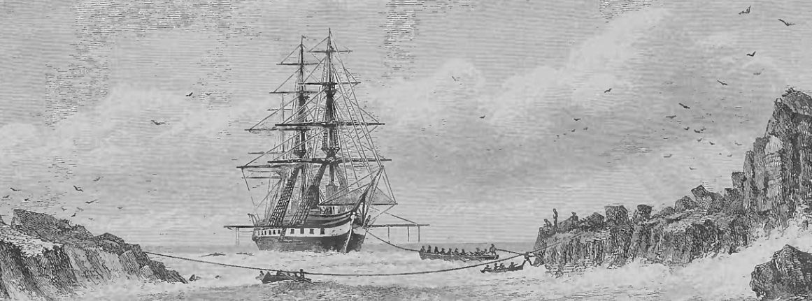
The Challenger Society Conference 2022 marks the 150th anniversary of the Challenger expedition and celebrates the birth of international and interdisciplinary oceanography.
When and where?
Conference: 6-8th September 2022
Side events: 5th, 9thSeptember 2022
Hosted by the Natural History Museum and Imperial College, London, UK
The meeting will be held in person at the Royal Geographical Society, Natural History Museum and Imperial College in South Kensington, London.
Key registration dates:
Abstract submission closes 15th May
Registration closes 1st July
|
|
|
|
Marine Information and Database Advisor Position at NatureScot
|
|
NatureScot are open for applications for a permanent position as 'Marine information and database adviser'.
The job will focus on ensuring marine information is accessible to a wide range of audiences and include updating and/or developing relevant online database and information platforms and requires technical knowledge and experience of systems development processes and methods, and a good understanding of the complexities of spatial and non-spatial data relating to marine biology, habitats and species and conservation.
Closing date is 10th June, 2022.
For more information, see the NatureScot website here. |
|
|
|
|