River Thames: current river conditions
The current conditions affecting boaters on the River Thames and what the warnings mean.
Updates to this page
- From:
- Environment Agency
- Published:
- 2 February 2020
- Last updated:
-
4 October 2026
Show all updates
-
River Thames: current conditions updated for Sunday 4 October 2026. No stream warning changes.
-
River Thames: current conditions updated for Saturday 3 October 2026. No stream warning changes.
-
River Thames: current conditions updated for Friday 1 October 2026. No stream warning changes.
-
River Thames: current conditions updated for Thursday 1 October 2026. No stream warning changes.
-
River Thames: river conditions updated for Wednesday 30 September 2026. No stream warning changes.
-
River Thames: river conditions updated for Tuesday 29th September 2026. No stream warning changes.
-
River Thames: river conditions updated for Sunday 27 September 2026. No stream warning changes.
-
River Thames: river conditions updated for Saturday 26 September 2026. No stream warning changes.
-
River Thames: river conditions updated for Friday 25 September 2026. No stream warning changes.
-
River Thames: current conditions updated for Thursday 24 September 2026. No stream warning changes.
-
River Thames: current conditions updated for Wednesday 23 September 2026. No stream warning changes.
-
River Thames: current conditions updated for Tuesday 22 September 2026. No stream warning changes.
-
River Thames: current conditions updated for Monday 21 September 2026. No stream warning changes.
-
River Thames: current conditions updated for Saturday 19 September 2026. No stream warning changes.
-
River Thames: current conditions updated for Friday 18 September 2026. No stream warning changes.
-
River Thames: current conditions updated for Thursday 17 September 2026. No stream warning changes.
-
River Thames: current conditions updated for Wednesday 16 September 2026. No stream warning changes.
-
River Thames: current conditions updated for Tuesday 15 September 2026. No stream warning changes.
-
River Thames: current conditions updated for Monday 14 September 2026. No stream warning changes.
-
River Thames: current conditions updated for Sunday 13 September 2026. No stream warning changes.
-
River Thames: current conditions updated for Saturday 12 September 2026. No stream warning changes.
-
River Thames: current conditions updated for Friday 11 September 2026. No stream warning changes.
-
River Thames: river conditions updated for Thursday 10 September 2026. No stream warning changes.
-
River Thames: river conditions updated for Wednesday 9 September 2026. No stream warning changes.
-
River Thames: river conditions updated for Tuesday 8 September 2026. No stream warning changes.
-
River Thames: river conditions updated for Monday 7 September 2026. No stream warning changes.
-
River Thames: river conditions updated for Sunday 6 September 2026. No stream warning changes.
-
River Thames: river conditions updated for Saturday 5 September 2026. No stream warning changes.
-
River Thames: current river conditions updated for Friday 4 September 2026. No stream waning changes.
-
River Thames: current conditions updated for Thursday 3 September 2026. No stream warning changes.
-
River Thames: current conditions updated for Wednesday 2 September 2026. No stream warning changes.
-
River Thames: current conditions updated for Tuesday 1 September 2026. No stream warning changes.
-
River Thames: current conditions updated for Monday 31 August 2026. No stream warning changes.
-
River Thames: river conditions updated for Sunday 30 August 2026. No stream warning changes.
-
River Thames: river conditions updated for Saturday 29 August 2026. No stream warning changes.
-
River Thames: river conditions updated for Friday 28 August 2026. No stream warning changes.
-
River Thames: river conditions updated for Thursday 27 August 2026. No stream warning changes.
-
River Thames: river conditions updated for Wednesday 26 August 2026. No stream warning changes.
-
River Thames: current conditions updated for Tuesday 25 August 2026. No stream warning changes.
-
River Thames: current conditions updated for Monday 24 August 2026. No stream warning changes.
-
River Thames: current conditions updated for Sunday 23 August 2026. No stream warning changes.
-
River Thames: current conditions updated for Saturday 22 August 2026. No stream warning changes.
-
River Thames: river conditions updated for Friday 21 August 2026. No stream warning changes.
-
River Thames: river conditions updated for Thursday 20 August 2026. No stream warning changes.
-
River Thames: river conditions updated for Wednesday 19 August 2026. No stream warning changes.
-
River Thames: river conditions updated for Tuesday 18 August 2026. No stream warning changes.
-
River Thames: river conditions updated for Monday 17 August 2026. No stream warning changes.
-
River Thames: river conditions updated for Sunday 16 August 2026. No stream warning changes.
-
River Thames: current conditions updated for Saturday 15 August 2026. No stream warning changes.
-
River Thames: current conditions updated for Friday 14 August 2026. No stream warning changes.
-
River Thames: current conditions updated for Thursday 13 August 2026. No stream warning changes.
-
River Thames: river conditions updated for Wednesday 12 August 2026. No stream warning changes.
-
River Thames: river conditions updated for Tuesday 11 August 2026. No stream warning changes.
-
River Thames: river conditions updated for Monday 10 August 2026. No stream warning changes.
-
River Thames: river conditions updated for Sunday 9 August 2026. No stream warning changes.
-
River Thames: river conditions updated for Friday 7 August 2026. No stream warning changes.
-
River Thames: river conditions updated for Thursday 6 August 2026. No stream warning changes.
-
River Thames: current conditions updated for Wednesday 5 August 2026. No stream warning changes.
-
River Thames: current conditions updated for Tuesday 4 August 2026. No stream warning changes.
-
River Thames: current conditions updated for Monday 3 August 2026. No stream warning changes.
-
River Thames: current conditions updated for Sunday 2 August 2026. No stream warning changes.
-
River Thames: current conditions updated for Saturday 1 August 2026. No stream warning changes.
-
River Thames: current conditions updated for Friday 31 July 2026. No stream warning changes.
-
River Thames: river conditions updated for Thursday 30 July 2026. No stream warning changes.
-
River Thames: river conditions updated for Wednesday 29 July 2026. No stream warning changes.
-
River Thames: river conditions updated for Tuesday 28 July 2026. No stream warning changes.
-
River Thames: river conditions updated for Monday 27 July 2026. No stream warning changes.
-
River Thames: current conditions updated for Sunday 26 July 2026. No stream warning changes.
-
River Thames: current conditions updated for Saturday 25 July 2026. No stream warning changes.
-
River Thames: current conditions updated for Friday 24 July 2026. No stream warning changes.
-
River Thames: current conditions updated for Thursday 23 July 2026. No stream warning changes.
-
River Thames: current conditions updated for Wednesday 22 July 2026. No stream warning changes.
-
River Thames: current conditions updated for Tuesday 21 July 2026. No stream warning changes.
-
River Thames: river conditions updated for Monday 20 July 2026. No stream warning changes.
-
River Thames: river conditions updated for Sunday 19 July 2026. No stream warning changes.
-
River Thames: river conditions updated for Saturday 18 July 2026. No stream warning changes.
-
River Thames: river conditions updated for Friday 17 July 2026. No stream warning changes.
-
River Thames: current conditions updated for Thursday 16 July 2026. No stream warning changes.
-
River Thames: current conditions updated for Wednesday 15 July 2026. No stream warning changes.
-
River Thames: Current conditions updated for Tuesday 14 July 2026. No stream warning changes.
-
River Thames: current conditions updated for Monday 13 July 2026. No stream warning changes.
-
River Thames: river conditions updated for Saturday 11 July 2026. No stream warning changes.
-
River Thames: river conditions updated for Friday 10 July 2026. No stream warning changes.
-
River Thames: river conditions updated for Thursday 9 July 2026. No stream warning changes.
-
River Thames: river conditions updated for Wednesday 8 July 2026. No stream warning changes.
-
River Thames: river conditions updated for Tuesday 7 July 2026. No stream warning changes.
-
River Thames: current conditions updated for Monday 6 July 2026. No stream warning changes.
-
River Thames: current conditions updated for Sunday 5 July 2026. No stream warning changes.
-
River Thames: current conditions updated for Saturday 4 July 2026. No stream warning changes.
-
River Thames: current conditions updated for Friday 3 July 2026. No stream warning changes.
-
River Thames: current river conditions updated for Thursday 2 July 2026. No stream warning changes.
-
River Thames: current conditions updated for Wednesday 1 July 2026. No stream warning changes.
-
River Thames: river conditions updated for Tuesday 30 June 2026. No stream warning changes.
-
River Thames: river conditions updated for Monday 29 June 2026. No stream warning changes.
-
River Thames: river conditions updated for Sunday 28 June 2026. No stream warning changes.
-
River Thames: river conditions updated for Saturday 27 June 2026. No stream warning changes.
-
River Thames: current conditions updated for Friday 26 June 2026. No stream warning changes.
-
River Thames: current conditions updated for Thursday 25 June 2026. No stream warning changes.
-
River Thames: current conditions updated for Wednesday 24 June 2026. No stream warning changes.
-
River Thames: current conditions updated for Tuesday 23 June 2026. No stream warning changes.
-
River Thames: current conditions updated for Monday 22 June 2026. No stream warning changes.
-
River Thames: current conditions updated for Sunday 21 June 2026. No stream warning changes.
-
River Thames: river conditions updated for Saturday 20 June 2026. No stream warning changes.
-
River Thames: river conditions updated for Friday 19 June 2026. No stream warning changes.
-
River Thames: river conditions updated for Thursday 18 June 2026. No stream warning changes.
-
River Thames: river conditions updated for Wednesday 17 June 2026. No stream warning changes.
-
River Thames: current conditions updated for Tuesday 16 June 2026. No stream warning changes.
-
River Thames: current conditions updated for Monday 15 June 2026. No stream warning changes.
-
River Thames: current conditions updated for Sunday 14 June 2026. No stream warning changes.
-
River Thames: current conditions updated for Saturday 13 June 2026. No stream warning changes.
-
River Thames: current conditions updated for Friday 12 June 2026. No stream warning changes.
-
River Thames: current conditions updated for Thursday 11 June 2026. No stream warning changes.
-
River Thames: river conditions updated for Wednesday 10 June 2026. No stream warning changes.
-
River Thames: river conditions updated for Tuesday 9 June 2026. No stream warning changes.
-
River Thames: river conditions updated for Monday 8 June 2026. No stream warning changes.
-
River Thames: river conditions updated for Sunday 7 June 2026. No stream warning changes.
-
River Thames: river conditions updated for Saturday 6 June 2026. No stream warning changes.
-
River Thames: current conditions updated for Friday 5 June 2026. No stream warning changes.
-
River Thames: current conditions updated for Thursday 4 June 2026. No stream warning changes.
-
River Thames: current conditions updated for Wednesday 3 June 2026. No stream warning changes.
-
River Thames: river conditions updated for Tuesday 2 June 2026. No stream warning changes.
-
River Thames: river conditions updated for Monday 1 June 2026. No stream warning changes.
-
River Thames: river conditions updated for Sunday 31 May 2026. No stream warning changes.
-
River Thames: river conditions updated for Saturday 30 May 2026. No stream warning changes.
-
River Thames: river conditions updated for Friday 29 May 2026. No stream warning changes.
-
River Thames: river conditions updated for Thursday 28 May 2026. No stream warning changes.
-
River Thames: current conditions updated for Wednesday 27 May 2026. No stream warning changes.
-
River Thames: current conditions updated for Tuesday 26 May 2026. No stream warning changes.
-
River Thames: current conditions updated for Monday 25 May 2026. No stream warning changes.
-
River Thames: current conditions updated for Sunday 24 2026. No stream warning changes.
-
River Thames: current conditions updated for Saturday 23 May 2026. No stream warning changes.
-
River Thames: current conditions updated for Friday 22 May 2026. No stream warning changes.
-
River Thames: current conditions updated for Thursday 21 May 2026. No stream warning changes.
-
River Thames: current conditions updated for Wednesday 20 May 2026. No stream warning changes.
-
River Thames: current conditions updated for Tuesday 19 May 2026. No stream warning changes.
-
River Thames: current conditions updated for Monday 18 May 2026. No stream warning changes.
-
River Thames: current conditions updated for Sunday 17 May 2026. No stream warning changes.
-
River Thames: current conditions updated for Saturday 16 May 2026. No stream warning changes.
-
River Thames: current conditions updated for Friday 15 May 2026. No stream warning changes.
-
River Thames: current conditions updated for Thursday 14 May 2026. No stream warning changes.
-
River Thames: current conditions updated for Wednesday 13 May 2026. No stream warning changes.
-
River Thames: current conditions updated for Tuesday 12 May 2026. No stream warning changes.
-
River Thames: river conditions updated for Monday 11 May 2026. No stream warning changes.
-
River Thames: river conditions updated for Sunday 10 May 2026. No stream warning changes.
-
River Thames: river conditions updated for Saturday 9 May 2026. No stream warning changes.
-
River Thames: river conditions updated for Friday 8 May 2026. No stream warning changes.
-
River Thames: current conditions updated for Thursday 7 May 2026. No stream warning changes.
-
River Thames: current conditions updated for Wednesday 6 May 2026. No stream warning changes.
-
River Thames: current conditions updated for Tuesday 5 May 2026. No stream warning changes.
-
River Thames: current conditions updated for Monday 4 May 2026. No stream warning changes.
-
River Thames: current conditions updated for Sunday 3 May 2026. Change to Blakes reach.
-
River Thames: river conditions updated for Saturday 2 May 2026. No stream warning changes.
-
River Thames: river conditions updated for Friday 1 May 2026. No stream warning changes.
-
River Thames: river conditions updated for Thursday 30 April 2026. No stream warning changes.
-
River Thames: river conditions updated for Wednesday 29 April 2026. No stream warning changes.
-
River Thames: current conditions updated for Tuesday 28 April 2026. No stream warning changes.
-
River Thames: river conditions updated for Monday 27 April 2026. No stream warning changes.
-
River Thames: river conditions updated for Sunday 26 April 2026. No stream warning changes.
-
River Thames: current conditions updated for Saturday 25 April 2026. No stream warning changes.
-
River Thames: current conditions updated for Friday 24 April 2026. No stream warning changes.
-
River Thames: current conditions updated for Thursday 23 April 2026. No stream warning changes.
-
River Thames: current conditions updated for Wednesday 22 April 2026. No stream warning changes.
-
River Thames: current conditions updated for Tuesday 21 April 2026. No stream warning changes.
-
River Thames: current conditions updated for Monday 20 April 2026. No stream warning changes.
-
River Thames: current conditions updated for Sunday 19 April 2026. No stream warning changes.
-
River Thames: current conditions updated for Saturday 18 April 2026. No stream warning changes.
-
River Thames: current conditions updated for Friday 17 April 2026. No stream warning changes.
-
River Thames: current conditions updated for Thursday 16 April 2026. No stream warning changes.
-
River Thames: current conditions updated for Wednesday 15 April 2026. No stream warning changes.
-
River Thames: current conditions updated for Tuesday 14 April 2026. No stream warning changes.
-
River Thames: current conditions updated for Monday 13 April 2026. Change to Osney reach.
-
River Thames: current conditions updated for Sunday 12 April 2026. No stream warning changes.
-
River Thames: river conditions updated for Saturday 11 April 2026. No stream warning changes.
-
River Thames: river conditions updated for Thursday 9 April 2026. No stream warning changes.
-
River Thames: river conditions updated for Wednesday 8 April 2026. No stream warning changes.
-
River Thames: current conditions updated for Tuesday 7 April 2026. No stream warning changes.
-
River Thames: current conditions updated for Monday 6 April 2026. No stream warning changes.
-
River Thames: current conditions updated for Saturday 4 April 2026. No stream warning changes.
-
River Thames: current conditions updated for Thursday 2 April 2026. Change to the Iffley reach.
-
River Thames: current conditions updated for Wednesday 1 April 2026. No stream warning changes.
-
River Thames: current conditions updated for Tuesday 31 March 2026. Changes to following reaches - Rushey, Shifford, Northmoor, Pinkhill, Eynsham, Kings and Godstow.
-
River Thames: river conditions updated for Monday 30 March 2026. No stream warning changes.
-
River Thames: river conditions updated for Sunday 29 March 2026. Changes to Caversham and Sonning reaches.
-
River Thames: current conditions updated for Saturday 28 March 2026. Change to Sunbury reach.
-
River Thames: current conditions updated for Friday 27 March 2026. Changes to following reaches - St John's, Buscot, Grafton, Radcot and Osney.
-
River Thames: current conditions updated for Thursday 26 March 2026. No stream warning changes.
-
River Thames: current conditions second update for Wednesday 25 March 2026. Change to the Osney reach.
-
River Thames: current conditions updated for Wednesday 25 March 2026. Changes to following reaches - Osney, Iffley, Penton Hook, Chertsey and Shepperton.
-
River Thames: current conditions updated for Tuesday 24 March 2026. No stream warning changes.
-
River Thames: current conditions updated for Monday 23 March 2026. Changes to the following reaches: Kings, Sandford, Abingdon, Culham, Clifton.
-
River Thames: current conditions updated for Sunday 22 March 2026. Changes to following reaches - Days, Benson, Whitchurch, Hambleden, Hurley, Temple, Marlow, Cookham, Boulters, Bray and Boveney.
-
River Thames: current conditions updated for Saturday 21 March 2026. Changes to following reaches: Cleeve, Goring, Shiplake, Marsh and Molesey.
-
River Thames: river conditions updated for Friday 20 March 2026. Changes to Mapledurham, Romney, Old Windsor, Bell Weir and Teddington reaches.
-
River Thames: current conditions updated for Thursday 19 March 2026. Changes to following reaches - Clifton and Blakes.
-
River Thames: current conditions updated for Wednesday 18 March 2026. Changes to following reaches - Northmoor, Goring, Whitchurch and Old Windsor.
-
River Thames: current conditions updated for Tuesday 17 March 2026. Changes to following reaches - Radcot, Eynsham, Hurley, Temple, Cookham, Bell Weir, Chertsey, Sunbury and Molesey.
-
River Thames: current conditions updated for Monday 16 March 2026. Changes to following reaches - Buscot, Rushey and Shifford
-
River Thames: current conditions updated for Sunday 15 March 2026. Changes to following reaches - Sunbury and Molesey.
-
River Thames: current conditions updated for Saturday 14 March 2026. Changes to the following reaches: Pinkhill, Cookham and Old Windsor.
-
River Thames: current conditions updated for 13 March 2025. Changes to following reaches - Goring, Whitchurch, Hurley, Temple, Boveney, Bell Weir and Chertsey.
-
River Thames: current conditions updated for Friday 13 March 2026. Changes to the following reaches: Godstow, Cleeve, Goring, Whitchurch and Mapledurham.
-
River Thames: current conditions updated for Thursday 12 March 2026. Changes to Bell Weir and Chertsey reaches.
-
River Thames: current conditions updated for Wednesday 11 March 2026. Changes to following reaches - Caversham, Sonning, Hurley and Temple.
-
River Thames: current conditions updated for Wednesday 11 March 2026. Change to the Cookham reach.
-
River Thames: river conditions updated for Tuesday 10 March 2026. Changes to Benson, Bell Weir, Sunbury and Molesey reaches.
-
River Thames: current conditions updated for Monday 9 March 2026. Changes to following reaches - Sandford, Abingdon, Culham, Boulters, Romney, Old Windsor and Bell Weir.
-
River Thames: current conditions updated for Sunday 8 March 2026. Change to Bray reach.
-
River Thames: current conditions updated for Saturday 7 March 2026. Changes to following reaches - Grafton, Penton Hook and Shepperton.
-
River Thames: current conditions updated for Friday 6 March 2026. Changes to following reaches - Days, Marsh, Hambleden and Boveney
-
River Thames: current conditions updated for Thursday 5 March 2026. Change to Teddington reach.
-
River Thames: current conditions updated for Wednesday 4 March 2026. No stream warning changes.
-
River Thames: current conditions updated for Tuesday 3 March 2026. Change to St Johns reach.
-
River Thames: current conditions updated for Monday 2 March 2026. No stream warning changes.
-
River Thames: current conditions updated for Sunday 1 March 2026. No stream warning changes.
-
River Thames: river conditions updated for Saturday 28 February 2026. No stream warning changes.
-
River Thames: river conditions updated for Friday 27 February 2026. No stream warning changes.
-
River Thames: current conditions updated for Thursday 26 February 2026. No stream warning changes.
-
River Thames: current conditions updated for Wednesday 25 February 2026. No stream warning changes.
-
River Thames: current conditions updated for Tuesday 24 February 2026. No stream warning changes.
-
River Thames: current conditions updated for Monday 23 February 2026. No stream warning changes.
-
River Thames: current conditions updated for Sunday 22 February 2026. No stream warning changes.
-
River Thames: river conditions updated for Saturday 21 February 2026. No stream warning changes.
-
River Thames: river conditions updated for Friday 20 February 2026. No stream warning changes.
-
River Thames: river conditions updated for Thursday 19 February 2026. No stream warning changes.
-
River Thames: river conditions updated for Wednesday 18 February 2026. No stream warning changes.
-
River Thames: river conditions updated for Tuesday 17 February 2026. No stream warning changes.
-
River Thames: current conditions updated for Monday 16 February 2026. No stream warning changes.
-
River Thames: current conditions updated for Sunday 15 February 2026. No stream warning changes.
-
River Thames: current conditions updated for Saturday 14 February 2026. No stream warning changes.
-
River Thames: current conditions updated for Friday 13 February 2026. No stream warning changes.
-
River Thames: current river conditions updated for Thursday 12 February 2026. No stream warning changes.
-
River Thames: current river conditions updated for Wednesday 11 February 2026. No stream warning changes.
-
River Thames: river conditions updated for Tuesday 10 February 2026. No stream warning changes.
-
River Thames: river conditions updated for Monday 9 February 2026. No stream warning changes.
-
River Thames: river conditions updated for Sunday 8 February 2026. No stream warning changes.
-
River Thames: river conditions updated for Saturday 7 February 2026. No stream warning changes.
-
River Thames current conditions updated for Friday 6 February. No stream warning changes.
-
River Thames current conditions updated for Thursday 5 February. No stream warning changes.
-
River Thames: current conditions updated for 4 February 2026. No stream warning changes.
-
River Thames: current conditions updated for Tuesday 3 February 2026. No stream warning changes.
-
River Thames: current conditions updated for Monday 2 February 2026. No stream warning changes.
-
River Thames: current conditions updated for Sunday 1 February 2026. No stream warning changes.
-
River Thames: river conditions updated for Saturday 31 January 2026. No stream warning changes
-
River Thames: river conditions updated for Friday 30 January 2026. No stream warning changes.
-
River Thames: river conditions updated for Thursday 29 January 2026. No stream warning changes.
-
River Thames: river conditions updated for Wednesday 28 January 2026. No stream warning changes.
-
River Thames current conditions updated for Tuesday 27 January 2026. No stream warning changes.
-
River Thames current conditions updated for Monday 26 January 2026. No stream warning changes.
-
River Thames: current conditions updated for Sunday 25 January 2026. No stream warning changes.
-
River Thames: current conditions updated for Saturday 24 January 2026. No stream warning changes.
-
River Thames: current conditions updated for Friday 23 January 2026. No stream warning changes.
-
River Thames: current conditions updated for Thursday 22 January 2026. Change to St Johns reach.
-
River Thames: current conditions updated for Wednesday 21 January 2026. No stream warning changes.
-
River Thames: current conditions updated for Tuesday 20 January 2026. No stream warning changes.
-
River Thames: river conditions updated for Monday 19 January 2026. Changes to St Johns and Caversham reaches.
-
River Thames: river conditions updated for Sunday 18 January 2026. No stream warning changes.
-
River Thames: current conditions updated for Saturday 17 January 2026. Changes to following reaches: Blakes and Boulters
-
River Thames: current conditions updated for Friday 16 January 2026. Changes to following reaches: St John's, Buscot, Grafton, Pinkhill, Days, Marsh, Bray and Penton Hook.
-
River Thames: current conditions updated for Thursday 15 January 2026. Change to Marsh reach.
-
River Thames: current conditions updated for Wednesday 14 January 2026. Changes to following reaches - Pinkhill, Benson, Bray, Romney, Old Windsor, Bell Weir, Chertsey, Shepperton, Sunbury, Molesey and Teddington.
-
River Thames: current conditions updated for Tuesday 13 January 2026. No stream warning changes.
-
River Thames: river conditions updated for Monday 12 January 2026. No stream warning changes.
-
River Thames: river conditions updated for Sunday 11 January 2026. Changes to Grafton, Days, Mapledurham, Bray, Penton Hook and Chertsey reaches.
-
River Thames: river conditions updated for Saturday 10 January 2026. Changes to Grafton, Radcot, Rushey, Northmoor, Pinkhill, Eynsham, Sandford, Abingdon, Culham, Days, Cleeve, Goring, Whitchurch, Sonning, Shiplake, Marsh, Hambledon, Hurley, Temple, Cookham, Boveney, Romney, Old Windsor, Bell Weir, Penton Hook reaches.
-
River Thames: river conditions updated for Friday 9 January 2026. Changes to Clifton, Caversham, Blakes, Sonning, Shiplake, Marlow, Penton Hook, Chertsey, Shepperton, Sunbury, Molesey and Teddington reaches
-
River Thames: river conditions updated for Thursday 8 January 2026. Changes to Caversham and Sonning reaches.
-
River Thames: current conditions updated for Wednesday 7 January 2026. Changes to following reaches: Rushey and Culham.
-
River Thames: current conditions updated for Tuesday 6 January 2026. Changes to following reaches - Northmoor.
-
River Thames: current conditions updated for Monday 5 January 2026. Changes to following reaches - Northmoor, Culham and Clifton.
-
River Thames: current conditions updated for Sunday 4 January 2026. No stream warning changes.
-
River Thames: current conditions updated for Saturday 3rd January 2026. Change to the Radcot reach.
-
River Thames: current conditions updated for Friday 2nd January 2026. Changes to the following reaches: Sonning, Romney, Old Windsor, Bell Weir, Penton Hook, Chertsey, Shepperton, Sunbury.
-
River Thames: current conditions updated for Thursday 1 January 2026. Change to Eynsham reach.
-
River Thames: river conditions updated for Wednesday 31 December 2025. Changes to Buscot, Grafton, Whitchurch and Molesey reaches.
-
River Thames: river conditions updated for Tuesday 30 December 2025. Changes to Sandford, Abingdon, Culham, Days and Benson reaches.
-
River Thames: river conditions updated for Monday 29 December 2025. Changes to Cleeve, Goring, Mapledurham, Caversham, Shiplake, Marsh, Hambleden, Hurley, Temple, Marlow, Cookham, Romney, Old Windsor, Bell Weir, Penton Hook, Chertsey, Shepperton and Teddington reaches.
-
River Thames: current conditions updated for Sunday 28 December 2025. Change to Boulters, Bray and Boveney reaches.
-
River Thames: current conditions updated for Saturday 27 December 2025. Change to St Johns, Sunbury and Molesey reaches.
-
River Thames: current conditions updated for Friday 26 December 2025. No stream warning changes.
-
River Thames: current conditions updated for Thursday 25 December 2025. Change to Teddington reach.
-
River Thames: current conditions updated for Wednesday 24 December 2025. Change to Blakes Lock.
-
River Thames: current conditions updated for Tuesday 23 December 2025. No stream warning changes.
-
River Thames: current conditions updated for Monday 22 December 2025. Change to Blakes reach.
-
River Thames: river conditions updated for Saturday 20 December 2025. Change to up stream of Blakes lock only.
-
River Thames: river conditions updated for Friday 19 December 2025. Changes to Shepperton, Sunbury, Molesey and Teddington reaches.
-
River Thames: current conditions updated for Thursday 18 December 2025. Changes to following reaches: Hurley, Temple, Bray, Boveney, Romney, Old Windsor, Bell Weir, Penton Hook, Chertsey and Teddington.
-
River Thames: current conditions updated for Wednesday 17 December 2025. Changes to following reaches: Romney and Old Windsor.
-
River Thames: current conditions updated for Tuesday 16 December 2025. Changes to following reaches - St Johns, Hurley, Temple and Boveney.
-
River Thames: current conditions updated for Monday 15 December 2025. Changes to following reaches - Bray and Chertsey.
-
River Thames: current conditions updated for Sunday 14 December 2025. Change to Bell Weir reach.
-
River Thames: current conditions updated for Saturday 13 December 2025. Changes to the following reaches: St Johns, Penton Hook and Shepperton.
-
River Thames: current conditions updated for Friday 12 December 2025. Changes to following reaches - Cookham, Boveney, Sunbury, Molesey and Teddington.
-
River Thames: current conditions updated for Thursday 11 December 2025. Changes to following reaches - Bray, Shepperton, Sunbury, Molesey and Teddington.
-
River Thames: current conditions updated for Wednesday 10 December 2025. Changes to following reaches - Grafton, Days, Mapledurham, Caversham, Hambleden, Boulters, Boveney, Bell Weir, Penton Hook and Chertsey.
-
River Thames: river conditions updated for Tuesday 9 December 2025. Changes to St Johns, Romney and Old Windsor reaches.
-
River Thames: current conditions updated for Monday 8 December 2025. Changes to following reaches: Cleeve, Goring, Marsh and Boveney.
-
River Thames: current conditions updated for Sunday 7 December 2025. Changes to following reaches: Days, Cleeve, Goring, Marsh and Hambleden.
-
River Thames: current conditions updated for Saturday 6 December 2025. No stream warning changes.
-
River Thames: current conditions updated for 5 December 2025. Changes to following reaches - Molesey and Teddington.
-
River Thames: current conditions updated for Friday 5 December 2025. Changes to following reaches - Buscot, Iffley, Sandford, Abingdon, Culham, Benson, Cleeve, Goring, Sonning, Shiplake, Marsh, Hambleden, Hurley, Temple, Marlow, Boveney, Romney, Old Windsor, Bell Weir, Penton Hook, Chertsey and Shepperton.
-
River Thames: current conditions updated for Thursday 4 December 2025. Changes to following reaches - Pinkhill, Days, Whitchurch and Sunbury.
-
River Thames: current conditions updated for Wednesday 3 December 2025. Changes to Days, Benson, Cleeve, Goring, Whitchurch and Mapledurham reaches.
-
River Thames: river conditions updated for Tuesday 2 December. Changes to Shifford, Clifton, Marsh, Hambleden, Hurley, Temple, Marlow, Cookham, Boulters, Bray, and Boveney reaches.
-
River Thames: current conditions updated for Tuesday 2 December 2025. Changes to following reaches - Radcot, Northmoor and Osney.
-
River Thames: current conditions updated for Monday 1 December 2025. Change to Sonning reach.
-
River Thames: river conditions updated for Sunday 30 November 2025. Change to Clifton reach only.
-
River Thames: river conditions updated for Saturday 29 November 2025. Changes to Osney and Clifton reaches.
-
River Thames current conditions updated for Friday 28 November 2025. No stream warning changes.
-
River Thames: current conditions updated for Thursday 27 November 2025. No stream warning changes.
-
River Thames: current conditions updated for Wednesday 26 November 2025. No stream warning changes.
-
River Thames: current conditions updated for Tuesday 25 November 2025. No stream warning changes.
-
River Thames: current conditions updated for Monday 24 November 2025. Changes to the following reaches - Hambleden, Hurley, Temple, Marlow, Cookham, Boulters, Bray and Boveney.
-
River Thames: current conditions updated for Sunday 23 November 2025. No stream warning changes.
-
River Thames: current conditions updated for Saturday 22 November 2025. Changes to following reaches - Iffley and Culham.
-
River Thames: current conditions updated for Friday 21 November 2025. Changes to following reaches - Clifton, Days, Benson, Cleeve, Goring, Whitchurch, Mapledurham, Sonning, Marsh and Hambleden.
-
River Thames: river conditions updated for Thursday 20 November 2025. No stream warning changes.
-
River Thames: river conditions updated for Wednesday 19 November 2025. Changes to Radcot, Northmoor and Marsh reaches.
-
River Thames: current conditions updated for Tuesday 18 November 2025. Changes to following reaches: Pinkhill, Sandford, Abingdon, Culham, Romney, Old Windsor and Bell Weir.
-
River Thames: current conditions updated for Monday 17 November 2025. Changes to following reaches: Pinkhill, Kings, Whitchurch, Penton Hook, Chertsey, Shepperton, Sunbury, Molesey and Teddington.
-
River Thames: current conditions second update for Sunday 16 November 2025. Changes to the following reaches: St Johns, Buscot, Grafton, Days, Benson, Cleeve, Goring, Whitchurch, Mapledurham, Marsh, Hambleden, Marlow, Romney, Old Windsor, Bell Weir, Penton Hook, Chertsey, Shepperton, Sunbury, Molesey, Teddington.
-
River Thames: current conditions updated for Sunday 16 November 2025. Changes to the following reaches: Radcot, Rushey, Molesey and Teddington
-
River Thames: current conditions updated for Saturday 15 November 2025. Changes to the following reaches: Northmoor, Eynsham, Godstow, Osney, Iffley, Molesey and Teddington
-
River Thames: current conditions second update for Friday 14 November 2025. Changes to the following reaches: Rushey, Shifford, Northmoor, Pinkhill, Eynsham, Kings, Godstow, Osney, Iffley, Sandford, Abingdon, Culham, Clifton, Caversham, Sonning, Shiplake, Marsh, Hambleden, Hurley, Temple, Marlow, Cookham, Boulters, Bray, Boveney.
-
River Thames: current conditions updated for Friday 14 November 2025. No stream warning changes.
-
River Thames: current conditions updated for Thursday 13 November 2025. No stream warning changes.
-
River Thames: river conditions updated for Wednesday 12 November 2025. No stream warning changes.
-
River Thames: river conditions updated for Tuesday 11 November 2025. No stream warning changes.
-
River Thames: river conditions updated for Monday 10 November 2025. No stream warning changes.
-
River Thames: river conditions updated for Sunday 9 November 2025. No stream warning changes.
-
River Thames current conditions updated for Saturday 8 November 2025. No stream warning changes.
-
River Thames current conditions updated for Friday 7 November 2025. No stream warning changes.
-
River Thames: current conditions updated for Thursday 6 November 2025. No stream warning changes.
-
River Thames: current conditions updated for Wednesday 5 November 2025. No stream warning changes.
-
River Thames: current conditions updated for Tuesday 4 November 2025. No stream warning changes.
-
River Thames: current conditions updated for Monday 3 November 2025. No stream warning changes.
-
River Thames: river conditions updated for Sunday 2 November 2025. No stream warning changes.
-
River Thames: river conditions updated for Saturday 1 November 2025. No stream warning changes.
-
River Thames: river conditions updated for Friday 31 October 2025. No stream warning changes.
-
River Thames: river conditions updated for Thursday 30 October 2025. No stream warning changes.
-
River Thames: current conditions updated for Wednesday 29 October 2025. No stream warning changes.
-
River Thames: current conditions updated for Tuesday 28 October 2025. No stream warning changes.
-
River Thames: current conditions updated for Monday 27 October 2025. No stream warning changes.
-
River Thames: current conditions updated for Sunday 26 October. No stream warning changes.
-
River Thames: current conditions updated for Saturday 25 October 2025. No stream warning changes.
-
River Thames: current conditions updated for Friday 24 October 2025. No stream warning changes.
-
River Thames: current conditions updated for Thursday 23 October 2025. No stream warning changes.
-
River Thames: current conditions updated for Wednesday 22 October 2025. No stream warning changes.
-
River Thames: current conditions updated for Tuesday 21 October 2025. No stream warning changes.
-
River Thames: current conditions updated for Monday 20 October 2025. No stream warning changes.
-
River Thames current conditions updated for Saturday 19 October 2025. No stream warning changes.
-
River Thames current conditions updated for Saturday 18 October 2025. No stream warning changes.
-
River Thames: current conditions updated for Friday 17 October 2025. No stream warning changes.
-
River Thames: current conditions updated for Thursday 16 October 2025. No stream warning changes.
-
River Thames: current conditions updated for Wednesday 15 October 2025. No stream warning changes.
-
River Thames: current conditions updated for Tuesday 14 October 2025. No stream warning changes.
-
River Thames: current conditions for Monday 13 October 2025. No stream warning changes.
-
River Thames: current conditions for Sunday 12 October 2025. No stream warning changes.
-
River Thames: current conditions for Saturday 11 October 2025. No stream warning changes.
-
River Thames: current conditions updated for Friday 10 October 2025. No stream warning changes.
-
River Thames: current conditions updated for Thursday 9 October 2025. No stream warning changes.
-
River Thames: current conditions updated for Wednesday 8 October 2025. No stream warning changes.
-
River Thames: current conditions updated for Tuesday 7 October 2025. No stream warning changes.
-
River Thames: current conditions updated for Monday 6 October 2025. No stream warning changes.
-
River Thames: current conditions updated Sunday 5 October 2025. No stream warning changes.
-
River Thames: current conditions updated for Saturday 4 October 2025. No stream warning changes.
-
River Thames: current conditions updated for Friday 3 October 2025. No stream warning changes.
-
River Thames: current conditions updated for Thursday 2 October 2025. No stream warning changes.
-
River Thames: current conditions updated for Wednesday 1 October 2025. No stream warning changes.
-
River Thames current conditions updated for Tuesday 30 September 2025. No stream warning changes.
-
River Thames current conditions updated for Monday 29 September 2025. No stream warning changes.
-
River Thames current conditions updated for Sunday 28 September 2025. No stream warning changes.
-
River Thames: current conditions updated for Saturday 27 September 2025. No stream warning changes.
-
River Thames: current conditions updated for Friday 26 September 2025. No stream warning changes.
-
River Thames: current conditions updated for Thursday 25 September 2025. No stream warning changes.
-
River Thames: current conditions updated for Wednesday 24 September 2025. No stream warning changes.
-
River Thames: river conditions updated for Tuesday 23 September 2025. No stream warning changes.
-
River Thames: current conditions updated for Monday 22 September 2025. No stream warning changes.
-
River Thames: river conditions updated for Sunday 21 September 2025. No stream warning changes.
-
River Thames: river conditions updated for Saturday 20 September 2025. No stream warning changes.
-
River Thames current conditions updated for Friday 19 September 2025. No stream warning changes.
-
River Thames current conditions updated for Thursday 18 September 2025. No stream warning changes.
-
River Thames: current conditions updated for Wednesday 17 September. No stream warning changes.
-
River Thames: current conditions updated for Tuesday 16 September 2025. No stream warning changes
-
River Thames: current conditions updated for Monday 15 September 2025. No stream warning changes.
-
River Thames: current conditions updated for Sunday 14 September 2025. No stream warning changes.
-
River Thames: current conditions updated for Saturday 13 September 2025. No stream warning changes.
-
River Thames: current conditions updated for Friday 12 September 2025. No stream warning changes.
-
River Thames: current conditions updated for Thursday 11 September 2025. No stream warning changes.
-
River Thames: river conditions updated for Wednesday 10 September 2025. No stream warning changes.
-
River Thames: current conditions updated for Tuesday 9 September 2025. No stream warning changes.
-
River Thames: current conditions updated for Monday 8 September 2025. No stream warning changes,
-
River Thames: current conditions updated for Sunday 7 September 2025. No stream warning changes,
-
River Thames: current conditions updated for Saturday 6 September 2025. No stream warning changes.
-
River Thames: current conditions updated for Friday 5 September 2025. No stream warning changes.
-
River Thames: current conditions updated for Thursday 4 September 2025. No stream warning changes.
-
River Thames: current conditions updated for Wednesday 3 September 2025. No stream warning changes.
-
River Thames: current conditions updated for Tuesday 2 September 2025. No stream warning changes.
-
River Thames: river conditions updated for Monday 1 September 2025. No stream warning changes.
-
River Thames: River conditions updated for Sunday 31 August 2025. No stream warning changes.
-
River Thames: current conditions updated for Saturday 30 August 2025. No stream warning changes.
-
River Thames: current conditions updated for Friday 29 August 2025. No stream warning changes
-
River Thames: current conditions updated for Thursday 28 August 2025. No stream warning changes
-
River Thames: current conditions updated for Wednesday 27 August 2025. No stream warning changes.
-
River Thames: current river conditions updated for Tuesday 26 August 2025. No stream warning changes.
-
River Thames: current conditions updated for Monday 25 August 2025. No stream warning changes.
-
River Thames: river conditions updated for Sunday 24 August 2025. No stream warning changes.
-
River Thames: river conditions updated for Saturday 23 August 2025. No stream warning changes.
-
River Thames: river conditions updated for Friday 22 August 2025. No stream warning changes.
-
River Thames: river conditions updated for Thursday 21 August 2025. No stream warning changes.
-
River Thames current conditions updated for Wednesday 20 August 2025. No stream warning changes.
-
River Thames current conditions updated for Tuesday 19 August 2025. No stream warning changes.
-
River Thames: current conditions updated for Monday 18 August 2025. No stream warning changes.
-
River Thames: current conditions updated for Sunday 17 August 2025. No stream warning changes.
-
River Thames: current conditions updated for Saturday 16 August 2025. No stream warning changes.
-
River Thames: current conditions updated for Friday 15 August 2025. No stream warning changes.
-
River Thames: current conditions updated for Thursday 14 August 2025. No stream warnings.
-
River Thames: current conditions updated for Wednesday 13 August 2025. No stream warning changes.
-
River Thames: river conditions updated for Tuesday 12 August 2025. No stream warning changes.
-
River Thames: river conditions updated for Monday 11 August 2025. No stream warning changes.
-
River Thames current conditions updated for Sunday 10 August 2025. No stream warning changes.
-
River Thames current conditions updated for Saturday 10 August 2025. No stream warning changes.
-
River Thames: current conditions updated for Friday 8 August 2025. No stream warning changes.
-
River Thames: current conditions updated for Thursday 7 August 2025. No stream warning changes.
-
River Thames: river conditions updated for Wednesday 6 August 2025. No stream warning changes.
-
River Thames: river conditions updated for Tuesday 5 August 2025. No stream warning changes.
-
River Thames: river conditions updated for Monday 4 August 2025. No stream warning changes.
-
River Thames: river conditions updated for Sunday 3 August 2025. No stream warning changes.
-
River Thames: river conditions updated for Saturday 2 August 2025. No stream warning changes.
-
River Thames: river conditions updated for Friday 1 August 2025. No stream warning changes.
-
River Thames: current conditions updated for Thursday 31 July 2025. No stream warning changes.
-
River Thames: river conditions updated for Wednesday 30 July 2025. No stream warning changes.
-
River Thames: current conditions updated for Tuesday 29 July 2025. No stream warning changes.
-
River Thames: current conditions updated for Monday 28 July 2025. No stream warning changes.
-
River Thames: current conditions updated for Sunday 27 July 2025. No stream warning changes.
-
River Thames: current river conditions updated for Saturday 26 July 2025. No stream warning changes.
-
River Thames: current conditions updated for Friday 25 July 2025. No stream warning changes.
-
River Thames: current conditions updated for Thursday 24 July 2025. No stream warning changes.
-
River Thames: River conditions updated for Wednesday 23 July 2025. No stream warning changes.
-
River Thames: River conditions updated for Tuesday 22 July 2025. No stream warning changes.
-
River Thames: current conditions updated for Monday 21 July 2025. No stream warning changes.
-
River Thames: current conditions updated for Sunday 20 July 2025. No stream warning changes.
-
River Thames: current conditions updated for Saturday 19 July 2025. No stream warning changes.
-
River Thames: current conditions updated for Friday 18 July 2025. No stream warning changes.
-
River Thames: current conditions updated for Thursday 17 July 2025. No stream warning changes.
-
River Thames: current conditions updated for Wednesday 16 July 2025. No stream warning changes.
-
River Thames: current conditions updated for Tuesday 15 July 2025. No stream warning changes.
-
River Thames: current conditions updated for Monday 14 July 2025. No stream warning changes.
-
River Thames: river conditions updated for Sunday 13 July. No stream warning changes.
-
River Thames: river conditions updated for Saturday 12 July. No stream warning changes.
-
River Thames: current conditions updated for Friday 11 July 2025. No stream warning changes.
-
River Thames current conditions updated for Thursday 10 July 2025. No stream warning changes.
-
River Thames: current conditions updated for Wednesday 9 July 2025. No stream warning changes.
-
River Thames: current conditions updated for Tuesday 8 July 2025. No stream warning changes.
-
River Thames: current conditions updated for Monday 7 July 2025. No stream warning changes.
-
River Thames: current conditions updated for Sunday 6 July 2025. No stream warning changes.
-
River Thames: current conditions updated for Saturday 5 July 2025. No stream warning changes.
-
River Thames: current conditions updated for Friday 4 July 2025. No stream warning changes.
-
River Thames: river conditions updated for Thursday 3 July 2025. No stream warning changes.
-
River Thames: river conditions updated for Wednesday 2 July 2025. No stream warning changes.
-
River Thames: current conditions updated for Tuesday 1 July 2025. No stream warning changes.
-
River Thames: current conditions updated for Monday 30 June 2025. No stream warning changes.
-
River Thames: current conditions updated for Sunday 29 June 2025. No stream warning changes.
-
River Thames: current conditions updated for Saturday 28 June 2025. No stream warning changes.
-
River Thames: current conditions updated for Friday 27 June 2025. No stream warning changes.
-
River Thames: current conditions updated for Thursday 26 June 2025. No stream warning changes.
-
River Thames: current conditions updated for Tuesday 25 June 2025. No stream warning changes.
-
River Thames: current conditions updated for Tuesday 24 June 2025. No stream warning changes.
-
River Thames: current conditions updated for Monday 23 June 2025. No stream warning changes.
-
River Thames: river conditions updated for Sunday 22 June 2025. No stream warning changes.
-
River Thames current conditions updated for Saturday 21 June 2025. No stream warning changes.
-
River Thames: current conditions updated for Friday 20 June 2025. No stream warning changes.
-
River Thames: current conditions updated for Thursday 19 June 2025. No stream warning changes.
-
River Thames: current conditions updated for Wednesday 18 June 2025. No stream warning changes.
-
River Thames: current conditions updated for Tuesday 17 June 2025. No stream warning changes.
-
River Thames: current conditions updated for Monday 16 June 2025. No stream warning changes.
-
River Thames: current conditions updated for Sunday 15 June 2025. No stream warning changes.
-
River Thames: current conditions updated for Saturday 14 June 2025. No stream warning changes.
-
River Thames: current conditions updated for Friday 13 June 2025. No stream warning changes.
-
River Thames: current conditions updated for Thursday 12 June 2025. No stream warning changes.
-
River Thames current conditions updated for Wednesday 11 June 2025. No stream warning changes.
-
River Thames current conditions updated for Tuesday 10 June 2025. No stream warning changes.
-
River Thames: current conditions updated for Monday 9 June 2025. No stream warning changes.
-
River Thames: current conditions updated for Sunday 8 June 2025. No stream warning changes.
-
River Thames: current conditions updated for Saturday 7 June 2025. No stream warning changes.
-
River Thames: current conditions updated for Friday 6 June 2025. No stream warning changes.
-
River Thames: current conditions updated for Thursday 5 June 2025. No stream warning changes.
-
River Thames: current conditions updated for Wednesday 4 June 2025. No stream warning changes.
-
River Thames: current conditions updated for Tuesday 3 June 2025. No stream warning changes.
-
River Thames: current conditions updated for Monday 2 June 2025. No stream warning changes.
-
River Thames: current conditions updated for Sunday 1 June 2025. No stream warning changes.
-
River Thames: current conditions updated for Saturday 31 May 2025. No stream warning changes.
-
River Thames: current conditions updated for Friday 30 May 2025. No stream warning changes
-
River Thames: current conditions updated for Thursday 29 May 2025. No stream warning changes.
-
River Thames: current conditions updated for Wednesday 28 May 2025. No stream warning changes.
-
River Thames: current conditions updated for Tuesday 27 May 2025. No stream warning changes.
-
River Thames: river conditions updated for Monday 26 May 2025. No stream warning changes.
-
River Thames: river conditions updated for Sunday 25 May 2025. No stream warning changes.
-
River Thames: current conditions updated for Friday 23 May 2025. No stream warning changes.
-
River Thames current conditions updated for Thursday 22 May 2025. No stream warning changes.
-
River Thames current conditions updated for Wednesday 21 May 2025. No stream warning changes.
-
River Thames: current conditions updated for Tuesday 20 May 2025. No stream warning changes.
-
River Thames: current conditions updated for Monday 19 May 2025. No stream warning changes.
-
River Thames: current conditions updated for Sunday 18 May 2025. No stream warning changes.
-
River Thames: current conditions updated for Saturday 17 May 2025. No stream warning changes
-
River Thames: current conditions updated for Friday 16 May 2025. No stream warning changes.
-
River Thames: current conditions updated for Thursday 15 May 2025. No stream warning changes.
-
River Thames: river conditions updated for Wednesday 14 May 2025. No stream warning changes.
-
River Thames: river conditions updated for Tuesday 13 May 2025. No stream warning changes.
-
River Thames current conditions updated for Monday 12 May 2025. No stream warning changes.
-
River Thames current conditions updated for Sunday 11 May 2025. No stream warning changes.
-
River Thames: current conditions updated for Saturday 10 May 2025. No stream warning changes.
-
River Thames: current conditions updated for Friday 9 May 2025. No stream warning changes.
-
River Thames: current conditions updated for Thursday 8 May 2025. No stream warning changes.
-
River Thames: current conditions updated for Wednesday 7 May 2025. No stream warning changes.
-
River Thames: current conditions updated for Tuesday 6 May 2025. No stream warning changes.
-
River Thames: current conditions updated for Monday 5 May 2025. No stream warning changes.
-
River Thames: river conditions updated for Sunday 4 May 2025. No changes.
-
River Thames: river conditions updated for Saturday 3 May 2025. No stream warning changes.
-
River Thames current conditions updated for Friday 2 May 2025. No stream warning changes.
-
River Thames: current conditions updated for Thursday 1 May 2025. No stream warning changes.
-
River Thames: current conditions updated for Wednesday 30 April 2025. No stream warning changes.
-
River Thames: current conditions updated for Tuesday 29 April 2025. No stream warning changes.
-
River Thames: current conditions updated for Monday 28 April 2025. No stream warning changes.
-
River Thames: current conditions updated for Sunday 27 April 2025. No stream warning changes.
-
River Thames: current conditions updated for Saturday 26 April 2025. No stream warning changes.
-
River Thames: river conditions updated for Friday 25 April 2025. No stream warning changes.
-
River Thames: river conditions updated for Thursday 24 April 2025. No stream warning changes.
-
River Thames current conditions updated for Wednesday 23 April 2025. No stream warning changes.
-
River Thames current conditions updated for Tuesday 22 April 2025. No stream warning changes.
-
River Thames current conditions updated for Monday 21 April 2025. No stream warning changes.
-
River Thames: current conditions updated for Sunday 20 April 2025. No stream warning changes.
-
River Thames: current conditions updated for Saturday 19 April 2025. No stream warning changes.
-
River Thames: current conditions updated for Friday 18 April. 2025. No stream warning changes
-
River Thames: current conditions updated for Thursday 17 April 2025. No stream warning changes.
-
River Thames: current conditions updated for Wednesday 16 April 2025. No stream warning changes.
-
River Thames: current conditions updated for Tuesday 15 April 2025. No stream warning changes.
-
River Thames: current conditions updated for Monday 14 April 2025. No stream warning changes.
-
River Thames: current conditions updated for Saturday 12 April 2025. No stream warning changes.
-
River Thames: current conditions updated for Friday 11 April 2025. No stream warning changes.
-
River Thames: current conditions updated for Thursday 10 April 2025. No stream warning changes.
-
River Thames: current conditions updated for Wednesday 9 April 2025. No stream warning changes.
-
River Thames: current conditions updated for Tuesday 8 April 2025. No stream warning changes.
-
River Thames: current conditions updated for Monday 7 April 2025. No stream warning changes.
-
River Thames: current conditions updated for Sunday 6 April 2025. No stream warning changes.
-
River Thames: current conditions updated for Saturday 5 April 2025. No stream warning changes.
-
River Thames: river conditions updated for Friday 4 April 2025. No stream warning changes.
-
River Thames: current conditions updated for Thursday 3 April 2025. No stream warning changes.
-
River Thames current conditions updated for Wednesday 2 April 2025. No stream warning changes.
-
River Thames current conditions updated for Tuesday 1 April 2025. No stream warning changes.
-
River Thames: current conditions updated for Monday 31 March 2025. Changes to following reaches - Caversham, Blakes and Marlow.
-
River Thames: current conditions updated for Sunday 30 March 2025. No stream warning changes.
-
River Thames: current conditions updated for Saturday 29 March 2025. No stream warning changes
-
River Thames: current conditions updated for Friday 28 March 2025. No stream warning changes.
-
River Thames: current conditions updated for Thursday 27 March 2025. Changes to following reaches - Sonning, Shiplake and Sunbury.
-
River Thames: current conditions updated for Wednesday 26 March 2025. Change to Sunbury reach.
-
River Thames: river conditions updated for Tuesday 25 March 2025. No stream warning changes.
-
River Thames: river conditions updated for Monday 24 March 2025. No stream warning changes.
-
River Thames current conditions updated for Sunday 23 March 2025. No stream warning changes.
-
River Thames current conditions updated for Saturday 22 March 2025. No stream warning changes.
-
River Thames: current conditions updated for Friday 21 March 2025. Change to Osney reach.
-
River Thames: current conditions updated for Thursday 20 March 2025. Changes to following reaches - Blakes, Marsh, Hambleden, Hurley, Temple, Cookham, Boulters, Bray, Boveney, Penton Hook, Chertsey, Shepperton and Sunbury.
-
River Thames: current conditions updated for Wednesday 19 March 2025. No stream warning changes.
-
River Thames: current conditions updated for Tuesday 18 March 2025. No stream warning changes.
-
River Thames: current conditions updated for Monday 17 March 2025. Changes to following reaches - Rushey, Shifford, Northmoor, Pinkhill, Eynsham, Kings, Godstow, Abingdon and Clifton
-
River Thames: current conditions updated for Sunday 16 March 2025. Changes to following reaches - St Johns, Buscot, Grafton, Radcot and Marlow.
-
River Thames: river conditions updated for Saturday 15 March 2025. Change to Sandford reach.
-
River Thames: river conditions updated for Friday 14 March 2025. No stream warning changes.
-
River Thames current conditions updated for Thursday 13 March 2025. No stream warning changes.
-
River Thames current conditions updated for Wednesday 12 March 2025. No stream warning changes.
-
River Thames: current conditions updated for Tuesday 11 March 2025. No stream warning changes
-
River Thames: current conditions updated for Monday 10 March 2025. Changes to following reaches - Culham, Hurley, Temple, Chertsey and Molesey.
-
River Thames: current conditions updated for Sunday 9 March 2025. No stream warning changes.
-
River Thames: current conditions updated for Saturday 8 March 2025. Changes to following reaches - Iffley, Days, Benson, Cleeve, Goring and Whitchurch.
-
River Thames: current conditions updated for Friday 7 March 2025. Changes to following reaches - Osney, Clifton, Benson, Romney, Old Windsor and Bell Weir.
-
River Thames: current conditions updated for Thursday 6 March 2025. Changes to following reaches - Sunbury and Molesey
-
River Thames: current conditions updated for Wednesday 5 March 2025. Changes to following reaches - St Johns, Radcot, Northmoor, Cleeve, Goring, Whitchurch, Mapledurham, Caversham, Sonning, Shiplake, Marsh, Hambleden, Cookham, Boulters, Bray, Boveney, Romney, Old Windsor and Teddington.
-
River Thames: current conditions updated for Tuesday 4 March 2025. Changes to following reaches - Rushey, Shifford, Sandford, Abingdon, Culham, Days, Penton Hook, Shepperton and Teddington.
-
River Thames: current conditions updated for Monday 3 March 2025. Change to Iffley reach.
-
River Thames: current conditions updated for Sunday 2 March 2025. Changes to following reaches: Pinkhill, Eynsham, Kings and Godstow.
-
River Thames: current conditions updated for Saturday 1 March 2025. Changes to following reaches - Buscot and Grafton
-
River Thames: current conditions updated for Friday 28 February 2025. No stream warning changes.
-
River Thames: current conditions updated for Thursday 27 February 2025. No stream warning changes.
-
River Thames: current conditions updated for Wednesday 26 February 2024. No stream warning changes.
-
River Thames: current conditions updated for Tuesday 25 February 2025. Changes to following reaches - St John's, Shifford, Northmoor, Pinkhill, Eynsham Kings, Godstow, Iffley, Sandford, Abingdon, Culham, Days, Benson, Goring, Whitchurch, Mapledurham, Caversham, Shiplake, Cookham, Boulters, Penton Hook and Shepperton.
-
River Thames: current conditions updated for Monday 24 February 2025. Changes to following reaches - Buscot, Grafton, Eynsham, Marsh and Hambleden.
-
River Thames: river conditions updated for Sunday 23 February 2025. Change to Radcot reach.
-
River Thames: current conditions updated for Saturday 22 February 2025. Changes to following reaches - Cookham, Boulters, Boveney, Old Windsor, Bell Weir, Chertsey, Sunbury, Molesey and Teddington.
-
River Thames: river conditions updated for Saturday 22 February 2025. Changes to Marsh, Hambleden, Hurley and Temple reaches.
-
River Thames: current conditions updated for Thursday 21 February 2025. No stream warning changes.
-
River Thames: current conditions updated for Thursday 20 February 2025. Changes to following reaches - Iffley, Hurley and Temple.
-
River Thames: current conditions updated for Wednesday 19 February 2025. Changes to following reaches - Benson and Boveney.
-
River Thames: current conditions updated for Tuesday 18 February 2025. Changes to following reaches - Radcot, Northmoor, Old Windsor, Bell Weir and Penton Hook.
-
River Thames: current conditions updated for Monday 17 February 2025. Change to Shifford and Cookham reach.
-
River Thames: current conditions updated for Sunday 16 February 2025. Changes to the following reaches: Days, Benson, Cleeve, Goring, Whitchurch, Mapledurham, Shiplake, Penton Hook and Sunbury.
-
River Thames: current conditions updated for Saturday 15 February 2025. Changes to following reaches - Pinkhill, Eynsham, Sandford, Abingdon, Culham, Boulters, Shepperton, Molesey and Teddington.
-
River Thames: current conditions updated for 14 February. Change to Kings and Godstow reaches.
-
River Thames: current conditions updated for Thursday 13 February 2025. Changes to Buscot and Grafton reaches.
-
River Thames: river conditions updated for Wednesday 12 February 2025. No stream warning changes.
-
River Thames: current conditions updated for Tuesday 11 February 2025. Changes to following reaches: Cookham, Boulters, Bray, Bell Weir, Molesey and Teddington.
-
River Thames: current conditions updated for Monday 10 February 2025, Changes to following reaches - Penton Hook and Sunbury.
-
River Thames: current conditions updated for Monday 10 February 2025. Changes to following reaches - Buscot, Grafton, Pinkhill, Kings, Godstow, Iffley, Sandford, Abingdon and Culham.
-
River Thames: current conditions updated for Sunday 9 February 2025. Changes to following reaches - Blakes, Boveney and Shepperton.
-
River Thames: current conditions updated for Saturday 8 February2025. Change to Osney reach.
-
River Thames: current conditions updated for Saturday 8 February 2025. Changes to following reaches - Buscot, Pinkhill, Culham, Caversham, Cookham and Shepperton.
-
River Thames: current conditions updated for Friday 7 February 2025. Changes to following reaches - Osney, Iffley, Sandford, Abingdon, Culham, Blakes, Boulters, Bray, Boveney, Bell Weir, Penton Hook and Sunbury.
-
River Thames: river conditions updated for Thursday 6 February 2025. Changes to the Grafton, Days, Molesey and Teddington reaches.
-
River Thames: river conditions updated for Wednesday 5 February 2025. Changes to the Kings and Godstow reaches.
-
River Thames: river conditions updated for Tuesday 4 February 2025. No changes to conditions.
-
River Thames: current conditions updated for Monday 3 February 2025. No stream warning changes.
-
River Thames: river conditions updated for Sunday 2 February 2025. Change to St John's reach.
-
River Thames current conditions updated for Saturday 1 February 2025. No stream warning changes.
-
River Thames current conditions updated for Friday 31 January 2025. No stream warning changes.
-
River Thames: current conditions updated for Thursday 30 January 2025. No changes made.
-
River Thames: current conditions updated for Wednesday 29 January 2025. No changes made.
-
River Thames: current conditions updated for Tuesday 28 January 2025. Changes to following reaches - Caversham and Blakes.
-
River Thames: current conditions updated for Monday 27 January 2025. Changes to the following reaches: Pinkhill, Kings, Godstow, Iffley, Sandford, Abingdon, Culham, Days, Cleeve, Goring, Mapledurham, Boulters, Bray.
-
River Thames: current conditions updated for Sunday 26 January 2025. No stream warning changes.
-
River Thames: river conditions updated for Saturday 25 January. Changes to Pinkhill, Eynsham, Kings, Iffley, Sandford, Abingdon, Culham, Days, Cleeve, Goring, Caversham, Blakes, Boulters, Bray, Mapledurham, Shiplake, Shepperton, Penton Hook, Molesey, Whitchurch and Teddington reaches.
-
River Thames: current conditions updated for Saturday 25 January 2025. Changes to following reaches - St Johns, Buscot, Grafton, Radcot, Rushey, Shifford, Eynsham, Clifton, Benson, Marsh, Hambleden, Hurley, Temple, Cookham, Old Windsor, Romney, Bell Weir and Chertsey.
-
River Thames: current conditions updated for Friday 24 January 2025. Changes to following reaches - Marlow, Boveney and Sunbury.
-
River Thames: river conditions updated for Friday 24 January. Changes to Grafton, Radcot, Rushey, Northmoor, Romney, Old Windsor, Bell Weir, Molesey and Teddington reaches.
-
River Thames: river conditions updated for Thursday 23 January 2025. Change to Marlow reach.
-
River Thames: stream conditions updated for Wednesday 22 January 2025. Changes to following reaches - Romney and Old Windsor.
-
River Thames: river conditions updated for Tuesday 21 January 2025. Changes to following reaches - Buscot, Clifton, Benson and Blakes.
-
River Thames: current conditions updated for Monday 20 January 2025. Changes to the following reaches: Northmoor.
-
River Thames: current conditions updated for Sunday 19 January 2025. Changes to the following reaches: Shifford, Whitchurch and Chertsey.
-
River Thames: current conditions updated for Saturday 18 January 2025. Changes to the following reaches: Romney, Old Windsor, Bell Weir.
-
River Thames: current conditions updated for Friday 17 January 2025. Changes to the following reaches: Eynsham, Iffley, Sonning.
-
River Thames: current conditions updated for Thursday 16 January 2025. Changes to following reaches - Radcot, Rushey, Days, Hurley, Temple, Cookham, Boulters and Boveney.
-
River Thames: current conditions updated for Wednesday 15 January 2025. Changes to following reaches - Godstow, Cleeve, Goring, Mapledurham, Caversham, Sonning, Shiplake, Marsh, Hambleden, Boulters, Bray, Penton Hook and Sunbury.
-
River Thames: current conditions updated for Tuesday 14 January 2025. Changes to following reaches - Pinkhill, Kings, Sandford, Abingdon, Culham, Shepperton and Molesey.
-
River Thames: current conditions updated for Monday 13 January 2025. Change to Teddington reach.
-
River Thames: current conditions updated for Sunday 12 January 2025. Change to Grafton reach.
-
River Thames current conditions updated for Saturday 11 January 2025. No stream warning changes.
-
River Thames: current conditions updated for Friday 10 January 2025. Change to St Johns reach.
-
River Thames: current conditions updated for Thursday 9 January 2025. No stream warning changes.
-
River Thames: current: conditions updated for Wednesday 8 January 2025. Change to Blakes reach.
-
River Thames: current conditions updated for Tuesday 7 January 2025. No stream warning changes.
-
River Thames: current conditions updated for Monday 6 January 2025. Changes to following reaches - St Johns, Pinkhill, Kings, Godstow, Iffley, Mapledurham, Caversham, Boulters and Bray.
-
River Thames: current conditions updated for Sunday 5 January 2025. Changes to following reaches - Buscot, Grafton, Eynsham, Days, Cookham, Penton Hook, Shepperton, Sunbury, Molesey and Teddington.
-
River Thames: current conditions updated for Sunday 5 January 2025. Changes to following reaches - Radcot, Rushey, Shiford, Northmoor, Sanford, Abingdon and Culham, Goring, Cleeve and Old Windsor.
-
River Thames: river conditions updated for Saturday 4 January 2024. Change to Chertsey reach.
-
River Thames: river conditions updated for Friday 3 January 2025. Changes to Sonning, Shiplake, Marsh, Hambledon, Hurley, Temple, Romney, Boveney, Old Windsor, Bell Weir reaches.
-
River Thames: river conditions updated for Friday 3 January 2025. Changes to following reaches: Radcot, Benson, Blakes, Boveney, Romney, Old Windsor, Bell Weir and Teddington.
-
River Thames: current conditions updated for Thursday 2 January 2025. Changes to the following reaches; Radcot, Clifton, Whitchurch, Boveney, Romney, Old Windsor, Bell Weir, Molesey.
-
River Thames: current conditions updated for Wednesday 1 January 2025. No stream warning changes.
-
River Thames: current conditions updated for Tuesday 31 December 2024. No stream warning changes.
-
River Thames: current conditions updated for Monday 30 December 2024. Changes to following reaches - Cleeve, Goring and Whitchurch.
-
River Thames: current conditions updated for Sunday 29 December 2024. Change to Clifton and Benson reaches.
-
River Thames: current conditions updated for Saturday 28 December 2024. Changes to the following reaches: Northmoor, Cookham, Old Windsor, Bell Weir, Chertsey, Molesey and Teddington.
-
River Thames: River conditions updated for Friday 27 December 2024. Stream warning changes for Caversham, Sonning, Shiplake, Marsh, Hambledon, Hurley, Temple and Romney reaches.
-
River Thames: River conditions updated for Thursday 26 December 2024. Stream warning changes for Radcot, Romney and Old Windsor reaches.
-
River Thames: River conditions updated for Wednesday 25 December 2024. Stream warning changes for Shifford, Pinkhill, Eynsham, Kings, Godstow, Iffley, Sandford, Abingdon, Culham, Mapledurham, Shiplake and Boveney reaches.
-
River Thames: river conditions updated for Tuesday 24 December 2024. Changes to Buscot and Rushey reaches.
-
River Thames: current conditions updated for Monday 23 December 2024. Changes to following reaches: Days, Bray and Shepperton.
-
River Thames current conditions updated for Sunday 22 December 2024. No stream warning changes.
-
River Thames: current conditions updated for Saturday 21 December 2024. Changes to following reaches - Bray, Boveney and Shepperton.
-
River Thames: current conditions updated for Friday 20 December 2024. Change to Boulters reach.
-
River Thames: current conditions updated for Thursday 19 December 2024. Changes to following reaches: Bray and Boveney.
-
River Thames: current conditions updated for Wednesday 18 December 2024. Changes to the following reaches: Penton Hook and Sunbury.
-
River Thames: current conditions updated for Monday 16 December 2024. Changes to following reaches. Grafton Molesey and Teddington.
-
River Thames: river conditions updated for Monday 16 December. Changes to the Grafton reach only.
-
River Thames: river conditions updated for Sunday 15 December. No stream warning changes.
-
River Thames: current conditions updated for Saturday 14 December 2024. No stream warning changes.
-
River Thames: current conditions updated for Friday 13 December 2024. Change to St John's reach.
-
River Thames current conditions updated for Thursday 12 December 2024. No stream warning changes.
-
River Thames: current conditions updated for Wednesday 11 December 2024. No stream warning changes.
-
River Thames: current conditions updated for Tuesday 10 December 2024. No stream warning changes.
-
River Thames: current conditions updated for Monday 9 December 2024. No stream warning changes.
-
River Thames: river conditions updated for Sunday 8 December 2024. No stream warning changes.
-
River Thames: current conditions updated for Saturday 7 December 2024. No stream warning changes.
-
River Thames: current conditions updated for Friday 6 December 2024. Change to St Johns reach.
-
River Thames: river conditions updated for Thursday 5 December 2024. Stream warning change to St Johns Reach.
-
River Thames: river conditions updated for Wednesday 4 December 2024. No stream warning changes.
-
River Thames current conditions updated for Tuesday 3 December 2024. No stream warning changes.
-
River Thames current conditions updated for Monday 2 December 2024. No stream warning changes.
-
River Thames: current conditions updated for Sunday 1 December 2024. No stream warning changes.
-
River Thames: current conditions updated for Saturday 30 November 2024. No stream warning changes.
-
River Thames: current conditions updated for Friday 29 November 2024. No stream warning changes.
-
River Thames: current conditions updated for Thursday 28 November 2024. No stream warning changes.
-
River Thames: current conditions updated for Wednesday 27 November 2024. No stream warning changes.
-
River Thames: current conditions updated for Tuesday 26 November 2024. Change to Blakes reach.
-
River Thames: current conditions updated for Monday 25 November 2024. Changes to following reaches - St Johns, Buscot, Grafton, Pinkhill, Iffley, Days, Benson, Mapledurham, Caversham, Blakes, Hurley, Temple, Cookham, Boulters, Bray, Boveney, Bell Weir, Penton Hook, Chertsey, Shepperton, Sunbury, Molesey and Teddington.
-
River Thames: river conditions updated for Sunday 24 November 2024. Changes to Godstow, Kings, Abingdon, Sandford, Culham, Old Windsor, Romney, Goring and Cleeve reaches.
-
River Thames: current conditions updated for Saturday 23 November 2024. Changes to following reaches: Shifford, Northmoor, Eynsham, Romney, Old Windsor, Molesey and Teddington.
-
River Thames: current conditions updated for Friday 22 November 2024.Changes to following reaches - Shifford, Northmoor, Eynsham, Romney and Old Windsor.
-
River Thames: current conditions updated for Thursday 21 November 2024. Change to Eynsham reach.
-
River Thames: current conditions updated for Wednesday 20 November 2024. Changes to following reaches - Rushey, Shifford, Northmoor, Iffley, Clifton, Days, Benson, Cleeve, Goring, Whitchurch, Mapledurham, Caversham, Sonning, Shiplake, Marsh, Hambleden, Hurley, Temple, Marlow, Cookham, Boulters, Bray, Boveney, Romney, Old Windsor, Bell Weir, Penton Hook, Chertsey, Shepperton and Molesey.
-
River Thames: current conditions second update for Tuesday 19 November 2024. Changes to the following reaches: Radcot, Osney, Sandford, Abingdon, Culham, Clifton, Sunbury and Teddington.
-
River Thames: current conditions updated for Tuesday 19 November 2024. Changes to following reaches - St John's, Buscot, Grafton, Grafton, Radcot, Rushey, Shifford, Northmoor, Pinkhill, Eynsham, Kings, Godstow.
-
River Thames: current conditions updated for Monday 18 November 2024. No stream warning changes.
-
River Thames: current conditions updated for Sunday 17 November 2024. Changes to following reaches - Abingdon and Shiplake.
-
River Thames: current conditions updated for Saturday 16 November 2024. No stream warning changes.
-
River Thames: river conditions updated for Friday 15 November 2024. Changes to Rushey, Shifford, Northmoor, Pinkhill, Eynsham, Kings, and Godstow reaches.
-
River Thames: river conditions updated for Thursday 14 November 2024. No stream warning changes.
-
River Thames current conditions updated for Wednesday 13 November 2024. No stream warning changes.
-
River Thames: current conditions updated for Tuesday 12 November 2024. Changes to following reaches: St John's, Buscot, Grafton and Radcot.
-
River Thames: current conditions updated for Monday 11 November 2024. Change to Culham reach.
-
River Thames: current conditions updated for Sunday 10 November 2024. Changes to following reaches - Osney, Sandford and Clifton.
-
River Thames: current conditions updated for Saturday 9 November 2024. No stream warning changes.
-
River Thames: current conditions updated for Friday 8 November 2024. Changes to following reaches - Iffley, Days, Benson, Cleeve, Goring, Whitchurch, Mapledurham, Caversham, Blakes, Sonning and Sunbury.
-
River Thames: current conditions updated for Thursday 7 November 2024. Changes to following reaches - Marsh, Hambleden, Hurley, Temple, Marlow, Cookham, Boulters, Bray, Boveney, Romney, Old Windsor and Bell Weir.
-
River Thames current conditions updated for 6 November 2024. No stream warning changes.
-
River Thames: current conditions updated for Tuesday 5 November 2024. No stream warning changes.
-
River Thames: current conditions updated for Monday 4 November 2024. No stream warning changes.
-
River Thames: current conditions updated for Sunday 3 November 2024. Changes to following reaches - Radcot, Osney, Penton Hook, Chertsey and Shepperton.
-
River Thames: current conditions updated for Saturday 2 November 2024. Changes to following reaches - Radcot, Rushey and Clifton.
-
River Thames: current conditions updated for Friday 1 November 2024. Changes to following reaches - Radcot and Shifford.
-
River Thames: current conditions updated for Friday 1 November 2024. Changes to following reaches - Buscot, Northmoor, Romney, Old Windsor, Molesey and Teddington.
-
River Thames: current conditions updated for Thursday 31 October 2024. Changes to following reaches - Whitchurch and Sonning.
-
River Thames: current conditions updated for Wednesday 30 October 2024. Changes to following reaches: Eynsham, Cleeve, Goring and Shiplake
-
River Thames: current conditions updated for Tuesday 29 October 2024. Changes to the following reaches: Iffley, Days, Benson and Mapledurham.
-
River Thames: current conditions updated for Monday 28 October 2024. Changes to following reaches - Sandford, Abingdon, Culham, Marsh, Hambleden, Hurley, Temple, Cookham, and Bell Weir.
-
River Thames current conditions updated for Sunday 27 October 2024. Changes to following reaches - Grafton, Pinkhill, Kings and Godstow.
-
River Thames: current conditions updated for Saturday 26 October 2024. Changes to following reaches - Caversham, Boulters, Bray, Boveney, Chertsey, Shepperton and Sunbury.
-
River Thames: current conditions updated for Saturday 26 October 2024. Changes to following reaches - Penton Hook, Shepperton, Molesey and Teddington.
-
River Thames: current conditions updated for Friday 25 October 2024. No stream warning changes.
-
River Thames: current conditions updated for Thursday 24 October 2024. Change to St John's reach.
-
River Thames: current conditions updated for Wednesday 23 October 2024. No stream warning changes.
-
River Thames: current conditions updated for Tuesday 22 October 2024. No stream warning changes.
-
River Thames: current conditions updated for Monday 21 October 2024. No stream warning changes.
-
River Thames: current conditions updated for Sunday 20 October 2024. Change to Teddington reach.
-
River Thames: current conditions updated for Sunday 20 October 2024. No stream warning changes.
-
River Thames: current conditions updated for Saturday 19 October 2024. No stream warning changes.
-
River Thames: current conditions updated for Friday 18 October 2024. No stream warning changes.
-
River Thames: current conditions updated for Thursday 17 October 2024. Changes to following reaches St John's and Teddington.
-
River Thames: current conditions updated for Wednesday 16 October 2024. No stream warning changes.
-
River Thames: river conditions updated for Tuesday 15 October 2024. Change to Teddington Reach.
-
River Thames: current conditions updated for Monday 14 October 2024. Change to Teddington reach.
-
River Thames: current conditions updated for Sunday 13 October 2024. Changes to the St. John's reach.
-
River Thames: current conditions updated for Saturday 12 October 2024. No stream warning changes.
-
River Thames: current conditions updated for Friday 11 October 2024. No stream warning changes.
-
River Thames: current conditions updated for 10 October 2024. No stream warning changes.
-
River Thames: current conditions updated for Wednesday 9 October 2024. Changes to following reaches - Northmoor, Pinkhill, Boulters, Bray.
-
River Thames: current conditions updated for Wednesday 9 October 2024. Changes to the following reaches: St Johns, Grafton, Eynsham, Kings, Godstow, Sandford, Abingdon, Culham, Sunbury, Molesey and Teddington.
-
River Thames: current conditions updated for Tuesday 8 October 2024. Changes to following reaches. Northmoor, Pinkhill, Eynsham and Bray.
-
River Thames: current conditions updated for Tuesday 8 October 2024. Changes to following reaches - Kings, Godstow.
-
River Thames: current conditions updated for Monday 7 October 2024. Changes to following reaches. Sandford, Abingdon, Culham, Sunbury and Molesey.
-
River Thames: current conditions updated for Sunday 6 October 2024. Changes to the Teddington and Boulters reaches.
-
River Thames: current conditions updated for Saturday 5 October 2024. No stream warning changes.
-
River Thames: current conditions updated for Friday 4 October 2024. No stream warning changes.
-
River Thames: current conditions updated for Thursday 3 October 2024. Change to Grafton reach.
-
River Thames: current conditions updated for Tuesday 2 October 2024. No stream warning changes.
-
River Thames: current conditions updated for 1 October 2024. No stream warning changes.
-
River Thames: current conditions updated for Monday 30 September 2024. Change to St Johns reach.
-
River Thames: current conditions updated for Sunday 29 September 2024. No stream warning changes.
-
River Thames: current conditions updated for Saturday 28 September 2024. No stream warning changes.
-
River Thames: current conditions updated for Friday 27 September 2024. No stream warning changes.
-
River Thames: current conditions updated for Thursday 26 September 2024. No stream warning changes.
-
River Thames: current conditions updated for Wednesday 25 September. Changes to following reaches - Blakes, Sunbury, Molesey and Teddington.
-
River Thames: current conditions updated for Tuesday 24 September 2024. Changes to following reaches - Caversham, Hurley, Temple, Boulters, Penton Hook, Chertsey and Shepperton.
-
River Thames: current conditions updated for Tuesday 24 September 2024. Changes to following reaches: St John's, Buscot, Grafton, Shifford, Northmoor, Pinkhill, Eynsham, Kings, Godstow, Iffley, Sandford, Abingdon, Culham, Days, Benson, Cleeve, Goring, Mapledurham, Shiplake, Marsh, Hambleden, Marlow, Cookham, Bray, Boveney, Romney, Old Windsor, Bell Weir, Penton Hook and Teddington
-
River Thames: current conditions updated for Monday 23 September 2024. Changes to following reaches - Radcot, Rushey, Osney, Clifton, Days, Benson, Cleeve, Goring, Whitchurch, Mapledurham, Sonning, Romney, Old Windsor, Bell Weir, Penton Hook, Chertsey, Shepperton, Sunbury and Molesey.
-
River Thames: current conditions updated for Monday 23 September 2024. Changes to following reaches - St Johns, Buscot, Grafton, Radcot, Rushey, Shifford, Northmoor, Pinkhill, Eynsham, Kings, Godstow, Caversham, Sonning, Shiplake, Marsh, Hambleden, Hurley, Temple, Marlow, Cookham, Boulters, Bray and Boveney.
-
River Thames: current conditions updated for Monday 23 September 2024. Changes to following reaches - Sandford, Abingdon, Culham and Clifton.
-
River Thames: current conditions updated for Sunday 22 September 2024. No stream warning changes.
-
River Thames: current conditions updated for Saturday 21 September 2024. No stream warning changes.
-
River Thames: current conditions updated for Friday 20 September 2024. No stream warning changes.
-
River Thames: current conditions updated for Thursday 19 September 2024. No stream warning changes.
-
River Thames: current conditions updated for Wednesday 18 September 2024. No stream warning changes.
-
River Thames: current conditions updated for Tuesday 17 September 2024. No stream warning changes.
-
River Thames: current conditions updated for Monday 16 September 2024. No stream warning changes.
-
River Thames current conditions updated for Sunday 15 September 2024. No stream warning changes.
-
River Thames current conditions updated for Saturday 14 September 2024. No stream warning changes.
-
River Thames current conditions updated for Friday 13 September 2024. No stream warning changes.
-
River Thames: current conditions updated for Thursday 12 September 2024. No stream warning changes.
-
River Thames: current conditions updated for Wednesday 11 September 2024. No stream warning changes.
-
River Thames: current conditions updated for Tuesday 10 September 2024. No stream warning changes.
-
River Thames: current conditions updated for Monday 9 September 2024. No stream warning changes.
-
River Thames: current conditions updated for Sunday 8 September 2024. No stream warning changes.
-
River Thames: current conditions updated for Saturday 7 September 2024. No stream warning changes.
-
River Thames: river conditions updated for Friday 6 September 2024. No stream warning changes.
-
River Thames: River conditions updated for Thursday 5 September 2024. No stream warning changes.
-
River Thames current conditions updated for Wednesday 4 September 2024. No stream warning changes.
-
River Thames current conditions updated for Tuesday 3 September 2024. No stream warning changes.
-
River Thames: current conditions updated for Monday 2 September 2024. No stream warning changes.
-
River Thames: current conditions updated for Sunday 1 September 2024. No stream warning changes.
-
River Thames: current conditions updated for Saturday 31 August 2024. No stream warning changes.
-
River Thames: current conditions updated for Friday 30 August 2024. No stream warning changes.
-
River Thames: current conditions updated for Thursday 29 August 2024. No stream warning changes.
-
River Thames: current conditions updated for Wednesday 28 August 2024. No stream warning changes.
-
River Thames: current conditions updated for Tuesday 27 August 2024. No stream warning changes.
-
River Thames: river conditions updated for Monday 26 August 2024. No stream warning changes.
-
River Thames current conditions updated for Sunday 25 August 2024. No stream warning changes.
-
River Thames current conditions updated for Saturday 24 August 2024. No stream warning changes.
-
River Thames: current conditions updated for Friday 23 August 2024. No stream warning changes.
-
River Thames: current conditions updated for Thursday 22 August 2024. No stream warning changes.
-
River Thames: current conditions updated for Wednesday 21 August 2024. No stream warning changes.
-
River Thames: current conditions updated for Tuesday 20 August 2024. No stream warning changes.
-
River Thames: current conditions updated for Monday 19 August 2024. No stream warning changes.
-
River Thames: current conditions updated for Sunday 18 August 2024. No stream warning changes.
-
River Thames; River conditions updated for Saturday 17 August 2024. No changes.
-
River Thames; river conditions updated for Friday 16 August 2024. No stream warning changes.
-
River Thames: current conditions updated for Thursday 15 August 2024. No stream warning changes.
-
River Thames: current conditions updated for Wednesday 14 August 2024. No stream warning changes.
-
River Thames: current conditions updated for Tuesday 13 August 2024. No stream warning changes.
-
River Thames: current conditions updated for Monday 12 August 2024. No stream warning changes.
-
River Thames: current conditions updated for Sunday 11 August 2024. No stream warning changes.
-
River Thames: current conditions updated for Friday 9 August 2024. No stream warning changes.
-
River Thames: current conditions updated for Thursday 8 August 2024. No stream warning changes.
-
River Thames: current conditions updated for Wednesday 7 August 2024. No stream warning changes.
-
River Thames: current conditions updated for Tuesday 6 August 2024. No stream warning changes.
-
River Thames: current conditions updated for Monday 5 August 2024. No stream warning changes.
-
River Thames: current conditions updated for Sunday 4 August 2024. No stream warning changes.
-
River Thames: current conditions updated for Saturday 3 August 2024. No stream warning changes.
-
River Thames: current conditions updated for Friday 2 August 2024. No stream warning changes.
-
River Thames: current conditions updated for Thursday 1 August 2024. No stream warning changes.
-
River Thames: current conditions updated for Wednesday 31 July 2024. No stream warning changes.
-
River Thames: current conditions updated for Tuesday 30 July 2024. No stream warning changes.
-
River Thames: current conditions updated for Monday 29 July 2024. No stream warning changes.
-
River Thames: current conditions updated for Sunday 28 July 2024. No stream warning changes.
-
River Thames: current conditions updated for Saturday 27 July 2024. No stream warning changes.
-
River Thames: current conditions updated for Friday 26 July 2024. No stream warning changes.
-
River Thames: current conditions updated for Thursday 25 July 2024. No stream warning changes.
-
River Thames: current conditions updated for Wednesday 24 July 2024. No stream warning changes.
-
River Thames: current conditions updated for Tuesday 23 July 2024. No stream warning changes.
-
River Thames: current conditions updated for Monday 22 July 2024. No stream warning changes.
-
River Thames: current conditions updated for Sunday 21 July 2024. No stream warning changes.
-
River Thames: current conditions updated for Saturday 20 July 2024. No stream waning changes.
-
River Thames: current conditions updated for Friday 19 July 2024. No stream warning changes.
-
River Thames: current conditions updated for Thursday 18 July 2024. No stream warning changes.
-
River Thames: current conditions updated for Wednesday 17 July 2024. No stream warning changes.
-
River Thames: current conditions updated for Tuesday 16 July 2024. No stream warning changes.
-
River Thames current conditions updated for Monday 15 July 2024. No stream warning changes.
-
River Thames: current conditions updated for Sunday 14 July 2024. No stream warning changes.
-
River Thames: current conditions updated for Saturday 13 July 2024. No stream warning changes.
-
River Thames: current conditions updated for Friday 12 July 2024. Change to Sunbury Reach.
-
River Thames: current conditions updated for Thursday 11 July 2024. No stream warning changes.
-
River Thames: current conditions updated for Wednesday 10 July 2024. Change to Sunbury reach.
-
River Thames: current conditions updated for 9 July 2024. No stream warning changes.
-
River Thames: river conditions updated for Monday 8 July 2024. No stream warning changes.
-
River Thames: river conditions updated for Sunday 7 July 2024. No stream warning changes.
-
River Thames current conditions updated for Saturday 6 July 2024. No stream warning changes.
-
River Thames current conditions updated for Friday 5 July 2024. No stream warning changes.
-
River Thames: current conditions updated for Thursday 4 July 2024. No stream warning changes.
-
River Thames: current conditions updated for Wednesday 3 July 2024. No stream warning changes.
-
River Thames: current conditions updated for Tuesday 2 June 2024. No stream warning changes.
-
River Thames: current conditions updated for Monday 1 July 2024. No stream warning changes.
-
River Thames: current conditions updated for Sunday 30 June 2024. No stream warning changes.
-
River Thames: current conditions updated for Saturday 29 June 2024. No stream warning changes.
-
River Thames: current conditions updated for Friday 28 June 2024. No stream warning changes.
-
River Thames: current conditions updated for Thursday 27 June 2024. No stream warning changes.
-
River Thames: current conditions updated for Wednesday 26 June 2024. No stream warning changes.
-
River Thames current conditions updated for Tuesday 25 June 2024. No stream warning changes.
-
River Thames: current conditions updated for Monday 24 June 2024. No stream warning changes.
-
River Thames: current conditions updated for Sunday 23 June 2024. No stream warning changes.
-
River Thames: current conditions updated for Saturday 22 June 2024. No stream warning changes.
-
River Thames: current conditions updated for Friday 21 June 2024. No stream warning changes.
-
River Thames: current conditions updated for Thursday 20 June 2024. No stream warning changes.
-
River Thames: current conditions updated for Wednesday 19 June 2024. No stream warning changes.
-
River Thames: current conditions updated for Tuesday 18 June 2024. No stream warning changes.
-
River Thames: current conditions updated for Monday 17 June 2024. No stream warning changes.
-
River Thames current conditions updated for Sunday 16 June 2024. No stream warning changes.
-
River Thames current conditions updated for Saturday 15 June 2024. No stream warning changes.
-
River Thames: current conditions updated for Friday 14 June 2024. No stream warning changes.
-
River Thames: current conditions updated for Thursday 13 June 2024. No stream warning changes
-
River Thames: current conditions updated for Wednesday 12 June 2024. No stream warning changes.
-
River Thames: current conditions updated for Tuesday 11 June 2024. No stream warning changes.
-
River Thames: current river conditions updated for Monday 10 June 2024, No stream warning changes.
-
River Thames: current conditions updated for Sunday 9 June 2024. No stream warning changes.
-
River Thames: river conditions updated for Saturday 8 June 2024. No changes.
-
River Thames: current conditions updated for Friday 7 June 2024. Change to upstream of Blakes Lock.
-
River Thames current conditions updated for Thursday 6 June 2024. No stream warning changes.
-
River Thames current conditions updated for Wednesday 5 June 2024. No stream warning changes.
-
River Thames: current conditions updated for Tuesday 4 June 2024. No stream warning changes.
-
River Thames: current conditions updated for Monday 3 June 2024. No stream warning changes.
-
River Thames: current conditions updated for Sunday 2 June 2024. No stream warning changes.
-
River Thames: current conditions updated for Saturday 1 June 2024. No stream warning changes.
-
River Thames: current conditions updated for Friday 31 May 2024. Change to Shepperton reach.
-
River Thames: current conditions updated for Thursday 30 May 2024. Changes to following reaches - Caversham, Sonning, Shiplake, Marsh, Hambleden, Hurley, Temple, Marlow, Cookham, Boulters, Bray and Bovney
-
River Thames: river conditions updated for Wednesday 29 May 2024. No changes.
-
River Thames: river conditions updated for Tuesday 28 My 2024. Changes to Osney, Sandford, Abingdon, Culham, Clifton, Days, Benson, Cleeve, Goring and Mapledurham reaches,
-
Current river conditions: updated 27 May 2024. Changes to the St Johns, Buscot, Grafton, Radcot, Goring, Whitchurch, Penton Hook, Chertsey, Sunbury and Molesey reaches.
-
River Conditions update for 26 May 2024. Updates to the Rushey, Shifford, Northmore, Pinkhill, Eynsham, Kings, Godstow and Marlow reaches.
-
River Conditions update for 26 May 2024. Updates to the Rushey, Shifford, Northmore, Pinkhill, Eynsham, Kings and Godstow reaches.
-
River Thames: current conditions updated for Saturday 25/5/2024. Changes to following reaches - Osney, Sandford, Abingdon and Culham
-
River Thames: current conditions updated for Friday 24 May 2024. Changes to following reaches - Whitchurch, Penton Hook, Chertsey, Shepperton and Sunbury
-
River Thames: current conditions updated for 24/05/2024. Change to Marlow reach.
-
River Thames: current conditions updated for Friday 24 May 2024. Changes to following reaches - Rushey, Shifford, Northmoor, Pinkhill, Eynsham, Kings, Godstow, Clifton, Sonning, Marsh and Hambleden.
-
River Thames: current conditions second update for Thursday 23 May 2024. Changes to the following reaches: Clifton, Sonning, Marsh, Hambledon.
-
River Thames: current conditions updated for Thursday 23 May 2024. Changes to the following reaches: St Johns, Buscot, Grafton, Radcot, Rushey, Shifford, Northmoor, Pinkhill, Eynsham, Kings, Godstow, Osney, Sandford, Abingdon, Culham, Clifton, Days, Benson, Cleeve, Goring, Whitchurch, Mapledurham, Caversham, Blakes, Sonning, Shiplake, Marsh, Hambleden, Hurley, Temple, Marlow, Cookham, Boulters, Bray and Boveney.
-
River Thames: current conditions updated for Wednesday 22 May 2024. Changes to the following reaches: Rushey, Shifford, Northmoor, Pinkhill, Eynsham, Kings, Godstow.
-
River Thames: current conditions updated for Tuesday 21 May 2024. Change to Osney reach.
-
River Thames: current conditions updated for Monday 20 May 2024. No stream warning changes.
-
River Thames: River conditions updated for Sunday 19 May 2024. No changes.
-
River Thames: river conditions updated for Saturday 18 May 2024. Change to Osney Reach.
-
River Thames current conditions updated for Friday 17 May 2024. No stream warning changes.
-
River Thames current conditions updated for Thursday 16 May 2024. No stream warning changes.
-
River Thames: current conditions updated for Wednesday 15 May 2024. Changes to following reaches - Penton Hook, Chertsey and Shepperton.
-
River Thames: current conditions updated for Tuesday 14 May 2024. Changes to following reaches - Caversham, Blakes, Sonning and Shiplake.
-
River Thames: current conditions updated for Monday 13 May 2024. No stream warning changes.
-
River Thames: current conditions updated for 12 May 2024. Change to Penton Hook reach.
-
River Thames: current conditions updated for Saturday 11 May 2024. Changes to following reaches - Osney, Sandford, Abingdon, Culham, Days, Benson, Cleeve, Goring, Whitchurch, Mapledurham, Marsh, Hambleden, Hurley, Temple, Marlow, Cookham, Boulters, Bray, Boveney and Sunbury.
-
Correction. River Thames: current conditions updated for Friday 10 May 2024. Changes to following reaches - St John's, Buscot, Grafton, Radcot, Rushey, Shifford, Northmoor, Pinkhill, Eynsham, Kings, Godstow and Penton Hook.
-
River Thames current conditions updated for Friday 10 May 2024. Changes to following reaches: Bell Weir.
-
River Thames: current conditions updated for Thursday 9 May 2024. Changes to following reaches - St John's, Rushey, Shifford, Northmoor, Pinkhill, Eynsham, Kings, Godstow, Osney, Boulters, Boveney, Romney, Old Windsor, Bell Weir, Chertsey, Sunbury, Molesey and Teddington.
-
River Thames: current conditions updated for Thursday 9 May 2024. Changes to following reaches - Whitchurch, Bray and Bell Weir.
-
River Thames: current conditions updated for Wednesday 8 May 2024. Changes to following reaches - Iffley, Sandford, Abingdon, Culham, Clifton, Boveney, Romney and Old Windsor.
-
River Thames: current conditions updated for Tuesday 7 May 2024. Changes to following reaches - Grafton, Rushey, Northmoor, Eynsham, Kings, Godstow, Sandford, Abingdon, Hurley and Temple.
-
River Thames: current conditions updated for Monday 6 April 2024. Changes to following reaches - Benson, Cleeve, Goring, Sonning, Shiplake, Marsh, Hambleden and Bovney.
-
River Thames: current conditions updated for Monday 6 May 2024. Changes to following reaches - Culham, Clifton, Cookham and Penton Hook.
-
River Thames: current conditions for Sunday 5 May 2024. Change to Shiplake reach.
-
River Thames: current conditions updated for Saturday 4 May 2024. No stream warning changes.
-
River Thames: current conditions updated for Friday 3 May 2024. Changes to the following reaches: Sandford, Abingdon, Culham and Shepperton.
-
River Thames: current conditions updated for Thursday 2 May 2024. Changes to the following reaches - Radcot, Shifford, Northmoor, Mapledurham, Caversham, Shiplake, Molesey and Teddington.
-
River Thames: current conditions updated for Wednesday 1 May 2024. Changes to following reaches - Eynsham, Kings, Godstow, Sandford, Abingdon, Culham and Days.
-
River Thames: current conditions updated for Tuesday 30 April 2024. Changes to following reaches - St John's, Buscot, Grafton, Rushey, Pinkhill, Kings, Godstow, Iffley, Sandford, Abingdon, Culham, Days, Benson, Cleeve, Goring, Mapledurham, Caversham, Sonning, Boulters and Bray.
-
River Thames: current conditions updated for Monday 29 April 2024. Changes to following reaches - Buscot, Radcot, Rushey, Shifford, Northmoor, Eynsham, Osney, Clifton, Whitchurch, Shiplake, Marsh, Hambleden, Hurley, Temple, Cookham, Boveney, Romney, Old Windsor, Bell Weir, Penton Hook, Chertsey, Shepperton, Sunbury, Molesey and Teddington.
-
River Thames: current conditions updated for Sunday 28 April 2024. No stream warning changes.
-
River Thames: current conditions updated for Saturday 27 April 2024. Change to Clifton reach.
-
River Thames: current conditions updated for Friday 26 April 2024. Change to Iffley reach.
-
River Thames: current conditions updated for Thursday 25 April 2024. No stream warning changes.
-
River Thames: current conditions updated for Wednesday 24 April 2024. No stream warning changes.
-
River Thames: current conditions updated for Tuesday 23 April 2024. No stream warning changes.
-
River Thames: current conditions updated for Monday 22 April 2024. Changes to following reaches - Osney, Boveney, Romney and Old Windsor.
-
River Thames: current conditions updated for Sunday 21 April 2024. Change to Chertsey reach.
-
River Thames: current conditions updated for Saturday 20 April 2024. Change to Hambleden reach.
-
River Thames: current conditions updated for Saturday 20 April 2024. Changes to following reaches - Sonning, Marsh, Hurley and Temple
-
River Thames: current conditions updated for Friday 19 April 2024. Changes to following reaches - Clifton and Sunbury.
-
River Thames: current conditions updated for Thursday 18 April 2024. Changes to following reaches - Buscot, Radcot, Rushey, Shifford, Northmoor, Eynsham, Kings, Godstow, Cookham, Romney and Old Windsor.
-
River Thames: current conditions updated for Wednesday 17 April 2024. Changes to following reaches: Benson and Whitchurch.
-
River Thames: current conditions updated for Tuesday 16 April 2024. No stream warning changes.
-
River Thames: current conditions updated for Monday April 15 2024. Changes to following reaches - Cleeve, Goring, Old Windsor and Penton Hook.
-
River Thames: current conditions updated for Monday 15 April 2024. Changes to following reaches - Sandford, Abingdon, Culham, Boveney, Old Windsor, Bell Weir and Shepperton.
-
River Thames: current conditions updated for Sunday 14 April 2024. Changes to following reaches - Shiplake, Marsh, Boulters, Bray and Molesey.
-
River Thames: current conditions updated for Sunday 14 April 2024. Changes to following reaches - Iffley and Shiplake.
-
River Thames: current river conditions updated for Saturday 13 April 2024. Changes to following reaches - Days, Mapledurham, Caversham and Teddington.
-
River Thames: current conditions updated for Friday 12 April 2024. Changes to following reaches - Grafton and Pinkhill.
-
River Thames: current conditions updated for Thursday 11 April 2024. No stream warning changes.
-
River Thames: current conditions updated for Wednesday 10 April 2024. No stream warning changes.
-
River Thames: current conditions updated for Tuesday 9 April 2024. Change to St John's reach.
-
River Thames: current conditions updated for Monday 8 April 2024. No stream warning changes.
-
River Thames: current conditions updated for Sunday 7 April 2024. No stream warning changes.
-
River Thames: current conditions updated for Saturday 6 April 2024. No stream warning changes.
-
River Thames: current conditions updated for Friday 5 April 2024. No stream warning changes.
-
River Thames: current conditions updated for Thursday 4 April 2024. No stream warning changes.
-
River Thames: current conditions updated for Wednesday 3 April 2024. No stream warning changes.
-
River Thames: current conditions updated for Tuesday 2 April 2024. No stream warning changes.
-
River Thames: current river conditions updated for Monday 1 April 2024. No stream warning changes.
-
River Thames: current river conditions updated for Sunday 31 March 2024. No stream warning changes.
-
River Thames: current river conditions updated for Saturday 30 March 2024. No stream warning changes.
-
River Thames: current conditions updated for Friday 29 March 2024. No stream warning changes.
-
River Thames: current conditions updated for Thursday 28 March 2024. Changes to following reaches - Cleeve, Goring, Mapledurham and Penton Hook.
-
River Thames: current conditions updated for Wednesday 27 March 2024. Changes to following reaches - St John's, Mapledurham and Molesey.
-
River Thames: current conditions updated for Wednesday 27 March 2024. Changes to following reaches - Grafton, Pinkhill, Iffley, Sandford, Abingdon, Culham, Days, Bell Weir, Shepperton and Teddington.
-
River Thames: current conditions updated for Tuesday 26 March 2024. Change to Iffley reach.
-
River Thames: current conditions updated for Monday 25 March 2024. Changes to following reaches - Sandford, Abingdon, Culham, Days, Cleeve, Goring, Bell Weir, Penton Hook, Molesey and Teddington.
-
River Thames: current conditions updated for Sunday 24 March 2024. Change to Pinkhill reach.
-
River Thames: current conditions updated for Saturday 23 March 2024. Change to Grafton reach.
-
River Thames: current river conditions updated for Friday 22 March 2024. No stream warning changes.
-
River Thames: current river conditions updated for Thursday March 21 2024. No stream warning changes.
-
River Thames: current conditions updated for Wednesday 20 March 2024. Change to St John's Reach.
-
River Thames: current river conditions updated for Tuesday 19 March 2024. No stream warning changes.
-
River Thames current conditions updated for Monday 18 March 2024. No stream warning changes.
-
River Thames: stream conditions updated for Sunday March 17 2024. Change to St John's reach.
-
River Thames: current conditions updated for Saturday 16 March 2024. No stream warning changes.
-
River Thames: current conditions updated for Friday 15 March 2024. Change to St John's reach.
-
River Thames: current conditions updated for 14 March 2024. No stream warning changes.
-
River Thames: current conditions updated for Wednesday 13 March 2024. Change to St Johns reach.
-
River Thames: current conditions updated for Tuesday 12 March 2024. No stream warning changes.
-
River Thames: river conditions updated for Monday 11 March 2024. No stream warning changes.
-
River Thames: river conditions updated for Sunday 10 March 2024. No stream warning changes.
-
River Thames: current conditions updated for Saturday March 9 2024. No stream warning changes.
-
River Thames: current conditions updated for Friday 8 March 2024. No stream warning changes.
-
River Thames: current conditions updated for Thursday 7 March 2024. Change to St John's reach.
-
River Thames: current conditions updated for Wednesday 6 March 2024. No stream warning changes.
-
River Thames: current conditions updated for Tuesday 5 March 2024. No stream warning changes.
-
River Thames: current conditions updated for Monday 4 March 2024. No stream warning changes.
-
River Thames: current conditions updated for Sunday 3 March 2024. No stream warning changes.
-
River Thames: current conditions updated for Saturday 2 March 2024. No stream warning changes.
-
River Thames: current conditions updated for Friday 1 March 2024. No stream warning changes.
-
River Thames: current conditions updated for Thursday 29 February 2024. No stream warning changes.
-
River Thames: current river conditions updated for Wednesday 28 February. No stream warning changes.
-
River Thames current conditions updated for Tuesday 27 February 2024. No stream warning changes.
-
River Thames: current conditions updated for Monday 26 February 2024. No stream warning changes.
-
River Thames: current conditions updated for Sunday 25 February 2024. No stream warning changes.
-
River Thames: current conditions updated for Saturday 24 February 2024. No stream warning changes.
-
River Thames: current conditions for Friday 23 February 2024. No stream warning changes.
-
River Thames: current conditions updated for Thursday 22 February 2024. No stream warning changes.
-
River Thames: current conditions for Wednesday 21 February 2024. No stream warning changes.
-
River Thames: current conditions updated for Tuesday 20 February 2024. No stream warning changes.
-
River Thames: current river conditions updated for Monday 19 February 2024. No stream warning changes.
-
River Thames: River conditions updated for Sunday 18 February 2024. No stream warning changes.
-
River Thames: current conditions updated for Saturday 17 February 2024. No stream warning changes.
-
River Thames current conditions updated for Friday 16 February 2024. No stream warning changes.
-
River Thames: current conditions updated for Thursday 15 February 2024. No stream warning changes.
-
River Thames: current conditions updated for Wednesday 14 February 2024. No stream warning changes.
-
River Thames: current conditions updated for Tuesday 13 February 2024. No stream warning changes.
-
River Thames: current conditions updated for Monday 12 February 2024. No stream warning changes.
-
River Thames: current conditions updated for Saturday 11 February 2024. No stream warning changes.
-
River Thames: current conditions updated for Saturday 10 February 2024. No stream warning changes.
-
River Thames: current conditions updated for Friday 9 February. Change to Teddington reach.
-
River Thames: current conditions updated for Thursday 8 February. Changes to following reaches - Mapledurham, Caversham, Shiplake, Cookham, Boulters, Bray, Boveney, Romney, Old Windsor, Bell Weir, Penton Hook, Chertsey, Shepperton, Molesey and Teddington.
-
River Thames: current conditions second update for Wednesday 7 February 2024. Changes to following reaches - St Johns, Kings, Godstow, Days, Benson, Cleeve, Goring, Sonning, Marsh, Hambleden, Hurley and Temple.
-
River Thames: current conditions updated for Wednesday 7 February 2024. Changes to following reaches - Buscot, Grafton, Radcot, Rushey, Shifford, Northmoor, Pinkhill, Eynsham, Osney, Sandford, Abingdon, Culham, Clifton, Whitchurch and Sunbury.
-
River Thames: current conditions updated for Tuesday 6 February 2024. Changes to the following reaches - Boulters and Sunbury.
-
River Thames: current conditions updated for Monday 5 February 2024. Change to Sunbury reach.
-
River Thames: current conditions updated for Sunday 4 February 2024. Changes to following reaches - Days, Benson, Cleeve, Goring, Whitchurch, Mapledurham and Sonning.
-
River Thames: current conditions updated for Saturday 3 February 2024. Changes to the following reaches: Days, Benson, Cleeve, Goring, Whitchurch, Mapledurham, Marsh, Hambleden, Hurley, Temple, Boveney, Chertsey, Sunbury.
-
River Thames: current conditions updated for 2 February 2024. Changes to the following reaches: Clifton, Shiplake, Romney, Old Windsor.
-
River Thames: current conditions updated for Thursday 1 February 2024. Changes to following reaches - Northmoor, Whitchurch, Cookham, Bell Weir and Shepperton.
-
River Thames: current conditions updated for Wednesday 31 January 2024. Changes to the following reaches - Buscot, Radcot, Rushey, Shifford, Eynsham, Osney, Benson, Cleeve, Goring and Mapledurham.
-
River Thames: current conditions updated for Tuesday 30 January 2024. Changes to following reaches - Bray, Penton Hook, Molesey and Teddington.
-
River Thames: river conditions updated for Monday 29 January 2024. Updates to Pinkhill, Kings, Godstow, and Caversham reaches.
-
River Thames: current conditions updated for Sunday 28 January 2024. Changes to following reaches: Grafton, Sandford, Abingdon, Culham and Day's.
-
River Thames current conditions updated for Saturday 27 January 2024. No stream warning changes.
-
River Thames: current conditions updated for Friday 26 January 2024. No stream warning changes.
-
River Thames: current conditions updated for Thursday 25 January 2024. Change to St John's reach.
-
River Thames: current conditions updated for Wednesday 24 January 2024. No stream warning changes.
-
River Thames: current river conditions updated for Tuesday 23 January 2024. Change to Teddington reach.
-
River Thames: current conditions updated for Monday 22 January 2024. Changes to following reaches - Sandford, Abingdon, Culham, Days, Mapledurham, Caversham, Penton Hook and Molesey.
-
River Thames: current conditions updated for Monday 22 January 2024. Changes to the following reaches - St Johns, Grafton, Benson, Cleeve, Goring and Penton Hook.
-
River Thames: current conditions updated for Sunday 21 January 2024. Changes to following reaches - Days, Benson, Cleeve, Goring and Caversham.
-
River Thames: current conditions updated for Saturday 20 January 2024. Changes to Sandford, Clifton, Mapledurham, Molesey and Teddington reaches.
-
River Thames: current river conditions updated for Friday 19 January 2024. Stream warning changes to Sandford, Abingdon and Culham reaches
-
River Thames: current conditions updated for Thursday 18 January 2024. Change to Grafton reach.
-
River Thames: current conditions updated for Tuesday 16 January 2024. No stream warning changes.
-
River Thames: current conditions updated for Monday 15 January 2024. No stream warning changes.
-
River Thames: current conditions updated for Sunday 14 January 2024. Change to St Johns reach.
-
River Thames: current conditions updated for Saturday 13 January 2024. No stream warning changes.
-
River Thames: current conditions updated for Friday 12 January 2024. No stream warning changes.
-
River Thames: current conditions updated for Thursday 11 January 2024. No stream warning changes.
-
River Thames: current conditions updated for Wednesday 10 January 2024. No stream warning changes.
-
River Thames: current conditions updated for Tuesday 9 January 2024. No stream warning changes.
-
River Thames current conditions updated for Monday 8 January 2024. No stream warning changes.
-
River Thames river current conditions updated for Sunday 7 January 2024. No stream warning changes.
-
River Thames current conditions updated for Sunday 7 January 2023. No stream warning changes.
-
River Thames: current conditions updated for Saturday 6 January 2024. No stream warning changes.
-
River Thames: current conditions updated for Friday 4 January 2024. No stream warning changes.
-
River Thames: current conditions updated for 4 January 2024. No stream warning changes.
-
River Thames: current conditions updated for Wednesday 3 January 2024. No stream warning changes.
-
River Thames: current conditions updated for Tuesday 2 January 2024. No stream warning changes.
-
River Thames: current conditions updated for Monday 1 January 2024. No stream warning changes.
-
River Thames: current river conditions updated for Sunday 31 December 2023. No stream warning changes.
-
River Thames: current conditions updated for Saturday 30 December 2023. No stream warning changes.
-
River Thames: current conditions updated for Friday 29 December 2023. Changes to following reaches: St Johns, Grafton, Pinkhill, Sandford, Abingdon, Culham, Boulters, Bray, Old Windsor, Bell Weir, Penton Hook, Shepperton, Sunbury, Molesey and Teddington.
-
River Thames: current conditions updated for Thursday 28 December 2023. Changes to following reaches: Old Windsor and Sunbury.
-
River Thames: current conditions updated for Wednesday 27 December 2023. Changes to following reaches - Pinkhill and Penton Hook.
-
River Thames: current conditions updated for Tuesday 26 December 2023. Changes to following reaches - Sandford, Abingdon, Culham, Boulters and Bray.
-
River Thames: current conditions updated for 25 December 2023. Changes to the following reaches - Bell Weir, Shepperton, Molesey, Teddington.
-
River Thames: current conditions updated for 24 December 2023. No stream warning changes.
-
River Thames: current river conditions updated for Saturday 23 December 2023. Changes to following reaches - St John's and Grafton.
-
River Thames: current river conditions updated for Friday 22 December 2023. No stream warning changes.
-
River Thames: current conditions updated for Thursday 21 December 2023. No stream warning changes.
-
River Thames: current conditions updated for Wednesday 20 December. Change to St Johns reach.
-
River Thames current conditions updated for Tuesday 19 December 2023. No stream warning changes.
-
River Thames current conditions updated for Monday 18 December 2023. No stream warning changes.
-
River Thames: current conditions updated for Sunday 17 December 2023. Change to St Johns reach.
-
River Thames: current conditions updated for Saturday 16 December 2023. No stream warning changes.
-
River Thames: current conditions updated for Friday 15 December 2023. No stream warning changes.
-
River Thames: current conditions updated for Thursday 14 December 2023. No stream warning changes.
-
River Thames: current conditions updated for Wednesday 13 December 2023. No stream warning changes.
-
River Thames: River conditions updated for Tuesday 12 December 2023. No stream warning changes.
-
River Thames: River conditions updated for Monday 11 December 2023. No stream warning changes.
-
River Thames: River conditions updated for Sunday 10 December. No stream warning changes.
-
River Thames: current conditions updated for Saturday 9 December 2023. No stream warning changes.
-
River Thames: current conditions updated for Friday 8 December 2023. Changes to following reaches - Shiplake and Bray.
-
River Thames: current conditions updated for Thursday 7 December 2023. Change to Hambleden reach.
-
River Thames: current conditions updated for Wednesday 6 December 2023. No stream warning changes.
-
River Thames: current conditions updated for Tuesday 5 December 2023. Changes to the following reaches - Sandford, Abingdon, Culham, Mapledurham, Caversham, Shiplake, Hambleden, Cookham, Boulters, Bray, Penton Hook, Shepperton, Molesey and Teddington reaches.
-
River Thames: current conditions updated for Tuesday 5 December 2023. Changes to the following reaches - St Johns, Grafton, Kings, Godstow, Iffley, Days, Benson, Cleeve, Goring, Sonning, Marsh, Hurley, Temple, Boveney, Romney, Old Windsor, Bell Weir, Penton Hook, Chertsey, Shepperton, Sunbury and Molesey reaches.
-
River Thames: current conditions updated for Monday 4 December 2023. Changes to the following reaches - Grafton, Pinkhill, Eynsham, Old Windsor, Bell Weir, Penton Hook, Chertsey, Shepperton and Teddington.
-
River Thames: current conditions updated for Sunday 3 December 2023. Change to Teddington reach.
-
River Thames: current conditions updated for Saturday 2 December 2023. Changes to the following reaches - Pinkhill, Eynsham, Sonning, Shiplake, Marsh, Hambleden, Hurley and Temple reaches.
-
River Thames: current conditions updated for Friday 1 December 2023. Changes to the following reaches - Iffley and Godstow.
-
River Thames: current conditions updated for Thursday 30 November 2023. Change to Kings reach.
-
River Thames: current conditions updated for Wednesday 29 November 2023. No stream warning changes.
-
River Thames: current conditions updated for Tuesday 28 November 2023. Change to Cookham reach.
-
River Thames: current conditions updated for Monday 27 November 2023. Changes to the following reaches - Grafton, Iffley, Benson, Cleeve, Goring, Mapledurham, Caversham, Romney and Old Windsor.
-
River Thames: current conditions updated for Sunday 26 November 2023. Changes to following reaches - Sandford, Abingdon, Culham, Days, Boulters, Boveney, Bell Weir, Penton Hook, Chertsey and Shepperton.
-
River Thames: current conditions updated for Saturday 25 November 2023. Changes to Bray and Sunbury reaches.
-
River Thames: current conditions updated for Friday 24 November 2023. Changes to St Johns and Molesey reaches.
-
River Thames: current conditions updated for Thursday 23 November 2023. Change to Teddington,
-
River Thames: current river conditions updated for Wednesday 22 November 2023. No stream warning changes.
-
River Thames: current river conditions updated for Tuesday 21 November 2023. No stream warning changes.
-
River Thames: current conditions updated for Monday 20 November 2023. No stream warning changes.
-
River Thames current conditions updated for Sunday 19 November 2023. No stream warning changes.
-
River Thames: current conditions updated for Saturday 18 November 2023. No stream warning changes.
-
River Thames: current conditions updated for Friday 17 November 2023. No stream warning changes.
-
River Thames: current conditions updated for Thursday 16 November 2023. No stream warning changes.
-
River Thames: current river conditions updated for Wednesday 15 November 2023. No stream warning changes.
-
River Thames: current river conditions updated for Tuesday 14 November 2023. No stream warning changes.
-
River Thames: current river conditions updated for Monday 13 November 2023. No stream warning changes.
-
River Thames: current river conditions updated for Sunday 12 November 2023. No stream warning changes.
-
River Thames: current river conditions updated for 11 November 2023. No stream warning changes.
-
River Thames: current conditions updated for Friday 10 November 2023. No stream warning changes.
-
River Thames: current conditions updated for Thursday 9 November 2023. No stream warning changes.
-
River Thames: current conditions updated for Wednesday 8 November 2023. No stream warning changes.
-
River Thames: current conditions updated for Tuesday 7 November 2023. No stream warning changes.
-
River Thames: current conditions updated for Monday 6 November 2023. No stream warning changes.
-
River Thames: current conditions updated for Sunday 5 November 2023. No stream warning changes.
-
River Thames: current conditions updated for Saturday 4 November 2023. No stream warning changes.
-
River Thames: current river conditions updated for 3 November 2023. No stream warning changes.
-
River Thames: current conditions updated for Thursday 2 November 2023. Changes to following reaches - Sandford, Boulters, Bray and Chertsey reaches. All reaches now displaying red warnings.
-
River Thames: current conditions updated for Thursday 2 November 2023. Changes to following reaches - Iffley, Mapledurham, Caversham, Blakes, Cookham, Bell Weir, Penton Hook, Shepperton, Sunbury and Teddington reaches.
-
River Thames: current conditions updated for Wednesday 1 November 2023. Changes to following reaches - Abingdon and Culham.
-
River Thames: current river conditions updated for 1 November 2023. No stream warning changes.
-
River Thames: current conditions updated for Tuesday 31 October 2023. Changes to Pinkhill, Iffley, Abingdon, Benson, Cleeve, Goring, Shiplake, Romney, Bell Weir and Sunbury reaches.
-
River Thames: current conditions updated for Monday 30 October 2023. Changes to following reaches: Osney and Chertsey.
-
River Thames: conditions updated for Monday 30 October 2023. Changes to following reaches: Grafton, Osney, Iffley, Benson, Mapledurham, Boveney, Chertsey and Teddington.
-
River Thames: current conditions updated for Sunday 29 October 2023. Changes to the following reaches - Osney, Iffley, Marsh, Hambledon, Old Windsor and Sunbury.
-
River Thames: current conditions updated for Sunday 29 October 2023. Changes to following reaches - Buscot, Osney and Caversham, Old Windsor and Sunbury.
-
River Thames: current conditions updated for Saturday 28 October 2023. Changes for the following reaches - Buscot, Osney, Cleeve, Goring, Marsh, Hambledon, Cookham, Boveney, Romney and Chertsey.
-
River Thames: current conditions updated for Friday 27 October 2023. Changes to following reaches - Pinkhill, Osney, Iffley, Sandford, Abingdon, Culham, Shiplake, Boulters, Bray, Old Windsor, Bell Weir, Penton Hook, Shepperton and Sunbury.
-
River Thames: current conditions updated for Thursday 26 October 2023. No stream changes.
-
River Thames: current conditions updated for Wednesday 25 October 2023. Change to Grafton reach.
-
River Thames: current conditions updated for Tuesday 24 October 2023. No stream changes.
-
River Thames: current conditions updated for Monday 23 October 2023. Changes to following reaches: Caversham, Blakes, Molesey and Teddington.
-
River Thames: current conditions updated for Sunday 22 October 2023. Change to Mapledurham reach.
-
River Thames: current conditions updated for Saturday 21 October 2023. Changes to following reaches - St Johns, Blakes, Shiplake, Hambleden, Hurley, Boulters, Bray, Romney, Old Windsor, Penton Hook, Chertsey, Shepperton, Molesey and Teddington.
-
River Thames: current conditions updated for Friday 20 October 2023. Changes to following reaches: Pinkhill, Marsh, Temple, Marlow, Cookham, Boveney, Bell Weir and Sunbury.
-
River Thames: current conditions updated for Friday 20 October 2023. Changes to following reaches - Grafton, Northmoor, Iffley, Sandford, Abingdon, Culham, Days, Benson, Cleeve, Goring, Whitchurch, Sonning, Romney, Old Windsor, Bell Weir, Penton Hook, Chertsey and Shepperton.
-
River Thames: current conditions updated for Friday 20 October 2023. Changes to following reaches - Buscot, Radcot, Rushey, Shifford, Eynsham, Kings, Godstow, Osney, Clifton, Days, Benson, Cleeve, Goring, Whitchurch, Mapledurham, Caversham, Sunbury, Molesey and Teddington.
-
River Thames: current conditions updated for Thursday 19 October 2023. Changes to following reaches - Osney and Clifton.
-
River Thames: current conditions updated for Wednesday 18 October 2023. Change to Radcot reach.
-
River Thames: current conditions updated for Tuesday 17 October 2023. Changes to following reaches - Radcot, Rushey, Shifford, Northmoor, Pinkhill, Eynsham, Kings, Godstow, Osney and Marlow.
-
River Thames: current conditions updated for Tuesday 17 October 2023. No stream warning changes.
-
River Thames: current conditions updated for Monday 16 October 2023. Change to Marlow reach.
-
River Thames: current conditions updated for Monday 16 October 2023. Changes to following reaches - Radcot and Shifford.
-
River Thames: current conditions updated for Sunday 15 October. Change to Rushey reach. Red boards out.
-
River Thames: current conditions updated for Sunday 15 October 2023. Changes to the following reaches: Romney, Old Windsor, Bell Weir.
-
River Thames current conditions updated for Saturday 14 October 2023. Changes to following reaches - St. Johns , Buscot, Grafton, Radcot, Iffley ,Sanford, Abingdon, Culham, Clifton, Shiplake, Marsh, Hambledon, Hurley, Temple, Marlow, Cookham, Boulters, Bray, Boveney
-
River Thames current conditions updated for Friday 13 October 2023. No stream warning changes.
-
River Thames current conditions updated for Thursday 12 October 2023. No stream warning changes.
-
River Thames current conditions updated for Wednesday 11 October 2023. No stream warning changes.
-
River Thames current conditions updated for Tuesday 10 October 2023. No stream warning changes
-
River Thames: current conditions updated for Monday 9 October 2023. No stream warning changes.
-
River Thames: current conditions updated for Sunday 8 October 2023. No stream warning changes.
-
River Thames: current conditions updated for Saturday 7 October 2023. No stream warning changes.
-
River Thames: current conditions updated for Friday 6 October 2023. No stream warning changes.
-
River Thames: current conditions updated for Thursday 5 October 2023. No stream warning changes.
-
River Thames: current conditions updated for Wednesday 4 October 2023. No stream warning changes.
-
River Thames: current river conditions updated for Tuesday 3 October 2023. No stream warning changes.
-
River Thames: Current river conditions Monday 2 October. No stream warning changes.
-
River Thames: Current river conditions updated for Sunday 1 October 2023. No stream warning changes.
-
River Thames current conditions updated for Saturday 30 September 2023. No stream warning changes.
-
River Thames: current conditions updated for Friday 29 September 2023. No stream warning changes.
-
River Thames: current conditions updated for Thursday 28 September 2023. No stream warning changes.
-
River Thames: current conditions updated for Wednesday 27 September 2023. No stream warning changes.
-
River Thames: current conditions updated for Tuesday 26 September 2023. No stream warning changes.
-
River Thames: current conditions updated for Monday 25 September 2023. No stream warning changes.
-
River Thames: current conditions updated for Sunday 24 September 2023. Changes to following reaches - Marsh, Hambleden, Hurley, Temple, Marlow, Cookham, Boulters, Bray and Boveney.
-
River Thames: current conditions updated for Saturday 23 September 2023. Changes to following reaches - Marsh, Hambleden, Hurley, Temple, Marlow, Cookham, Boulters, Bray and Boveney.
-
River Thames: River conditions updated for Friday 22 September. No stream warning changes.
-
River Thames: Current river conditions updated for Thursday 21 September. No stream warning changes,
-
River Thames current conditions updated for Wednesday 20 September 2023. No stream warning changes.
-
River Thames current conditions updated for Tuesday 19 September 2023. No stream warning changes.
-
River Thames: current conditions updated for Monday 18 September 2023. No stream warning changes.
-
River Thames: current conditions updated for Sunday 17 September 2023. No stream warning changes.
-
River Thames: current conditions updated for Saturday 16 September 2023. No stream warning changes.
-
River Thames: current conditions updated for Friday 15 September 2023. No stream warning changes.
-
River Thames: current conditions updated for Thursday 14 September 2023. No stream warning changes.
-
River Thames: current conditions updated for Wednesday 13 September 2023. No stream warning changes.
-
River Thames: River conditions updated for Tuesday 12 September 2023. No stream warning changes.
-
River Thames: current conditions updated for Monday 11 September 2023. No stream warning changes.
-
River Thames: current conditions updated for Sunday 10 September 2023. No stream warning changes.
-
River Thames: current conditions updated for Saturday 9 September 2023. No changes to stream warnings.
-
River Thames: current conditions for Friday 8 September 2023. No stream warning changes.
-
River Thames: current conditions updated for Thursday 7 September 2023. No stream warning changes.
-
River Thames: current conditions updated for Wednesday 6 September 2023. No stream warning changes.
-
River Thames: current conditions updated for Tuesday 5 September 2023. No stream warning changes.
-
River Thames: current conditions updated for Monday 4 September 2023. No stream warning changes.
-
River Thames: current conditions updated for Sunday 3 September 2023. No stream warning changes.
-
River Thames : Current conditions updated for Saturday 2 September. No stream warning changes.
-
River Thames: current conditions updated for Friday 1 September 2023. No stream warning changes.
-
River Thames current conditions updated for Thursday 31 August 2023. No stream warning changes.
-
River Thames current conditions updated for Wednesday 30 August 2023. No stream warning changes.
-
River Thames: current conditions updated for Tuesday 29 August 2023. No stream warning changes.
-
River Thames: current conditions updated for Monday 28 August 2023. No stream warning changes.
-
River Thames: current conditions updated for Sunday 27 August 2023. No stream warning changes.
-
River Thames: current conditions updated for Saturday 26 August 2023. No stream warning changes.
-
River Thames: current conditions updated for Friday 25 August 2023. No stream warning changes.
-
River Thames: current conditions updated for Thursday 24 August 2023. No stream warning changes.
-
River Thames: river conditions updated for Wednesday 23 August. No stream warning changes.
-
River Thames: current river conditions updated for Tuesday 22 August 2023. No stream warning changes.
-
River Thames: current conditions updated for Monday 21 August 2023. No stream warning changes.
-
River Thames current conditions updated for Sunday 20 August 2023. No stream warning changes.
-
River Thames: current conditions updated Saturday 19 August 2023. No stream warning changes.
-
River Thames: current conditions updated Friday 18 August 2023. No stream warning changes.
-
River Thames: current conditions updated Thursday 17 August 2023. No stream warning changes.
-
River Thames: current conditions updated Wednesday 16 August 2023. No stream warning changes.
-
River Thames: current conditions updated Tuesday 15 August 2023. No stream warning changes.
-
River Thames: current conditions updated Monday 14 August 2023. No stream warning changes.
-
River Thames: current conditions updated Sunday 13 August 2023. No stream warning changes.
-
River Thames: river conditions updated for Saturday 12 August 2023. No stream warning changes.
-
River Thames: current conditions updated for Friday 11 August 2023. No stream warning changes.
-
River Thames: current conditions updated for Thursday 10 August 2023. No stream warning changes.
-
River Thames: current conditions updated for Wednesday 9 August 2023. No stream warning changes.
-
River Thames: current conditions updated for Tuesday 8 August 2023. No stream warning changes.
-
River Thames: current conditions updated for Monday 7 August 2023. No stream warning changes.
-
River Thames: current conditions updated for Sunday 6 August 2023. No stream warning changes.
-
River Thames: river conditions updated Saturday 5 August 2023. No stream warning changes.
-
River Thames: river conditions updated Friday 4 August 2023. No stream warning changes.
-
River Thames: river conditions updated Thursday 3 August 2023. No stream warning changes.
-
River Thames: current river conditions updated Wednesday 2 August 2023. No stream warning changes.
-
River Thames: current conditions updated for Tuesday 1 August 2023. No stream warning changes.
-
River Thames: current conditions updated for Monday 31 July 2023. No stream warning changes.
-
River Thames: current conditions updated for Sunday 30 July 2023. No stream warning changes.
-
River Thames: current conditions updated for Saturday 29 July 2023. No stream warning changes.
-
River Thames: current conditions updated for Friday 28 July 2023. No stream warning changes.
-
River Thames: current conditions updated for Thursday 27 July 2023. No stream warning changes.
-
River Thames: current conditions updated for Wednesday 26 July 2023. No stream warning changes.
-
River Thames: current conditions updated for Tuesday 25 July 2023. No stream warning changes.
-
River Thames: current river conditions updated Monday 24 July 2023. No stream warning changes.
-
River Thames; current conditions updated Sunday 23 July 2023. No stream warning changes.
-
River Thames conditions updated for Saturday 22 July 2023. No stream warning changes.
-
River Thames conditions updated for Friday 21 July 2023. No stream warning changes.
-
River Thames: current conditions updated for Thursday 20 July 2023. No stream warning changes.
-
River Thames: current conditions updated for Wednesday 19 July 2023. No stream warning changes.
-
River Thames: current conditions updated for Tuesday 18 July 2023. No stream warning changes.
-
River Thames: current conditions updated for Monday 17 July 2023. No stream warning changes.
-
River Thames current conditions updated for Sunday 16 July 2023. No stream warning changes.
-
River Thames current conditions updated for Saturday 15 July 2023. No stream warning changes.
-
River Thames conditions updated for 14 July 2023. No stream warning changes.
-
River Thames conditions updated for 13 July 2023. No stream warning changes.
-
River Thames: current conditions updated for Wednesday 12 July 2023. No stream warning changes
-
River Thames: current conditions updated for Tuesday 11 July 2023. No stream warning changes.
-
River Thames: current conditions updated for Monday 10 July 2023. No stream warning changes.
-
River Thames: current conditions updated for Sunday 9 July 2023. No stream warning changes.
-
River Thames: current conditions updated for Saturday 8 July 2023. No stream warning changes.
-
River Thames: current river conditions updated Friday 7 July 2023. No stream warning changes.
-
River Thames: current river conditions updated Thursday 6 July 2023. No stream warning changes.
-
River Thames: current river conditions updated Wednesday 5 July 2023. No stream warning changes.
-
River Thames: current river conditions updated Tuesday 4 July 2023. No stream warning changes.
-
River Thames: current river conditions updated Monday 3 July 2023. No stream warning changes.
-
River Thames conditions updated for Sunday 2 July 2023. No stream warning changes.
-
River Thames conditions updated for Saturday 1 July 2023. No stream warning changes.
-
River Thames: current conditions updated for Friday 30 June 2023. No stream warning changes.
-
River Thames: current conditions updated for Thursday 29 June 2023. No stream warning changes.
-
River Thames: current conditions updated Wednesday 28 June 2023. No stream warning changes
-
River Thames: current conditions updated Monday 27 June 2023. No stream warning changes
-
River Thames: current conditions updated Monday 26 June 2023. No stream warning changes
-
River Thames: current conditions updated Sunday 25 June 2023. No stream warning changes.
-
River Thames: current conditions updated Saturday 24 June. No stream warning changes.
-
River Thames: current conditions updated for Friday 23 June 2023. No changes to stream warnings.
-
River Thames: current conditions updated for Thursday 22 June 2023. No stream warning changes.
-
River Thames current conditions updated for Wednesday 21 June 2023. No stream warning changes
-
River Thames: current conditions updated for Tuesday 20 June 2023. No stream warning changes.
-
River Thames: current conditions updated for Monday 19 June 2023. No stream warning changes.
-
River Thames: current conditions updated for Sunday 18 June. No stream warning changes.
-
River Thames current conditions updated for Saturday 17 June 2023. No stream warning changes
-
River Thames: current river conditions updated for Friday 16 June 2023. No stream warning changes.
-
River Thames: current river conditions updated for Thursday 15 June 2023. No stream warning changes.
-
River Thames: current conditions updated for Wednesday 14 June 2023. No stream warning changes
-
River Thames: current river conditions updated Tuesday 13 June 2023. No stream warning changes.
-
River Thames current conditions updated for Monday 12 June 2023. No stream warning changes.
-
River Thames: Current conditions updated for Sunday 11 June 2023. No stream warning changes.
-
River Thames: current conditions updated for Saturday 10 June 2023. No stream warning changes
-
River Thames: current conditions updated for Friday 9 June 2023. No stream warning changes.
-
Thursday 8 June 2023. No stream warning changes.
-
River Thames: Current conditions updated for Wednesday 7 June. No stream warning changes.
-
River Thames: Current conditions updated for Tuesday 6 June. No stream warning changes.
-
River Thames: Current conditions updated for Monday 5 June. No stream warning changes.
-
River Thames: Current conditions updated for Sunday 4 June. No stream warning changes.
-
River Thames: current conditions updated for Saturday 3 June 2023. No stream warning changes.
-
River Thames: current conditions updated for Friday 2 June 2023. No stream warning changes.
-
River Thames: current conditions updated for Thursday 1 June 2023. No stream warning changes.
-
River Thames: current conditions updated for Wednesday 31 May 2023. No stream warning changes.
-
River Thames: current conditions updated for Tuesday 30 May 2023. No stream warning changes.
-
River Thames: current conditions updated for Monday 29 May 2023. No stream warning changes.
-
River Thames: current conditions updated for 28 May 2023. No stream warning changes.
-
River Thames: current conditions updated for Saturday 27 May 2023. No stream warning changes.
-
River Thames: current conditions updated for Friday 26 May 2023. Change to Blakes reach. No stream warnings are now in force.
-
River Thames: Current river conditions updated Thursday 25 May 2023. No stream warning changes.
-
River Thames conditions updated for Wednesday 24 May 2023. No stream warning changes.
-
River Thames conditions updated for Tuesday 23 May 2023. No stream warning changes.
-
River Thames conditions updated for Monday 22 May 2023. No stream warning changes.
-
River Thames: current conditions updated for Sunday 21 May 2023. No stream warning changes.
-
River Thames current conditions updated for Saturday 20 May 2023. No stream warning changes.
-
River Thames: current conditions updated for Friday 19 May 2023. No stream warning changes.
-
River Thames: current conditions updated for Thursday 18 May 2023. Changes to the following reaches - Caversham, Sonning and Shiplake. No stream warnings at these sites.
-
River Thames: current conditions updated for Wednesday 17 May 2023. Changes to following reaches - St Johns, Buscot, Grafton, Radcot, Marsh, Hambleden, Hurley, Temple, Marlow, Cookham, Boulters, Bray, Boveney, Penton Hook, Chertsey, Shepperton, Sunbury and Molesey.
-
River Thames: current conditions updated for Tuesday 16 May 2023. Changes to following reaches - St John's, Buscot, Rushey, Shifford, Northmoor, Pinkhill, Eynsham, King's, Godstow and Day's.
-
River Thames: current stream conditions updated 15 May 2023. Changes to Sandford, Abingdon, Culham, Clifton, Osney, Molesey and Teddington reaches.
-
River Thames: current conditions updated for Sunday 14 May 2023. Changes to following reaches - Iffley, Clifton, Benson, Cleeve, Goring, Whitchurch, Mapledurham, Blake's, Sonning, Shiplake, Marsh, Hambleden, Marlow, Cookham, Romney, Old Windsor, Bell Weir and Teddington.
-
River Thames: conditions updated for Saturday 13 May 2023. Changes to following reaches: Grafton, Radcot, Rushey, Shifford, Northmoor, Pinkhill, Eynsham, Kings, Godstow, Hurley, Temple, Bray, Boveney, Romney, Old Windsor, Bell Weir and Chertsey.
-
River Thames: current conditions updated for Friday 12 May 2023. Changes to following reaches - Penton Hook, Shepperton, Sunbury and Molesey.
-
River Thames: current conditions updated for Thursday 11 May 2023. Change to Blake's reach, now on Red caution: strong stream.
-
River Thames: current conditions second update for 10 May 2023. Changes to the following reaches- Hurley, Temple, Cookham, Bray, Romney, Old Windsor, Bell Weir, Penton Hook, Chertsey, Shepperton, Sunbury and Molesey. Red Boards out at these reaches.
-
River Thames: current conditions updated for Wednesday 10 May 2023. Changes to following reaches - Whitchurch, Sonning, Shiplake, Marsh, Hambleden and Boveney now on Red Caution: strong stream.
-
River Thames: current conditions second update for Tuesday 9 May 2023. Changes to the following reaches - Radcot, Rushey, Clifton, Days, Benson, Cleeve, Goring, Whitchurch, Mapledurham, Caversham, Blakes, Sonning, Shiplake, Romney, Old Windsor, and Bell Weir. Reaches Radcot, Rushey and Clifton on Red Boards.
-
River Thames: current conditions updated for Tuesday 9 May 2023. Changes to the following reaches - St Johns, Buscot, Grafton, Northmoor, Pinkhill, Eynsham, Kings, Godstow, Osney, Iffley, Penton Hook, Chertsey, Shepperton, Molesey and Teddington. Osney reach on Red Boards.
-
River Thames: current conditions updated for Monday 8 May 2023. Changes to following reaches - Grafton, Sunbury and Molesey.
-
River Thames: current conditions updated for Sunday 7 May 2023. Changes to following reaches - Grafton, Radcot, Rushey, Shifford, Osney, Sandford, Abingdon, Culham, Clifton, Marlow and Molesey.
-
River Thames: current conditions updated for Sunday 7 May 2023. Changes to following reaches - Grafton, Radcot, Rushey, Marsh, Hambledon, Hurley, Temple, Marlow, Cookham, Boulters, Bray and Boveney.
-
River Thames: Current conditions updated for Saturday 6 May 2023. Changes to the following reaches - Grafton, Radcot and Rushey.
-
River Thames: Current conditions updated for 5 May 2023. No stream warning changes.
-
River Thames: Current stream warning conditions updated 4 May 2023. Updates to Osney, Sandford, Abingdon, Culham, Clifton, Marsh, Hambleden, Hurley, Temple, Marlow, Cookham, Boulters, Bray and Boveney reaches.
-
River Thames conditions updated for Wednesday 3 May 2023. No stream warning changes.
-
River Thames conditions updated for Tuesday 2 May 2023. Changes to the Sunbury reach.
-
River Thames: current conditions updated for Monday 1 May 2023. Changes to following reaches - St John's, Buscot, Grafton, Radcot, Osney, Iffley, Marlow, Penton Hook, Chertsey, Shepperton, Molesey, Teddington.
-
River Thames: current conditions updated for Saturday 29 April 2023. Changes to the following reaches: St Johns, Buscot, Grafton, Radcot and Marlow.
-
River Thames conditions updated for Friday 28 April 2023. Changes to following reaches - Day's, Benson, Cleeve, Goring, Whitchurch and Mapledurham.
-
River Thames: current conditions updated for Thursday 27 April. No stream warning changes.
-
River Thames conditions updated for Wednesday 26 April 2023. Changes to following reaches - Osney, Clifton, Sandford, Molesey and Teddington. Correction to Osney.
-
River Thames conditions updated for Wednesday 26 April 2023. Changes to following reaches - Osney, Clifton, Sandford, Molesey and Teddington.
-
River Thames: current conditions updated for Tuesday 25 April. No stream warning changes.
-
River Thames: current conditions updated Monday 24 April. Changes to the following reaches Teddington and Molesey
-
River Thames conditions updated for Sunday 23 April 2023. Changes to the following reaches: Marlow, Molesey and Teddington.
-
River Thames conditions updated for Saturday 22 April. No stream warning changes.
-
River Thames: current conditions updated for 21 April 2023. Changes to following reaches - Eynsham, Marlow, Romney, Old Windsor and Bell Weir.
-
River Thames: current conditions updated for Friday 21 April 2023. Changes to the following reaches - Buscot, Radcot, Rushey, Shifford, Northmoor, Kings, Godstow, Clifton, Whitchurch, Sonning and Romney.
-
River Thames: current conditions updated for Thursday 20 April 2023. Changes to following reaches - Iffley, Abingdon, Culham, Clifton, Marsh, Hambleden, Marlow and Boveney.
-
River Thames: current conditions updated for 19 April 2023. Changes to the following reaches- Grafton, Pinkhill, Days, Benson, Cleeve, Goring, Mapledurham, Caversham, Blakes, Shiplake, Hurley, Temple, Cookham, Old Windsor, Bell Weir, Penton Hook, Chertsey, Shepperton and Sunbury. All now Yellow Decreasing.
-
River Thames: current conditions update Tuesday 18 April 2023. Changes to the following reaches - St John's, Day's and Molesey.
-
River Thames: current conditions updated for Monday 17 April 2023. Changes to following reaches - Boulters, Bray and Teddington.
-
River Thames: current conditions update Friday 16 April 2023. Change to St Johns Reach.
-
River Thames: current conditions updated Saturday 15 April. No stream warning changes.
-
River Thames: current conditions update Friday 14 April 2023. Change to Boulters Reach.
-
River Thames conditions updated for Thursday 13 April 2023. No stream warning changes.
-
River Thames: current conditions updated for Wednesday 12 April 2023. Change to Teddington reach.
-
River Thames: current conditions updated for Tuesday 11 April 2023. Change to Shepperton reach.
-
River Thames: current conditions updated for Monday 10 April 2023. Changes to following reaches - Boulters, Bray, Shepperton.
-
River Thames: current conditions updated for Sunday 9 April 2023. Change to Teddington reach.
-
River Thames: current conditions updated for Saturday 8 April 2023. No stream warning changes.
-
River Thames: current conditions updated for Friday 7 April 2023. No stream warning changes.
-
River Thames: current conditions updated Thursday 6 April 2023. No stream warning changes.
-
River Thames: current conditions updated Wednesday 5 April. No stream warning changes.
-
River Thames: current conditions updated for 4 April 2023. No stream warning changes.
-
River Thames: current river conditions updated for Monday 3 April 2023. No stream warning changes.
-
River Thames: current river conditions updated for Sunday 2 Aril 2023. No stream warning changes.
-
River Thames: current conditions updated for Saturday 1 April 2023. Change to St Johns reach.
-
River Thames: current conditions updated for Friday 31 March 2023. No stream warning changes.
-
River Thames: current conditions updated for Thursday 30 March 2023. Change to Teddington reach.
-
River Thames: current conditions updated for Thursday 30 March 2023. No stream warning changes.
-
River Thames: current conditions updated for 29 March 2023. Change to Teddington reach.
-
River Thames: current conditions updated for Tuesday 28 March 2023. Change to St John's reach.
-
River Thames: current conditions updated for Monday 27 March 2023. No stream warning changes.
-
River Thames: Current conditions update 26 March 2023. No changes.
-
River Thames: current conditions updated for 25 March 2023. Changes to following reaches - Boulters and Teddington. All reaches are now displaying red boards.
-
River Thames: current conditions updated for 25 March 2023. Updates to Romney, Old Windsor, Shepperton and Molesey reaches.
-
River Thames: current conditions updated for Friday 24 March 2023. Second update. Change to the following reaches – Day's, Mapledurham, Bray, Penton Hook and Molesey.
-
River Thames: current conditions updated for Friday 25 March 2023. Change to following reaches – St John’s, Sandford, Day's, Cleeve, Goring, Hambleden, Hurley, Temple, Cookham, Romney, Old Windsor, Bell Weir, Chertsey, Sunbury and Molesey.
-
River Thames: current conditions second update for 23 March 2023. Changes to the following reaches - Buscot, Rushey, Shifford, Northmoor, Pinkhill, Eynsham, King's, Godstow, Iffley, Sandford, Abingdon, Caversham, Blake's, Sonning, Shiplake, Marsh, Hambleden, Hurley, Temple, Cookham, Boulter's, Bray, Boveney, Penton Hook, Chertsey, Shepperton, Sunbury and Teddington.
-
River Thames: current conditions updated for Thursday 23 March 2023. Change to following reaches - Grafton, Radcot, Osney, Sandford, Culham and Whitchurch.
-
River Thames: current conditions updated for Wednesday 22 March 2023. Change to Molesey reach.
-
River Thames: current conditions updated for Tuesday 21 March 2023. No stream changes.
-
River Thames: current conditions updated for Monday 20 March 2023. Changes to the following reaches - Osney, Whitchurch, Sonning, Cookham, Boulters, Bray and Penton Hook.
-
River Thames: current conditions updated for Sunday 19 March 2023. Change to Iffley reach.
-
River Thames: current conditions updated for Saturday 18 March 2023. No stream warning changes.
-
River Thames current current conditions updated for Friday 17 March 2023. No stream warning changes.
-
River Thames stream warning update 16 March. Updates to Sonning and Chertsey.
-
River Thames current conditions. Updated 15 March 2023. No stream warning changes.
-
River Thames current river conditions updated for Tuesday 14 March. Changes to Buscot, Sonning, Shiplake, Marsh, Hambleden, Boveney, Romney, Old Windsor, Bell Weir, Penton Hook, Sunbury and Molesey.
-
River Thames current river conditions updated for Monday 13 March. Changes to Hurley and Temple reaches. Environment Agency Floodline information removed. Line no longer in use.
-
River Thames current river conditions updated for Monday 13 March 2023. Changes to Romney and Old Windsor reaches.
-
River Thames: current conditions updated for Sunday 12 March 2023. Changes to following reaches - Radcot, Rushey, Shifford, Northmoor, Goring, Bell Weir, Shepperton and Teddington.
-
River Thames current conditions updated for Sunday 12 March 2023. No stream warning changes.
-
River Thames: Current Conditions updated for 11 March 2023. Changes to the following reaches - Blakes, Shiplake, Hurley, Temple, Romney, Old Windsor and Shepperton
-
River Thames current river conditions updated for Saturday 11 March 2023. Changes to the following reaches: Bell Weir Lock, Chertsey Lock, Molesey, Teddington
-
River Thames current river conditions updated for Friday 10 March 2023. Changes to the following reaches - Buscot, Rushey, Shifford, Goring, Whitchurch, Blake's, Sonning, Marsh, Hambleden, Marlow, Boveney, Romney, Old Windsor, Bell Weir and Sunbury.
-
River Thames current river conditions updated for Friday 10 March 2023. Changes to the following reaches - St John's, Buscot, Grafton, Radcot, Northmoor, Osney, Iffley, Sandford, Abingdon, Culham, Clifton, Day's, Benson, Cleeve, Goring, Whitchurch, Mapledurham, Penton Hook, Chertsey and Shepperton
-
River Thames current conditions 2nd update for Thursday 9 March 2023. There are now 22 locks with Yellow Caution stream increasing.
-
River Thames current conditions updated for Thursday 9 March 2023. No stream warning changes.
-
River Thames current conditions updated for Wednesday 8 March 2023. No stream warning changes.
-
River Thames current conditions updated for Tuesday 7 March 2023. No stream warning changes.
-
River Thames river conditions updated Monday 6 March. Changes to the following reaches Caversham, Blakes and Shiplake.
-
River Thames current conditions updated for Sunday 5 March 2023. No stream warning changes.
-
River Thames conditions updated for Saturday 4 March 2023. No stream warning changes.
-
River Thames current conditions updated for Friday 3 March 2023. No stream warning changes.
-
River Thames current conditions updated for Thursday 2 March 2023. No stream warning changes.
-
River Thames current conditions updated for Wednesday 1 March 2023. No stream warning changes.
-
River Thames current river conditions updated for Tuesday 28 February 2023. No stream warning changes.
-
River Thames current river conditions updated for Monday 27 February 2023. No stream warning changes.
-
River Thames current conditions updated for Sunday 26 February 2023. No stream warning changes.
-
River Thames current conditions updated for Saturday 25 February 2023. No stream warning changes.
-
River Thames current conditions updated for Friday 24 February 2023. No stream warning changes.
-
River Thames current conditions updated for Thursday 23 February 2023. No stream warning changes.
-
River Thames current conditions updated for Wednesday 22 February 2023. No stream warning changes.
-
River Thames current conditions updated for Tuesday 21 February 2023. No stream warning changes.
-
River Thames current conditions updated for Monday 20 February 2023. No stream warning changes.
-
River Thames current conditions updated for Sunday 19 February 2023. No stream warning changes.
-
River Thames current conditions updated for Saturday 18 February 2023. No stream warning changes.
-
River Thames current conditions updated for Friday 17 February 2023. No stream warning changes.
-
River Thames current conditions updated for Thursday 16 February 2023. No stream warning changes.
-
River Thames current conditions updated for Wednesday 15 February 2023. No stream warning changes.
-
River Thames current conditions updated for Tuesday 14 February 2023. No stream warnings at any locks except Caversham, Blakes and Shiplake locks which are still on Yellow caution: stream decreasing.
-
River Thames current conditions updated for Monday 13 February 2023. Godstow to Osney Lock changed to no stream warning.
-
River Thames: 2nd update for 12 February 2023. Changes to the following reaches, Radcot, Rushey, Shifford, Northmoor, Pinkhill, Eynsham, Kings and Godstow
-
River Thames current conditions updated for Sunday 12 February 2023. No stream warning changes.
-
River Thames: current conditions updated for Saturday 11 February 2023. No stream changes.
-
River Thames: current conditions updated for Friday 10 February 2023. No stream changes.
-
River Thames: current conditions updated for Thursday 9 February 2023. No stream changes.
-
River Thames: current conditions updated for Wednesday 8 February 2023. Changes to following reaches - Sandford, Abingdon, Culham and Clifton.
-
River Thames current conditions updated for Tuesday 7 February 2023. One stream change – Godstow lock to Osney lock now on Caution stream decreasing.
-
River Thames current conditions updated for Monday 6 February 2023. No stream warning changes.
-
River Thames current conditions updated for Sunday 5 February 2023. No stream warning changes.
-
River Thames current conditions updated for Saturday 4 February 2023. No stream warning changes.
-
River Thames: current conditions updated for Friday 3 February 2023. Changes to following reaches - Iffley, Sonning, Marlow and Sunbury
-
River Thames: current conditions updated for Thursday 2 February 2023. Changes to the following reaches - Grafton, Northmoor, Pinkhill, Eynsham, King's, Osney, Iffley, Clifton, Day's, Benson, Cleeve, Goring, Whitchurch, Mapledurham, Blake's, Sonning, Penton Hook, Boveney, Chertsey, Shepperton, Molesey and Teddington.
-
River Thames: current conditions updated for Wednesday 1 February 2023. Change to Penton Hook reach.
-
River Thames: current conditions updated for Wednesday 1 February 2023. Changes to following reaches - Buscot, Radcot, Rushey and Shifford.
-
River Thames: current conditions updated for Tuesday 31 January 2023. Changes to following reaches - Buscot, Radcot, Rushey, Shifford, Pinkhill, Eynsham, Osney, Clifton, Day's, Caversham, Blake's, Marlow, Romney.
-
River Thames: current conditions updated for Monday 30 January 2023. Changes to following reaches - Marsh, Hambleden, Hurley, Temple, Marlow and Cookham.
-
River Thames current conditions updated for Sunday 29 January 2023. No stream warning changes.
-
River Thames: current conditions updated for Saturday 28 January 2023. The following reaches changed to Caution stream decreasing - Grafton, Pinkhill, King’s, Godstow and Sonning, Romney, Old Windsor and Bell Weir reaches now have no stream warning.
-
River Thames: current conditions updated for Friday 27 January 2023. Changes to Benson and Mapledurham reach.
-
River Thames: current conditions updated for Thursday 26 January 2023. Changes to the following reaches: Sandford, Abingdon, Culham, Cleeve, Bray, Shepperton and Sunbury.
-
River Thames: current conditions updated for Wednesday 25 January 2023. Changes to Boulters reach and Molesey reach.
-
River Thames: current conditions updated for Tuesday 24 January 2023. Two changes; St John's reach and Teddington reach Caution Stream Decreasing.
-
River Thames current conditions updated for Monday 23 January 2023. Upstream of Blake's Lock now Caution strong stream
-
River Thames current conditions updated for Sunday 22 January 2023. Blakes Lock now Caution stream decreasing.
-
River Thames current conditions updated for Friday 20 January 2023. No stream warning changes.
-
River Thames current conditions updated for Friday 20 January 2023. No changes.
-
River Thames current conditions updated for Thursday 19 January 2023. No changes.
-
River Thames current conditions updated for Wednesday 18 January 2023. No changes.
-
River Thames current river conditions updated for Tuesday 17 January 2023.
-
Updated for 16 January 2022
-
River Thames current river conditions updated for Sunday 15 January 2023
-
River Thames current river conditions updated for Saturday 14 January 2023
-
River Thames: current river conditions updated for Friday 13 January 2023
-
River Thames current river conditions updated for Thursday 12 January 2023.
-
Added a section on using navigation marks.
-
Added contact details for the Environment Agency.
-
First published.
-
Before you take your boat out on the River Thames, you should find out the current river conditions and make sure you understand what they mean. You should also check if there are any closures or restrictions in your area.
Current river conditions: updated 4 October 2026
We update our information about the river conditions and strong stream warnings once a day by 11am. You should also check the warning boards displayed at lock sites or talk to lock staff if you are using your boat on the river.
Lechlade to Oxford
| Reach | Current conditions |
|---|---|
| Upstream of St John’s Lock | No stream warnings |
| St John’s Lock to Buscot Lock | No stream warnings |
| Buscot Lock to Grafton Lock | No stream warnings |
| Grafton Lock to Radcot Lock | No stream warnings |
| Radcot Lock to Rushey Lock | No stream warnings |
| Rushey Lock to Shifford Lock | No stream warnings |
| Shifford Lock to Northmoor Lock | No stream warnings |
| Northmoor Lock to Pinkhill Lock | No stream warnings |
| Pinkhill Lock to Eynsham Lock | No stream warnings |
| Eynsham Lock to Kings Lock | No stream warnings |
| Kings Lock to Godstow Lock | No stream warnings |
| Godstow Lock to Osney Lock | No stream warnings |
| Osney Lock to Iffley Lock | No stream warnings |
Oxford to Henley
| Reach | Current conditions |
|---|---|
| Iffley Lock to Sandford Lock | No stream warnings |
| Sandford Lock to Abingdon Lock | No stream warnings |
| Abingdon Lock to Culham Lock | No stream warnings |
| Culham Lock to Clifton Lock | No stream warnings |
| Clifton Lock to Days Lock | No stream warnings |
| Days Lock to Benson Lock | No stream warnings |
| Benson Lock to Cleeve Lock | No stream warnings |
| Cleeve Lock to Goring Lock | No stream warnings |
| Goring Lock to Whitchurch Lock | No stream warnings |
| Whitchurch Lock to Mapledurham Lock | No stream warnings |
| Mapledurham Lock to Caversham Lock | No stream warnings |
| Upstream of Blakes Lock | No stream warnings |
| Caversham Lock to Sonning Lock | No stream warnings |
| Sonning Lock to Shiplake Lock | No stream warnings |
| Shiplake Lock to Marsh Lock | No stream warnings |
| Marsh Lock to Hambleden Lock | No stream warnings |
Henley to Teddington
| Reach | Current conditions |
|---|---|
| Hambleden Lock to Hurley Lock | No stream warnings |
| Hurley Lock to Temple Lock | No stream warnings |
| Temple Lock to Marlow Lock | No stream warnings |
| Marlow Lock to Cookham Lock | No stream warnings |
| Cookham Lock to Boulters Lock | No stream warnings |
| Boulters Lock to Bray Lock | No stream warnings |
| Bray Lock to Boveney Lock | No stream warnings |
| Boveney Lock to Romney Lock | No stream warnings |
| Romney Lock to Old Windsor Lock | No stream warnings |
| Old Windsor Lock to Bell Weir Lock | No stream warnings |
| Bell Weir Lock to Penton Hook Lock | No stream warnings |
| Penton Hook Lock to Chertsey Lock | No stream warnings |
| Chertsey Lock to Shepperton Lock | No stream warnings |
| Shepperton Lock to Sunbury Lock | No stream warnings |
| Sunbury Lock to Molesey Lock | No stream warnings |
| Molesey Lock to Teddington Lock | No stream warnings |
What the warnings mean
Any river activity poses a greater risk when there are strong currents, high river levels or cold weather conditions. River flows can increase even during the summer months. Never assume that sunny weather means the conditions are not hazardous.
The Environment Agency may display warning boards at locks to inform river users of the conditions. Read the explanations of what these mean for you. Do not take risks and never underestimate the power of the river.
Strong stream warning

A red sign with white text reading 'Caution: Strong stream'.
When a strong stream warning has been issued, and red boards are displayed at our lock sites and on GOV.UK, the Environment Agency advises users of all boats not to navigate. The strong flows make it difficult and dangerous to navigate.
The flow of water close to weirs and sluices is particularly hazardous and a risk to life.
People in hire boats arriving at a lock where these boards are displayed should stop immediately. Contact your hire boat operator to ask for instructions.
Stream increasing warning

A yellow sign with black text reading 'Caution: Stream increasing'.
When these yellow boards are displayed, the Environment Agency advises:
- users of all unpowered boats not to navigate
- users of powered boats to find a safe mooring
River flows are likely to strengthen, and strong stream boards could be displayed very soon and without further warning.
The flow of water close to weirs and sluices is particularly hazardous and a risk to life.
Stream decreasing warning
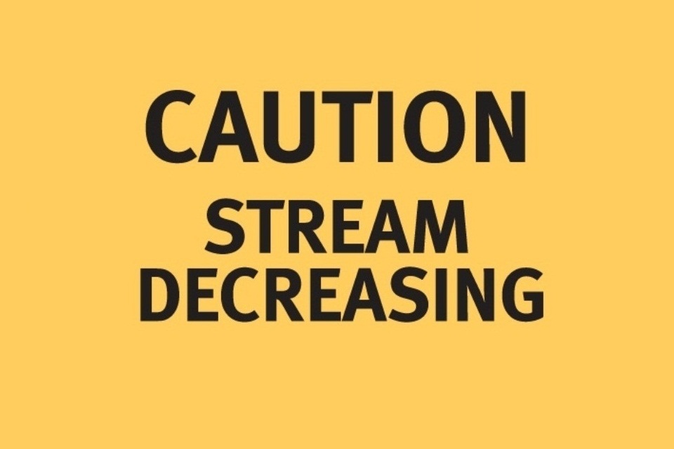
A yellow sign with black text reading 'Caution: Stream decreasing'.
When these yellow boards are displayed, the Environment Agency advises:
- users of all unpowered boats not to navigate
- users of powered boats to navigate with caution
A stream decreasing warning board will be issued once a strong stream warning board is no longer required. The flow of water close to weirs and sluices, however, remains extremely hazardous and a risk to life.
Weirs and sluices
Keep well away from weirs and sluices at all times, but especially when any stream warnings are active.
Flow conditions may change unexpectedly and without warning when our weir assets are being operated, making these areas extremely hazardous and a risk to life.
Using navigation marks
When travelling upstream, keep red navigation buoys to your left and green navigation buoys to your right.
When travelling downstream, keep red buoys to your right and green buoys to your left.
You may pass single yellow marker buoys on either side.
In all cases, keep well clear of navigation buoys. Be aware of possible shoals on the inside of river bends.
Dealing with changing river conditions
If you find yourself in conditions where the Environment Agency advises you to stop navigating, please take the advice and stop. Even the most experienced boater can be caught out, so think about those who could be put in danger if they have to help you.
You may find the following measures helpful. Not all conditions will be serious enough to need all the suggested measures.
Moor your boat in a safe place, preferably in a marina or at a recognised mooring. Limited space may be available at some locks. Moor against high banks if you can.
Ensure your mooring lines are fastened to secure fixings such as bollards, rings or even trees. Put out extra lines for more security and allow enough slack for a further rise in river levels. Do not rely on your own mooring pins or stakes, as they might not hold.
If possible, put extra fendering (such as scaffold poles or strong timber posts) between your boat and the bank side. This may prevent your boat drifting onto the river bank and becoming caught up when levels drop.
Make sure you have a safe exit ashore from your boat. If not, consider returning home or finding alternative accommodation until conditions improve.
If you are not able to vacate your boat safely and are running low on essential supplies or have other safety concerns, treat this as an emergency. Dial 999 to ask for evacuation.
Those in hire boats should stop immediately if you are advised to stop navigating. Contact your hire boat operator and follow their instructions.
Please remember your life is more important than your boat.
The Environment Agency does not provide emergency services. We are not able to carry out search and rescue, or provide supplies to stranded boats.
Contact the Environment Agency
General enquiries
National Customer Contact Centre
PO Box 544
Rotherham
S60 1BY
Email enquiries@environment-agency.gov.uk
Telephone 03708 506 506
Telephone from outside the UK (Monday to Friday, 8am to 6pm GMT) +44 (0) 114 282 5312
Monday to Friday, 8am to 6pm.
Environment incident hotline
Contact form https://www.gov.uk/rep...
Telephone (24 hour service) 0800 80 70 60
Floodline
Telephone (24 hour service) 0345 988 1188
Type talk (for the hard of hearing) 0345 602 6340